
Thottiyam is a panchayat town in Tiruchirappalli district in the Indian state of Tamil Nadu. Thamilselvi Thirugnanam is the current President of Thottiyam. It is situated 60 km north-west of Tiruchirapalli on Tiruchy-Namakkal State Highway (SH-25) and further it connects Namakkal-Salem-Bangalore National Highway. It is located near the Kaveri River, about 12 km north-west of Musiri. Koranganatha Temple located in the outskirts of the town is a historic temple built during the Chola period in the 10th century.

Perambalur is one of the 38 districts in the state of Tamil Nadu, India. The district headquarters is located at Perambalur. The district occupies an area of 1,752 km² and had a population of 565,223 with a sex-ratio of 1,003 females for every 1,000 males in 2011.

Tiruchirappalli District is one of the 38 districts, located along the Kaveri River, in Tamil Nadu, India. The headquarters of the district is the city of Tiruchirappalli, also known as Trichy.

Karur District is one of the 38 districts in the Indian state of Tamil Nadu. The main town in Karur District is the city of Karur, which is also the district headquarters. The district has a population of 1,064,493 with a sex-ratio of 1,015 females for every 1,000 males, according to 2011 census.
Musiri is a municipality in the Tiruchirappalli district in the Indian state of Tamil Nadu. It has an average elevation of 82 metres (269 feet).
Nannilam is a panchayat town in Thiruvarur District in the Indian state of Tamil Nadu. It is the headquarters town for Nannilam Taluk.
Pullambadi is a Panchayat town in Tiruchirappalli district in the Indian state of Tamil Nadu. Pullambadi town panchayat heads the revenue block of Pullambadi in the taluk of Lalgudi.

Thuraiyur is a town and a municipality in the Tiruchirappalli district in the Indian state of Tamil Nadu. It was upgraded to a III Grade Municipality from Town Panchayat on 17 January 1970, and to a II Grade Municipality in May 1998. It was upgraded to Selection Grade Municipality in the year 2008. It is also a taluka. It is located 310 km away from Chennai.
Thalaivasal(தலைவாசல்) is a town in the Salem district of Tamil Nadu, India. It is located 18 km away from the Sub-district Headquarter Attur and 70 km away from the Salem District Headquarter. It is one of the Taluks of the Salem District
Perambalur taluk is a taluk of Perambalur district in Tamil Nadu, India. Its headquarters is the town of Perambalur.
Andapuram is a village on the banks of Uppar river, in the Namakkal district of the Indian state of Tamil Nadu. Andapuram is a Gram Panchayat, falling in the Mohanur Revenue Block, Namakkal Taluk. Andapuram is in the Namakkal Assembly constituency and Namakkal Parliamentary constituency of India.
Brammadesam is an Indian Panchayat village located in Tindivanam taluk of Villupuram district in the state of Tamil Nadu. It is one of the 56 village panchayats coming under Marakkanam block of the Villupuram district. The village code for Brahmadesam is 10 and it falls under the Marakkanam Block.
The Trichinopoly district was a district of the erstwhile Madras Presidency of British India. It covered the present-day districts of Tiruchirappalli, Karur, Ariyalur and Perambalur in the Indian state of Tamil Nadu. The administrative headquarters was the town of Trichinopoly, Trichy or Tiruchi, now known as Tiruchirappalli. The district covered an area of 2,632 square miles (6,820 km2) in 1907. It was bound by the districts of South Arcot to the north, Salem to the west, Coimbatore to the west and north-west, Tanjore to the east and Madurai to the south. The princely state of Pudukkottai remained within the jurisdiction of Trichinopoly district from 1865 to 1947.
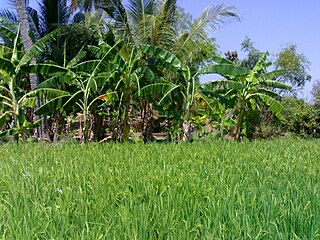
Iluppaiyur or Eluppaiyur is a small village in Sathanur Panchayat in Tiruchirappalli District in Tamil Nadu, India. This village belongs to Thinnanur Post and Musiri Taluk. Most of the people in this village belongs to the Arunattu Vellalar caste. Iluppaiyur village is located 4 km from Karattampatti and approximately 30 km distance from Trichy. The main economy is based on agriculture. Main agriculture product is Rice.The major source of irrigation is Wells. The population of Iluppaiyur is around 500. Presently, around 300 voters dwell in this village. Musiri Panchayat Union Elementary School Iluppaiyur is located here with strength around 60.
The Musiri block is a revenue block in the Tiruchirappalli district of Tamil Nadu, India. It has a total of 33 panchayat villages.
Lalgudi block is a revenue block in the Tiruchirappalli district of Tamil Nadu, India. It has a total of 45 panchayat villages. Lalgudi block is one of the two revenue blocks in the taluk of Lalgudi, the other one is Pullambadi revenue block. Lalgudi union office is in the small town of Puvallur just 2 km from Lalgudi. Most area of this block are fertile wet lands. very few areas are dry lands. Kothari sugars and chemicals pvt ltd. Kattur is present in this block.
Thirudesamalai or Thiruthiyamalai, is a village in Tiruchirappalli District in the Indian state of Tamil Nadu.
C.Ayyampalayam is a village located in the Manachanallur taluk of the Tiruchirappalli district of the Indian state Tamil Nadu. It is situated 5 km away from taluk headquarter Manachanallur and 20 km away from district headquarter Tiruchirappalli.
Pavithiram is a village thendral Nagar this village first dtcp layout starting the thendral Nagar layout only dtcp land in main road(Pavithrampudur Gram panchayat) in Senthamangalam Taluk, Namakkal district of Tamil Nadu state in India. Varagur is 1.5 kilometers, Erumaipatti is 8 kilometers and Thathaiyangarpet is 9 kilometers away from the village. And it is a major Suburb of Varagur Town.

