Related Research Articles

The Ogallala Aquifer is a shallow water table aquifer surrounded by sand, silt, clay, and gravel located beneath the Great Plains in the United States. One of the world's largest aquifers, it underlies an area of approximately 174,000 sq mi (450,000 km2) in portions of eight states. It was named in 1898 by geologist N. H. Darton from its type locality near the town of Ogallala, Nebraska. The aquifer is part of the High Plains Aquifer System, and rests on the Ogallala Formation, which is the principal geologic unit underlying 80% of the High Plains.

Stormwater, also spelled storm water, is water that originates from rain, including snow and ice melt. Stormwater can soak into the soil (infiltrate), be stored on the land surface in ponds and puddles, evaporate, or contribute to surface runoff. Most runoff is conveyed directly to nearby streams, rivers, or other water bodies without treatment.

Hydrogeology is the area of geology that deals with the distribution and movement of groundwater in the soil and rocks of the Earth's crust. The terms groundwater hydrology, geohydrology, and hydrogeology are often used interchangeably.

Terrain or relief involves the vertical and horizontal dimensions of land surface. The term bathymetry is used to describe underwater relief, while hypsometry studies terrain relative to sea level. The Latin word terra means "earth."

Geologic modelling,geological modelling or geomodelling is the applied science of creating computerized representations of portions of the Earth's crust based on geophysical and geological observations made on and below the Earth surface. A geomodel is the numerical equivalent of a three-dimensional geological map complemented by a description of physical quantities in the domain of interest. Geomodelling is related to the concept of Shared Earth Model; which is a multidisciplinary, interoperable and updatable knowledge base about the subsurface.
The Floridan aquifer system, composed of the Upper and Lower Floridan aquifers, is a sequence of Paleogene carbonate rock which spans an area of about 100,000 square miles (260,000 km2) in the southeastern United States. It underlies the entire state of Florida and parts of Alabama, Georgia, Mississippi, and South Carolina.

The Shuttle Radar Topography Mission (SRTM) is an international research effort that obtained digital elevation models on a near-global scale from 56°S to 60°N, to generate the most complete high-resolution digital topographic database of Earth prior to the release of the ASTER GDEM in 2009. SRTM consisted of a specially modified radar system that flew on board the Space Shuttle Endeavour during the 11-day STS-99 mission in February 2000. The radar system was based on the older Spaceborne Imaging Radar-C/X-band Synthetic Aperture Radar (SIR-C/X-SAR), previously used on the Shuttle in 1994. To acquire topographic data, the SRTM payload was outfitted with two radar antennas. One antenna was located in the Shuttle's payload bay, the other – a critical change from the SIR-C/X-SAR, allowing single-pass interferometry – on the end of a 60-meter (200-foot) mast that extended from the payload bay once the Shuttle was in space. The technique employed is known as interferometric synthetic aperture radar. Intermap Technologies was the prime contractor for processing the interferometric synthetic aperture radar data.

MODFLOW is the U.S. Geological Survey modular finite-difference flow model, which is a computer code that solves the groundwater flow equation. The program is used by hydrogeologists to simulate the flow of groundwater through aquifers. The source code is free public domain software, written primarily in Fortran, and can compile and run on Microsoft Windows or Unix-like operating systems.
GMS is water modeling application for building and simulating groundwater models from Aquaveo. It features 2D and 3D geostatistics, stratigraphic modeling and a unique conceptual model approach. Currently supported models include MODFLOW, MODPATH, MT3DMS, RT3D, FEMWATER, SEEP2D, and UTEXAS.
Visual MODFLOW (VMOD) is a software program developed by Waterloo Hydrogeologic. Originally released in 1994, Visual MODFLOW was the first commercially available graphical interface for the open source groundwater modeling engine called MODFLOW. As of May 2012, a newer .NET version of the software was rebranded as Visual MODFLOW Flex. The program also combines proprietary extensions, such as MODFLOW-SURFACT, MT3DMS and a three-dimensional model explorer. Visual MODFLOW supports MODFLOW-2000, MODFLOW-2005, MODFLOW-NWT, MODFLOW-LGR, MODFLOW-SURFACT, and SEAWAT.
Groundwater models are computer models of groundwater flow systems, and are used by hydrogeologists. Groundwater models are used to simulate and predict aquifer conditions.
FEFLOW is a computer program for simulating groundwater flow, mass transfer and heat transfer in porous media and fractured media. The program uses finite element analysis to solve the groundwater flow equation of both saturated and unsaturated conditions as well as mass and heat transport, including fluid density effects and chemical kinetics for multi-component reaction systems.
ZOOMQ3D is a numerical finite-difference model, which simulates groundwater flow in aquifers. The program is used by hydrogeologists to investigate groundwater resources and to make predictions about possible future changes in their quantity and quality. The code is written in C++, an object-oriented programming language and can compile and run on Windows and Unix operating systems.

A hydrologic model is a simplification of a real-world system that aids in understanding, predicting, and managing water resources. Both the flow and quality of water are commonly studied using hydrologic models.
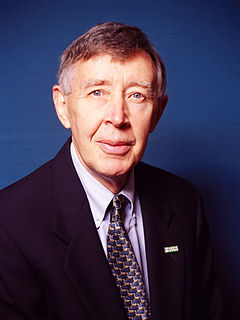
Charles G. "Chip" Groat is an American geologist. He is a professional in the earth science community with involvement in geological studies, energy and minerals resource assessment, ground-water occurrence and protection, geomorphic processes and landform evolution in desert areas, and coastal studies.
The Geochemist's Workbench (GWB) is an integrated set of interactive software tools for solving a range of problems in aqueous chemistry. The graphical user interface simplifies the use of the geochemical code.
Aquaveo is a modeling software company based in Provo, Utah that develops software used to model and simulate groundwater, watershed, and surface water resources. Its main software products include SMS, GMS, WMS, and Arc Hydro Groundwater.

Amazon Fire TV is a line of digital media player and microconsoles developed by Amazon. The devices are small network appliances that deliver digital audio and video content streamed via the Internet to a connected high-definition television. They also allow users to access local content and to play video games with the included remote control or another game controller, or by using a mobile app remote control on another device.
EMIGMA is a geophysics interpretation software platform developed by Petros Eikon Incorporated for data processing, simulation, inversion and imaging as well as other associated tasks. The software focuses on non-seismic applications and operates only on the Windows operating system. It supports files standard to the industry, instrument native formats as well as files used by other software in the industry such as AutoCAD, Google Earth and Oasis montaj. There is a free version of EMIGMA called EMIGMA Basic developed to allow viewing of databases created by licensed users. It does not allow data simulation nor modeling nor data import. The software is utilized by geoscientists for exploration and delineating purposes in mining, oil and gas and groundwater as well as hydrologists, environmental engineers, archaeologists and academic institutions for research purposes. Principal contributors to the software are R. W. Groom, H. Wu, E. Vassilenko, R. Jia, C. Ottay and C. Alvarez.
Mary Catherine Hill is an American hydrologist, the winner of the Walter L. Huber Civil Engineering Research Prize and of the Dooge Medal of the International Association of Hydrological Sciences, and a Darcy Lecturer for the National Ground Water Association. After working for many years at the United States Geological Survey, she became a professor of geology at the University of Kansas.
References
- 1 2 Zheng, C. (October 17, 1990). MT3D, A modular three-dimensional transport model for simulation of advection, dispersion and chemical reactions of contaminants in groundwater systems (PDF) (Report). Rockville, Maryland: S.S. Papadopulos & Associates. Retrieved 2017-06-21.
- ↑ "A Brief History of MT3D". MT3DMS Resources. The Hydrogeology Group, University of Alabama. October 30, 2006. Retrieved 2017-06-21.
- 1 2 Bedekar, V.; Morway, E.D.; Langevin, C.D.; Tonkin, M. (2016). MT3D-USGS version 1: A U.S. Geological Survey release of MT3DMS updated with new and expanded transport capabilities for use with MODFLOW. Techniques and Methods 6–A53. U.S. Geological Survey. doi:10.3133/tm6A53.
| | This scientific software article is a stub. You can help Wikipedia by expanding it. |