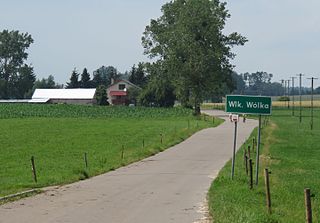
Battle of Wólka Węglowa refers to the battle on September 19, 1939, that took place near Wólka Węglowa, during the last stages of the Polish counteroffensive of the Invasion of Poland.

Wólka is a village in the administrative district of Gmina Skępe, within Lipno County, Kuyavian-Pomeranian Voivodeship, in north-central Poland. It lies approximately 6 kilometres (4 mi) east of Skępe, 18 km (11 mi) east of Lipno, and 57 km (35 mi) east of Toruń.

Szyndziel is a village in the administrative district of Gmina Sokółka, within Sokółka County, Podlaskie Voivodeship, in north-eastern Poland, close to the border with Belarus. It lies approximately 8 kilometres (5 mi) north-west of Sokółka and 39 km (24 mi) north-east of the regional capital Białystok.

Bugaj Dmeniński is a village in the administrative district of Gmina Kodrąb, within Radomsko County, Łódź Voivodeship, in central Poland. It lies approximately 8 kilometres (5 mi) east of Radomsko and 79 km (49 mi) south of the regional capital Łódź.
Anielin is a village in the administrative district of Gmina Okonek, within Złotów County, Greater Poland Voivodeship, in west-central Poland.

Bobowo ( ; is a village in Starogard County, Pomeranian Voivodeship, in northern Poland. It is the seat of the gmina called Gmina Bobowo. It lies approximately 10 kilometres south of Starogard Gdański and 54 km south of the regional capital Gdańsk.
Wólka Cybulska is a settlement in the administrative district of Gmina Wydminy, within Giżycko County, Warmian-Masurian Voivodeship, in northern Poland.
Boża Wólka is a village in the administrative district of Gmina Mrągowo, within Mrągowo County, Warmian-Masurian Voivodeship, in northern Poland.

Wólka Bagnowska is a village in the administrative district of Gmina Mrągowo, within Mrągowo County, Warmian-Masurian Voivodeship, in northern Poland. It lies approximately 7 kilometres (4 mi) south-west of Mrągowo and 48 km (30 mi) east of the regional capital Olsztyn.
Wólka Baranowska is a village in the administrative district of Gmina Mrągowo, within Mrągowo County, Warmian-Masurian Voivodeship, in northern Poland.

Wólka Prusinowska is a village in the administrative district of Gmina Piecki, within Mrągowo County, Warmian-Masurian Voivodeship, in northern Poland. It lies approximately 8 kilometres (5 mi) south of Piecki, 21 km (13 mi) south of Mrągowo, and 54 km (34 mi) east of the regional capital Olsztyn.

Wielka Wólka is a village in the administrative district of Gmina Biskupiec, within Nowe Miasto County, Warmian-Masurian Voivodeship, in northern Poland.

Wólka Wielka is a settlement in the administrative district of Gmina Biskupiec, within Olsztyn County, Warmian-Masurian Voivodeship, in northern Poland. It lies approximately 12 kilometres (7 mi) north of Biskupiec and 35 km (22 mi) north-east of the regional capital Olsztyn.

Kozia Wólka is a settlement in the administrative district of Gmina Małdyty, within Ostróda County, Warmian-Masurian Voivodeship, in northern Poland. It lies approximately 8 kilometres (5 mi) east of Małdyty, 26 km (16 mi) north of Ostróda, and 45 km (28 mi) west of the regional capital Olsztyn.
Wólka Majdańska is a village in the administrative district of Gmina Miłomłyn, within Ostróda County, Warmian-Masurian Voivodeship, in northern Poland.

Plebania Wólka is a settlement in the administrative district of Gmina Morąg, within Ostróda County, Warmian-Masurian Voivodeship, in northern Poland. It lies approximately 25 km (16 mi) north of Ostróda and 41 km (25 mi) west of the regional capital Olsztyn.
Wólka Klonowska is a settlement in the administrative district of Gmina Ostróda, within Ostróda County, Warmian-Masurian Voivodeship, in northern Poland.
Wólka Szczycieńska is a village in the administrative district of Gmina Szczytno, within Szczytno County, Warmian-Masurian Voivodeship, in northern Poland.
Żółwia is a village in the administrative district of Gmina Goleniów, within Goleniów County, West Pomeranian Voivodeship, in north-western Poland.

Grąd is a village in the administrative district of Gmina Brojce, within Gryfice County, West Pomeranian Voivodeship, in north-western Poland. It lies approximately 5 kilometres (3 mi) east of Brojce, 16 km (10 mi) east of Gryfice, and 82 km (51 mi) north-east of the regional capital Szczecin.


