Gmina Łopuszno is a rural gmina in Kielce County, Świętokrzyskie Voivodeship, in south-central Poland. Its seat is the village of Łopuszno, which lies approximately 27 kilometres (17 mi) west of the regional capital Kielce.

Gmina Miedziana Góra is a rural gmina in Kielce County, Świętokrzyskie Voivodeship, in south-central Poland. Its seat is the village of Miedziana Góra, which lies approximately 7 kilometres (4 mi) north-west of the regional capital Kielce.
Gmina Mniów is a rural gmina - administrative district - in Kielce County, Świętokrzyskie Voivodeship, located in south-central Poland. Its seat is the village of Mniów, which lies approximately 17 kilometres (11 mi) north-west of the regional capital Kielce.

Kosin is a village in the administrative district of Gmina Annopol, within Kraśnik County, Lublin Voivodeship, in eastern Poland. It lies approximately 8 kilometres (5 mi) south-east of Annopol, 24 km (15 mi) south-west of Kraśnik, and 67 km (42 mi) south-west of the regional capital Lublin.
Bugaj is a village in the administrative district of Gmina Strawczyn, within Kielce County, Świętokrzyskie Voivodeship, in south-central Poland. It lies approximately 7 kilometres (4 mi) east of Strawczyn and 10 km (6 mi) north-west of the regional capital Kielce.
Chełmce is a village in the administrative district of Gmina Strawczyn, within Kielce County, Świętokrzyskie Voivodeship, in south-central Poland. It lies approximately 6 kilometres (4 mi) east of Strawczyn and 11 km (7 mi) north-west of the regional capital Kielce.
Hucisko is a village in the administrative district of Gmina Strawczyn, within Kielce County, Świętokrzyskie Voivodeship, in south-central Poland. It lies approximately 4 kilometres (2 mi) north-west of Strawczyn and 19 km (12 mi) north-west of the regional capital Kielce.
Korczyn is a village in the administrative district of Gmina Strawczyn, within Kielce County, Świętokrzyskie Voivodeship, in south-central Poland. It lies approximately 7 kilometres (4 mi) west of Strawczyn and 21 km (13 mi) west of the regional capital Kielce.
Kuźniaki is a village in the administrative district of Gmina Strawczyn, within Kielce County, Świętokrzyskie Voivodeship, in south-central Poland. It lies approximately 6 kilometres (4 mi) north-west of Strawczyn and 21 km (13 mi) north-west of the regional capital Kielce.
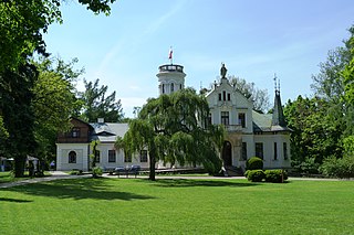
Oblęgór is a village in the administrative district of Gmina Strawczyn, within Kielce County, Świętokrzyskie Voivodeship, in south-central Poland. It lies approximately 4 kilometres (2 mi) north-east of Strawczyn and 14 km (9 mi) north-west of the regional capital Kielce.
Oblęgorek is a village in the administrative district of Gmina Strawczyn, within Kielce County, Świętokrzyskie Voivodeship, in south-central Poland. It lies approximately 5 kilometres (3 mi) east of Strawczyn and 12 km (7 mi) north-west of the regional capital Kielce.
Promnik is a village in the administrative district of Gmina Strawczyn, within Kielce County, Świętokrzyskie Voivodeship, in south-central Poland. It lies approximately 3 kilometres (2 mi) south of Strawczyn and 15 km (9 mi) west of the regional capital Kielce.
Ruda Strawczyńska is a village in the administrative district of Gmina Strawczyn, within Kielce County, Świętokrzyskie Voivodeship, in south-central Poland. It lies approximately 4 kilometres (2 mi) west of Strawczyn and 19 km (12 mi) west of the regional capital Kielce.

Strawczyn is a village in Kielce County, Świętokrzyskie Voivodeship, in south-central Poland. It is the seat of the gmina called Gmina Strawczyn. It lies approximately 16 km (10 mi) north-west of the regional capital Kielce.
Strawczynek is a village in the administrative district of Gmina Strawczyn, within Kielce County, Świętokrzyskie Voivodeship, in south-central Poland. It lies approximately 2 kilometres (1 mi) east of Strawczyn and 14 km (9 mi) north-west of the regional capital Kielce.
Pękosławice is a village in the administrative district of Gmina Waśniów, within Ostrowiec County, Świętokrzyskie Voivodeship, in south-central Poland. It lies approximately 2 kilometres (1 mi) north of Waśniów, 14 km (9 mi) west of Ostrowiec Świętokrzyski, and 43 km (27 mi) east of the regional capital Kielce.
Złota is a village in Pińczów County, Świętokrzyskie Voivodeship, in south-central Poland. It is the seat of the gmina called Gmina Złota. It lies approximately 18 kilometres (11 mi) south of Pińczów and 56 km (35 mi) south of the regional capital Kielce.
Kobyla Góra is a village in Ostrzeszów County, Greater Poland Voivodeship, in west-central Poland. It is the seat of the gmina called Gmina Kobyla Góra. It lies approximately 12 kilometres (7 mi) west of Ostrzeszów and 130 km (81 mi) south-east of the regional capital Poznań.
Rozłazino is a village in the administrative district of Gmina Łęczyce, within Wejherowo County, Pomeranian Voivodeship, in northern Poland. It lies approximately 8 kilometres (5 mi) south-east of Łęczyce, 24 km (15 mi) west of Wejherowo, and 51 km (32 mi) west of the regional capital Gdańsk.


