Maarssenbroek

Last updated
Maarssenbroek
Maarssenbroek met waterstede bisonspoor.jpg
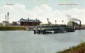
View on Maarssenbroek
P06-UT-positiekaart2-gemlabels.png
Red pog.svg
Maarssenbroek
Location in the Netherlands
Netherlands location map.svg
Red pog.svg
Maarssenbroek
Maarssenbroek (Netherlands)
Coordinates: 52°8′2″N5°1′35″E / 52.13389°N 5.02639°E / 52.13389; 5.02639
Country Netherlands
Province Utrecht
Municipality Stichtse Vecht
Area
[1]
  Total4.99 km2 (1.93 sq mi)
Elevation
[2]
−0.4 m (−1.3 ft)
Population
 (2021) [1]
  Total23,190
  Density4,600/km2 (12,000/sq mi)
Time zone UTC+1 (CET)
  Summer (DST) UTC+2 (CEST)
Postal code
3605-3608 [1]
Dialing code 0346

Maarssenbroek is a town in the Dutch province of Utrecht. It is nowadays part of the municipality of Stichtse Vecht. It lies on the west side of the Amsterdam-Rhine Canal.

Contents

Between 1815 and 1857, Maarssenbroek was a separate municipality.

Maarssenbroek is divided into thirteen residential areas with names picked from plant types and animal species as listed below. The various areas are ordered alphabetically on both sides of the main roads which are aptly named Floraweg (`Flora road`), Vogelweg (`Bird road`) and Safariweg (`Safari road`). starting from the south of the town. The entrances to the residential areas are marked on the main access roads by blue signs on which a silhouette of the animal responsible for the area's name has been stenciled in white.

The streets in the residential areas of Maarssenbroek don't have names themselves; the addresses are composed by appending the house number to the area name. Within the residential areas the location of the addresses are indicated with green signs in white lettering pointing out the street where a specific house number can be found (e.g. a sign "501-599" pointing to the right).

Transportation

Related Research Articles

<span class="mw-page-title-main">Kensington</span> District within the Royal Borough of Kensington and Chelsea in central London

Kensington is an area of London in the Royal Borough of Kensington and Chelsea, around 2.9 miles (4.6 km) west of Central London.

<span class="mw-page-title-main">Acton, London</span> Town in Greater London, England

Acton is a town and area in west London, England, within the London Borough of Ealing. It is 6.1 miles (10 km) west of Charing Cross.

<span class="mw-page-title-main">Dinxperlo</span> Town and former municipality in Gelderland, Netherlands

Dinxperlo is a town and former municipality in the eastern Netherlands, situated directly at the Germany-Netherlands border.

<span class="mw-page-title-main">Zoetermeer</span> City and municipality in South Holland, Netherlands

Zoetermeer is a city in the Western Netherlands, in the province of South Holland. The municipality covers an area of 37.05 km2 (14.31 sq mi) of which 2.60 km2 (1.00 sq mi) is water. A small village until the late 1960s, it had 6,392 inhabitants in 1950. By 2023 this had grown to 126.998, making it the fourth largest population centre in the province of South Holland, after Rotterdam, The Hague and Leiden. While now a city in its own right, Zoetermeer started out as a suburb of The Hague and is still a part of the Greater The Hague urban area.

<span class="mw-page-title-main">Newmarket, Ontario</span> Town in Ontario, Canada

Newmarket is a town and regional seat of the Regional Municipality of York in the Canadian province of Ontario. It is part of Greater Toronto in the Golden Horseshoe region of Southern Ontario. The name stems from the fact that the settlement was a "New Market", in contrast to York as the Old Market.

<span class="mw-page-title-main">Yonge Street</span> Historic road in Ontario, Canada

Yonge Street is a major arterial route in the Canadian province of Ontario connecting the shores of Lake Ontario in Toronto to Lake Simcoe, a gateway to the Upper Great Lakes. Ontario's first colonial administrator, John Graves Simcoe, named the street for his friend Sir George Yonge, an expert on ancient Roman roads.

<span class="mw-page-title-main">Rhodes, New South Wales</span> Suburb of Sydney, New South Wales, Australia

Rhodes is an Inner West suburb of Sydney, in the state of New South Wales, Australia. Rhodes is located 12 kilometres west of the Sydney central business district, in the local government area of the City of Canada Bay. It was formerly part of Concord Municipality until a merger with Drummoyne Council to form Canada Bay in December 2000.

<span class="mw-page-title-main">Portsea Island</span> Island off the southern coast of England

Portsea Island is a flat and low-lying natural island 24.5 square kilometres in area, just off the southern coast of Hampshire in England. Portsea Island contains the majority of the city of Portsmouth.

<span class="mw-page-title-main">Homebush, New South Wales</span> Suburb of Sydney, New South Wales, Australia

Homebush is a suburb in the Inner West of Sydney in the state of New South Wales, Australia. It is located 12 kilometres west of the Sydney central business district, in the local government area of the Municipality of Strathfield.

<span class="mw-page-title-main">House numbering</span> Unique numbering of buildings in a street or area

House numbering is the system of giving a unique number to each building in a street or area, with the intention of making it easier to locate a particular building. The house number is often part of a postal address. The term describes the number of any building with a mailbox, or even a vacant lot.

<span class="mw-page-title-main">Witbank</span> City in Mpumalanga, South Africa

Witbank, officially eMalahleni, is a city situated on the Highveld of Mpumalanga, South Africa, within the Emalahleni Local Municipality. The name Witbank is Afrikaans for "white ridge", and is named after a white sandstone outcrop where wagon transport drivers rested. The city is known for its coal-mining in the surrounding region.

<span class="mw-page-title-main">Rockdale, New South Wales</span> Suburb of Sydney, New South Wales, Australia

Rockdale is a suburb in southern Sydney, in the state of New South Wales, Australia. Rockdale is located 13 kilometres south of the Sydney central business district and is part of the St George area. Rockdale is one of the administrative centres for the local government area of the Bayside Council. Since 1985 Rockdale has been a twinned city with Bitola, in the Republic of Macedonia.

oThongathi Place in KwaZulu-Natal, South Africa

oThongathi, previously and still commonly known as Tongaat, is a town in KwaZulu-Natal, South Africa, about 40 kilometres (25 mi) north of Durban and 28 kilometres (17 mi) south of KwaDukuza. It now forms part of eThekwini Metropolitan Municipality, or the Greater Durban area. The area is home to the oldest Indian community in South Africa, having been where the first indentured Indian laborers settled in 1860 to work in the sugar-cane plantations. Much of the architectural style in the town was the work of Ivan Mitford-Barberton, and many buildings are in the Cape Dutch style of architecture.

<span class="mw-page-title-main">Kensington, Victoria</span> Suburb of Melbourne, Victoria, Australia

Kensington is an inner-city suburb in Melbourne, Victoria, Australia, 4 km (2.5 mi) north-west of Melbourne's Central Business District, located within the City of Melbourne local government area. Kensington recorded a population of 10,745 at the 2021 census.

<span class="mw-page-title-main">Alexandria, New South Wales</span> Suburb of Sydney, New South Wales, Australia

Alexandria is an inner southern suburb of Sydney, New South Wales, Australia. Alexandria is located 5 kilometres south of the Sydney central business district and is part of the local government area of the City of Sydney. The postcode is 2015.

<span class="mw-page-title-main">George, South Africa</span> City in Western Cape, South Africa

George is the second largest city in the Western Cape province of South Africa. The city is a popular holiday and conference centre, as well as the administrative and commercial hub and the seat of the Garden Route District Municipality. It is named after the British Monarch George III.

<span class="mw-page-title-main">Street name</span> Identifying name given to a street or road

A street name is an identifying name given to a street or road. In toponymic terminology, names of streets and roads are referred to as odonyms or hodonyms. The street name usually forms part of the address. Buildings are often given numbers along the street to further help identify them. Odonymy is the study of road names.

Swansea city centre in Swansea, Wales, contains the main shopping, leisure and nightlife district in Swansea. The city centre covers much of the Castle ward including the area around Oxford Street, Castle Square, and the Quadrant Shopping Centre; Alexandra Road, High Street, Wind Street and the Castle; Parc Tawe; and the Maritime Quarter extending down to the seafront.

Kostinbrod is a town in western Bulgaria. It is the seat of Kostinbrod Municipality. It is located 15 km west of the capital city of Sofia. It is located on two important transport corridors: Lom — Sofia — Thessaloniki and Sofia — Belgrade. The international railway line to Western Europe passes through the municipality, with a train stop at Kostinbrod Station.

<span class="mw-page-title-main">Durbanville</span> Town in Western Cape, South Africa

Durbanville, previously called Pampoenkraal, is a town in the Western Cape province of South Africa, part of the greater Cape Town metropolitan area. It is a semi-rural residential suburb on the north-eastern outskirts of the metropolis surrounded by farms producing wine and wheat.

References

  1. 1 2 3 "Kerncijfers wijken en buurten 2021". Central Bureau of Statistics. Retrieved 27 March 2022.
  2. "Postcodetool for 3605BD". Actueel Hoogtebestand Nederland (in Dutch). Het Waterschapshuis. Retrieved 27 March 2022.