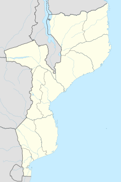
Mozambique, officially the Republic of Mozambique, is a country located in southeastern Africa bordered by the Indian Ocean to the east, Tanzania to the north, Malawi and Zambia to the northwest, Zimbabwe to the west, and Eswatini and South Africa to the southwest. The sovereign state is separated from the Comoros, Mayotte and Madagascar by the Mozambique Channel to the east. The capital and largest city is Maputo.
Telecommunications in Mozambique include radio, television, fixed and mobile telephones, and the Internet.

Tete is the capital city of Tete Province in Mozambique. It is located on the Zambezi River, and is the site of two of the four bridges crossing the river in Mozambique. A Swahili trade center before the Portuguese colonial era, Tete continues to dominate the west-central part of the country and region, and is the largest city on the Zambezi. In the local language, Nyungwe, Tete means "reed".

Beira[ˈbɐjɾɐ] is the capital and largest city of Sofala Province, where the Pungwe River meets the Indian Ocean, in the central region of Mozambique. It is the fourth-largest city by population in Mozambique, after Maputo, Matola and Nampula. Beira had a population of 397,368 in 1997, which grew to 530,604 in 2019. A coastal city, it holds the regionally significant Port of Beira, which acts as a gateway for both the central interior portion of the country as well as the land-locked nations of Zimbabwe, Zambia and Malawi.
The metical is the currency of Mozambique, abbreviated with the symbol MZN or MT. It is nominally divided into 100 centavos. The name metical comes from Arabic مثقال (mithqāl), a unit of weight and an alternative name for the gold dinar coin that was used throughout much of Africa until the 19th century.

Xai-Xai is a city in the south of Mozambique. Until 1975, the city was named João Belo. It is the capital of Gaza Province. As of 2007 it has a population of 116,343.
Nacala, also known as Cidade de Nacala or Nacala-Porto is a city on the northern coast of Mozambique. Located in the southwestern indentation of inner Fernao Veloso Bay, it is the deepest natural port on the east coast of Africa. Nacala serves as the terminal for the Nacala railway, a rail line to the landlocked Malawi. South of Nacala is Mozambique Island, at one time the capital of Mozambique and now a World Heritage site.

Mozambique has a historic Hindu community. Some of their ancestors came to Mozambique at least 500 years ago. Predating their economic participation in Mozambique before the arrival of Vasco da Gama, they adapted during the Portuguese colonial rule. An exodus began during the civil war between 1975 and 1990. After 1990 political and social reforms in Mozambique, the Hindu community along with the other minority religions, have once again begun to become vibrant.
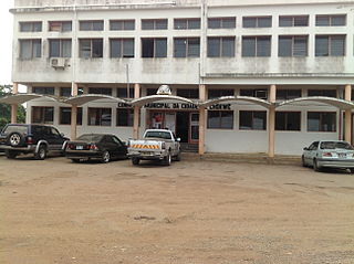
Chokwé, and earlier known as Vila Trigo de Morais, is a rural town and capital of Chokwe District in the province of Gaza in Mozambique. It is located about 230 kilometres (140 mi) north of the capital city of Maputo. This agricultural town is noted for its tomatoes.

Chókwè District is a district of Gaza Province in south-western Mozambique. Its principal town is Chokwe. The district is located in the south of the province, and borders with Mabalane District in the north, Guijá District in the east, Chibuto, Xai-Xai, and Bilene Macia Districts in the southeast, Magude District of Maputo Province in the south, and with Massingir District in the west. The area of the district is 2,466 square kilometres (952 sq mi). It has a population of 187,422 (2007).

Filipe Jacinto Nyusi is a Mozambican politician serving as the fourth President of Mozambique since 2015. He is the current leader of FRELIMO, the party that has governed Mozambique since its independence from Portugal in 1975. Additionally, he has served as the Chairman of the Southern African Development Community since August 2020.
Railway stations in Mozambique include:
Nicocoro is a village in Ancuabe District in Cabo Delgado Province in northeastern Mozambique.
Langima is a village in Ancuabe District in Cabo Delgado Province in northeastern Mozambique.
Chiure or Chiure Novo is a town in Chiure District in Cabo Delgado Province in northeastern Mozambique.

The Catholic University of Mozambique is a university in Mozambique.
The 2006 Mozambique earthquake occurred at 22:19 UTC on 22 February. It had a magnitude of 7.0 on the moment magnitude scale and caused 4 deaths and 36 injuries. The epicenter was near Machaze in Manica Province of southern Mozambique, just north of the Save River. It was the largest historical earthquake in Mozambique and the first earthquake in southern Africa to have an identified surface rupture.
Ngalue Cave is an archaeological site located in the Niassa province of Mozambique. Excavated primarily by Julio Mercader in 2007, Ngalue is a Middle Stone Age site. Due to its relatively dry environment and the shape of the cave, Ngalue had very good preservation and not only were stone tools and animal bones found. There were preserved starch grains on many of the stone tools as well. Overall, this site can help add to our knowledge of the Middle Stone Age site in the Niassa valley and to our understanding of the subsistence of Middle Stone Age peoples in Eastern Africa as a whole.