Madrid metropolitan area

Last updated
Madrid metropolitan area
Área metropolitana de Madrid
Metropolitan area
Madrid ESA354454.tiff
Madrid and surroundings
MadridMetropolitanaDensidad2002.png
Madrid metropolitan area
CountryFlag of Spain.svg  Spain
Largest city Madrid (3,223,334)
Area
  Metro
5,336 km2 (2,060 sq mi)
Population
(2021)
   Metro
6,980,646
  Metro density1,185/km2 (3,069/sq mi)
Gross Metropolitan Product
[1]
  Total€234.6 billion (2021)

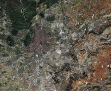
The Madrid metropolitan area is a monocentric metropolitan area in the centre of the Iberian peninsula, around the municipality of Madrid, Spain. It is not related to any sort of administrative delimitation, and thus, its limits are ambiguous.

According to data from the OECD it has an estimated 2021 population of 6,980,646 people [2] and covers an area of 5,335.97 square kilometres (2,060.23 sq mi). It is considered the largest metropolitan area in Spain, the 2nd largest in the European Union and the 54th largest in the world. [3] [4] [5] [6]

Two distinct zones of urbanisation can be distinguished extending further than the municipality of Madrid:

The largest suburbs are to the south, and in general along the main routes leading out of Madrid.

The GDP of the metropolitan area of Madrid was estimated to be 189 billion euros in 2009 and represents over 90% of the GDP of the region of Madrid. [7] The GDP per capita was 37,758 euros in the metropolitan area while it reached 30,453 euros for the Madrid region.

In regard to the Madrid functional urban area (FUA), that is, the wider commuting zone, the territory has experienced by the turn of the 21st century an increase of extensive suburbanisation with a larger share of inhabitants living more than 25km away from the functional urban centre as well as the deepening of the traditional NW-SE socio-spatial segregation pattern. [8] Another challenge is the lack of environmental sustainability of the current mobility model. [8]

See also

Related Research Articles

<span class="mw-page-title-main">Economy of Spain</span>

The economy of Spain is a highly developed social market economy. It’s the world's 15th largest by nominal GDP and the sixth-largest in Europe. Spain is a member of the European Union and the eurozone, as well as the Organization for Economic Co-operation and Development and the World Trade Organization. In 2021, Spain was the twentieth-largest exporter in the world and the sixteenth-largest importer. Spain is listed 27th in the United Nations Human Development Index and 37th in GDP per capita by the World Bank. Some of the main areas of economic activity are the automotive industry, medical technology, chemicals, shipbuilding, tourism and the textile industry.

<span class="mw-page-title-main">Community of Madrid</span> Autonomous community of Spain

The Community of Madrid is one of the seventeen autonomous communities of Spain. It is located in the centre of the Iberian Peninsula, and of the Central Plateau. Its capital and largest municipality is the City of Madrid, which is also the capital of the country. The Community of Madrid is bounded to the south and east by Castilla–La Mancha and to the north and west by Castile and León. It was formally created in 1983, in order to adress the particular status of the City of Madrid as the national capital city and in urban hierarchy. Its limits are those of the province of Madrid, which was until then conventionally included in the historical region of New Castile.

<span class="mw-page-title-main">Castilla–La Mancha</span> Autonomous community of Spain

Castilla–La Mancha is an autonomous community of Spain. Comprising the provinces of Albacete, Ciudad Real, Cuenca, Guadalajara and Toledo, it was created in 1982. The government headquarters are in Toledo, which is the capital de facto.

<span class="mw-page-title-main">Metropolitan area</span> Administrative unit of a dense urban core and its satellite cities

A metropolitan area or metro is a region consisting of a densely populated urban agglomeration and its surrounding territories sharing industries, commercial areas, transport network, infrastructures and housing. A metropolitan area usually comprises multiple principal cities, jurisdictions and municipalities: neighborhoods, townships, boroughs, cities, towns, exurbs, suburbs, counties, districts and even states and nations in areas like the eurodistricts. As social, economic and political institutions have changed, metropolitan areas have become key economic and political regions.

<span class="mw-page-title-main">Urban area</span> Human settlement with high population density and infrastructure of built environment

An urban area, built-up area or urban agglomeration is a human settlement with a high population density and an infrastructure of built environment. This is the core of a metropolitan statistical area in the United States, if it contains a population of more than 50,000.

<span class="mw-page-title-main">Porto metropolitan area</span> Place in Porto

The Porto Metropolitan Area is a metropolitan area in northern Portugal centered on the City of Porto, Portugal's second largest city. The metropolitan area, covering 17 municipalities, is the second largest urban area in the country and one of the largest in the European Union, with a population in 2021 of 1,737,395 in an area of 2,040.31 km².

<span class="mw-page-title-main">North Region, Portugal</span> NUTS II Region in Portugal

The North Region or Northern Portugal is the most populous region in Portugal, ahead of Lisbon, and the third most extensive by area. The region has 3,576,205 inhabitants according to the 2017 census, and its area is 21,278 kilometres (13,222 mi) with a density of 173 inhabitants per square kilometre. It is one of five regions of Mainland Portugal. Its main population center is the urban area of Porto, with about one million inhabitants; it includes a larger political metropolitan region with 1.8 million, and an urban-metropolitan agglomeration with 2.99 million inhabitants, including Porto and neighboring cities, such as Braga, Guimarães and Póvoa de Varzim. The Commission of Regional Coordination of the North (CCDR-N) is the agency that coordinates environmental policies, land-use planning, cities and the overall development of this region, supporting local governments and associations.

The larger urban zone (LUZ), or functional urban area (FUA), is a measure of the population and expanse of metropolitan and surrounding areas which may or may not be exclusively urban. It consists of a city and its commuting zone outside it.

<span class="mw-page-title-main">Metropolitan areas of Mexico</span> List of biggest metropolitan areas in Mexico

Metropolitan areas of Mexico have been traditionally defined as the group of municipalities that heavily interact with each other, usually around a core city, in Mexico. The phenomenon of metropolization in Mexico is relatively recent, starting in the 1940s. Because of an accelerated level of urbanization in the country, the definition of a metropolitan area is reviewed periodically by the Mexican population and census authorities.

<span class="mw-page-title-main">Coslada</span> Municipality in Community of Madrid, Spain

Coslada is a city and municipality in the autonomous community of Madrid in central Spain.

<span class="mw-page-title-main">El Casar</span> Place in Castile-La Mancha, Spain

El Casar is a municipality located in the province of Guadalajara, Castile-La Mancha, Spain.

<span class="mw-page-title-main">Metropolitan areas in Romania</span>

Metropolitan areas in Romania are private agencies of public utility which were established by Law no. 351 of 6 July 2001 with the aim of encouraging the development of neighboring towns and communes within a radius of 30 km. The first to be established was the metropolitan area of Iași, on 8 April 2004, while the last is that of Drobeta-Turnu Severin, on 28 August 2019. There are 24 metropolitan areas in Romania that have been constituted as of 2019.

<span class="mw-page-title-main">Rivas-Vaciamadrid</span> Place in Community of Madrid, Spain

Rivas-Vaciamadrid is the 15th most populated city in the Community of Madrid, Spain. It belongs to the Madrid metropolitan area and is located just 15 km from central Madrid, to the south-east. In the southern part of the municipality, the Manzanares river flows into the Jarama, which is part of the Lower Manzanares and Jarama Rivers Regional Park. Almost three quarters of the municipality form part of the park, making it an important ecological centre with numerous lakes and various species of wildlife and fauna.

<span class="mw-page-title-main">Barcelona metropolitan area</span> Urban area in Catalonia, Spain

The Barcelona urban area is an urban area in Catalonia (Spain) centered on the city of Barcelona and located less than 100 km south of the border with France. With a population of over 5 million, it is one of the largest urban areas in Europe.

<span class="mw-page-title-main">Pezuela de las Torres</span> Municipality in Community of Madrid, Spain

Pezuela de las Torres is a municipality located in the Community of Madrid, Spain. Closely related to Guadalajara, this Alcarrian village maintains a unique spirit of country labour and tradition.

This article includes several ranked indicators for Spain's 17 autonomous communities, as well as for the autonomous cities of Ceuta and Melilla.

<span class="mw-page-title-main">Madrid</span> Capital and largest city of Spain

Madrid is the capital and most populous city of Spain. The city has almost 3.4 million inhabitants and a metropolitan area population of approximately 6.7 million. It is the second-largest city in the European Union (EU), and its monocentric metropolitan area is the second-largest in the EU. The municipality covers 604.3 km2 (233.3 sq mi) geographical area. Madrid lies on the River Manzanares in the central part of the Iberian Peninsula at about 650 metres above mean sea level. Capital city of both Spain and the surrounding autonomous community of Madrid, it is also the political, economic and cultural centre of the country. The climate of Madrid features hot summers and cool winters.

References

  1. "Gross domestic product (GDP) at current market prices by metropolitan regions". ec.europa.eu.
  2. OECD-OCDE – Spain
  3. "World Urban Areas: Population & Density" (PDF). Demographia . Retrieved 2008-08-10.
  4. Eurostat, Urban Audit database Archived 2011-04-06 at the Wayback Machine , accessed on 2009-03-12. Data for 2004.
  5. Thomas Brinkoff, Principal Agglomerations of the World, accessed on 2009-03-12. Data for 2009-01-01.
  6. United Nations Department of Economic and Social Affairs, World Urbanisation Prospects (2007 revision), (United Nations, 2008), Table A.12. Data for 2007.
  7. (in Spanish) http://www.madrid.org/iestadis/fijas/estructu/economicas/contabilidad/descarga/ipibmt1.xls
  8. 1 2 Gómez Giménez, José Manuel; Hernández Aja, Agustín (2018). "Retos de las áreas urbanas funcionales españolas: el caso madrileño, 1991-2011" [Challenges for Spanish functional urban areas: the case study of Madrid, 1991-2011]. In Monclús, Javier; Díez Medina, Carmen (eds.). Ciudad y formas urbanas. Perspectivas transversales. Volumen 6. Formas urbanas y territorio (PDF). Prensas de la Universidad de Zaragoza; Institución Fernando el Católico. p. 111. ISBN   978-84-17358-85-3.