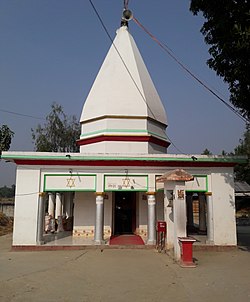
Padaul is a village development committee in Mahottari District in the Janakpur Zone of south-eastern Nepal. At the time of the 1991 Nepal census it had a population of 4806 people living in 868 individual households.
Sonamai, सोनामाई is a village development committee in Mahottari District in the Janakpur Zone of south-eastern Nepal. At the time of the 2011 Nepal census it had a population of 8,973 people living in 1,662 individual households.
Suga Bhawani is a village development committee in Mahottari District in the Janakpur Zone of south-eastern Nepal. At the time of the 1991 Nepal census it had a population of 4527 people living in 726 individual households.
Baku is a village development committee (VDC) in Solukhumbu District in the Sagarmatha Zone of north-eastern Nepal. Baku lies in the Himalaya, 59 km South of Mount Everest and is bordered by the valleys of the Dudh Kosi River (West) and Hinku Drangka River (East). At the time of the 1991 Nepal census it had a population of 4159 people living in 777 individual households. At the time of the 2011 census, the population of the VDC Baku was 4844 inhabitants in 963 individual households.
Bhagawanpur is a Village Development Committee in Siraha District in the Sagarmatha Zone of south-eastern Nepal. At the time of the 1991 Nepal census it had a population of 2845 people residing in 455 individual households.
Badgama is a village and market center in Kanchanrup Municipality in Saptari District in the Sagarmatha Zone of south-eastern Nepal. It was merged in the municipality along with other 8 Villages since 18 May 2013. At the time of the 1991 Nepal census it had a population of 3287 people living in 550 individual households.
Barsain is a village development committee in Saptari District in the Sagarmatha Zone of south-eastern Nepal. At the time of the 2011 Nepal census it had a population of 5458 people living in 991 individual households.
Bathnaha is a village development committee in Saptari District in the Sagarmatha Zone of south-eastern Nepal. At the time of the 2011 Nepal census it had a population of 5,011 people living in 1,180 individual households.
Belhi Chapena is a village development committee in Saptari District in the Sagarmatha Zone of south-eastern Nepal. At the time of the 2011 Nepal census it had a population of 5,807 people living in 1105 individual households.
Bhutahi is a village development committee in Saptari District in the Sagarmatha Zone of south-eastern Nepal. At the time of the 2011 Nepal census it had a population of 4,016 people living in 785 individual households.
Bishariya is a village development committee in Saptari District in the Sagarmatha Zone of south-eastern Nepal. At the time of the 2011 Nepal census, it had a population of 7,120 people living in 1,410 individual households.
Dauda is a village development committee in Saptari District in the Sagarmatha Zone of south-eastern Nepal. At the time of the 2011 Nepal census it had a population of 6,290 people living in 1,049 individual households.
Dhanagadi is a village development committee in Saptari District in the Sagarmatha Zone of south-eastern Nepal. At the time of the 2011 Nepal census it had a population of 5,201 people living in 954 individual households.
Inarwa Phulbariya is a village in Khadak Municipality in Saptari District in the Sagarmatha Zone of South-Eastern Nepal. It is the former Village Development Committee of Nepal. At the time of the 2011 Nepal census, it had a population of 5,403 people living in 1,027 individual households.
Ko. Madhepura is a village development committee in Saptari District in the Sagarmatha Zone of south-eastern Nepal. At the time of the 2011 Nepal census it had a population of 4,608.
Lalapati is a village development committee in Saptari District in the Sagarmatha Zone of south-eastern Nepal. At the time of the 2011 Nepal census it had a population of 5,509 people living in 996 individual households. After newly formed lower administrative division, Lalapati belongs to Chhinnamasta Gaunpalika as Ward No.4. lalapatti laleswarnath mahadev
Maina Sahasrabahu is a village in Khadak Municipality in Saptari District in the Sagarmatha Zone of South-Eastern Nepal. It is the former Village Development Committee of Nepal. At the time of the 2011 Nepal census, it had a population of 4,047 people living in 779 individual households.
Malekpur is a village development committee in Saptari District in the Sagarmatha Zone of south-eastern Nepal. At the time of the 2011 Nepal census it had a population of 6,601 people living in 1,258 individual households.
Paterwa is a village development committee in Saptari District in the Sagarmatha Zone of south-eastern Nepal. At the time of the 1991 Nepal census it had a population of 3069 people living in 570 individual households.
Sarashwar is a village development committee in Saptari District in the Sagarmatha Zone of south-eastern Nepal. At the time of the 1991 Nepal census it had a population of 3855 people living in 669 individual households.

