Maison Dieu, Faversham

Last updated

Maison Dieu
Maison Dieu, Ospringe, Kent - geograph.org.uk - 41929.jpg
Maison Dieu
Coordinates 51°18′41″N0°52′25″E / 51.3115°N 0.8735°E / 51.3115; 0.8735
OS grid reference TR0036260855
Built1234
Built for Henry III
Governing bodyEnglish Heritage
TypeGrade II*
Designated29 July 1950
Reference no.1069431
Kent UK location map.svg
Red pog.svg
Maison Dieu location in Kent

Maison Dieu ('House of God') is a hospital, monastery, hostel, retirement home and royal lodge commissioned by Henry III in 1234. The timber framed building is located beside Watling Street, now the A2 road, in Ospringe, Faversham, in Kent, England.

Contents

Edward Hasted noted in 1798 that it was dedicated to the Virgin Mary. The foundation consisted of a master and three regular brethren of the Order of the Holy Cross. There were also two secular clerks, who celebrated mass for the soul of the founder and the souls of his royal predecessors and successors. They were required to be hospitable, and to entertain the poor and needy passers-by and pilgrims (heading along Watling Street). There was a chamber in the building which the king used to rest when he passed this way; it was called Camera Regis, or the king's chamber. [1] The history and records of the building also give insight into the way sick and disabled people fitted into society during the medieval period. For example, in 1235 the 'blind daughter of Andrew of Faversham' was admitted to Maison Dieu as a 'servant of God and sister of the hospital'. [2]

Timeline

DateEvent
1234Commissioned by Henry III
1240 King Henry III granted to the master and brethren of the Maison Dieu the privilege of a market and a fair to be held in this parish of Headcorn. The fair used formerly to be held on St. Peter's Day, 29 June. But it had been for some years past[ when? ], held on 12 June. [3]
1245Robert de Bathel, the abbot of St Augustine's Abbey in Canterbury, granted the right of burial to the brethren of this hospital, wearing the habit, and to the diseased who happened to die here, but to none else. [1]
1314Nicholas de Staple (the master), left the hospital after an argument with the other brethren, and went to the hospital of St. John the Baptist, Oxford. The brethren of the Oxford hospital sent a brother to Ospringe in his place. In 1334, he returned to Ospringe. [4]
1360Upon his journey to the port of Dover to return to France at the end of his captivity, King John II of France stopped at the hospital, which then had a royal lodge, and stayed.
1384On a taxation, the revenues of the hospital were valued at the church of Headcorn, at 20 marks, that is £13 6s 8d. [1]
28 September 1511 Archbishop Warham made a visit to the hospital. [4]
November 1518The last brethren of the Order of the Holy Cross died, supposedly of the plague, which scared away others from the place. [5] Afterwards the hospital became secular. [4] The estate then passed to St John's College, Cambridge. The contents were given to the abbots of St Augustine's Abbey. The building then became a public house. [5]
1573The building was leased to Robert Transham (a friend of Thomas Arden (from the 1592 play Arden of Faversham)). He also rebuilt the Parsonage (also leased from St John's College), using materials from the Maison Dieu chapel. Robert was later buried in Ospringe Parish Church. [6]
1925The building became England's earliest village museum. Water Lane beside Maison Dieu still flooded every winter until 1965, when the stream was diverted by a culvert during the building of the M2 motorway. [7]
1950The building became a Grade II* listed building. [8]

Currently

It is under the guardianship of English Heritage and managed by the Maison Dieu Museum Trust. Currently it is used to display Roman artefacts from the surrounding area including the ruined 'Church of Our Lady of Elwarton' in Stone. [9] but is only open at weekends and Bank Holidays from Good Friday to October.

Maison Dieu taken in 1890s Maison Dieu 1890 01.jpg
Maison Dieu taken in 1890s
Image of Maison Dieu taken in 1900 Maison Dieu 1900.jpg
Image of Maison Dieu taken in 1900

Historic images of the Maison Dieu

The Faversham Society have many historic images of the Maison Dieu as part of their archives. In the image from the 1890s the original building can be seen. In 1900 the lower portion of the building was converted into a shop. Original images can be seen in the Faversham Society Museum Archive.


Related Research Articles

<span class="mw-page-title-main">Faversham</span> Market town in England

Faversham is a market town in Kent, England, 8 miles (13 km) from Sittingbourne, 48 miles (77 km) from London and 10 miles (16 km) from Canterbury, next to the Swale, a strip of sea separating mainland Kent from the Isle of Sheppey in the Thames Estuary. It is close to the A2, which follows an ancient British trackway which was used by the Romans and the Anglo-Saxons, and known as Watling Street. The name is of Old English origin, meaning "the metal-worker's village".

<span class="mw-page-title-main">Stephen de Pencester</span>

Stephen de Pencester was Warden of the Cinque Ports when the first authoritative list of Cinque Ports Confederation Members was produced in 1293.

<span class="mw-page-title-main">Brogdale</span> Human settlement in England

Brogdale is a hamlet in Kent, England, immediately south of the M2 motorway, 2 miles (3.2 km) south of Faversham. It is one of several hamlets making up the civil parish of Ospringe and is in the Borough of Swale. Its western half is in the Kent Downs Area of Outstanding Natural Beauty.

<span class="mw-page-title-main">Robert Hales</span> English admiral

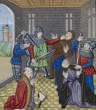
Sir Robert Hales was Grand Prior of the Knights Hospitaller of England, Lord High Treasurer, and Admiral of the West. He was killed in the Peasants' Revolt.

<span class="mw-page-title-main">Dunkirk, Kent</span> Human settlement in England

Dunkirk is a village and civil parish between Faversham and Canterbury in southeast England. It lies on the Canterbury Road between Boughton under Blean and Harbledown. This was the main Roman road from the Kentish ports to London, also known as Watling Street.

<span class="mw-page-title-main">Luddenham, Kent</span> Human settlement in England

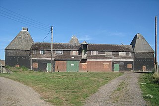
Luddenham is a widespread hamlet or small village north-west of Faversham in Kent, England, with many long-distance views across the Swale and the Isle of Sheppey. It is on the edge of Luddenham Marshes and is also home of Luddenham School. Oare Gunpowder Works are on the edge of the village. It had, according to Edward Hasted in 1798, 396 acres of low flat arable land and 200 acres of meadow and pasture, although half of those are marsh. It is in the civil parish of Norton, Buckland and Stone.

<span class="mw-page-title-main">Bobbing, Kent</span> Human settlement in England

Bobbing is a village and civil parish in the Swale district of Kent, England, about a mile north-west of Sittingbourne, and forming part of its urban area. The hamlet of Howt Green and village of Keycol are included within the parish. According to the 2011 census Bobbing parish had a population of 1,969.

<span class="mw-page-title-main">Iwade</span> Human settlement in England

Iwade is a village and civil parish 2 miles (3.2 km) north of the town of Sittingbourne in the English county of Kent.

<span class="mw-page-title-main">Ospringe</span> Human settlement in England

Ospringe is a village and area of Faversham in the English county of Kent. It is also the name of a civil parish, which since 1935 has not included the village of Ospringe.

<span class="mw-page-title-main">Maison Dieu, Dover</span> Municipal building in Dover, Kent, England

The Hospital of St Mary, Domus Dei, or Maison Dieu, is a medieval building in Dover, England which forms the oldest part of Dover Town Hall. The Town Hall and remains of mediaeval Maison Dieu were Grade I listed in 1973.

<span class="mw-page-title-main">Oad Street</span> Human settlement in England

Oad Street is a small hamlet in the English county of Kent.

Goodnestone is a village and former civil parish, now in the parish of Graveney with Goodnestone, in the Swale district of Kent, England. The village is mainly on the road 'Head Hill Road' towards Graveney. In 1961 the parish had a population of 58.

<span class="mw-page-title-main">Bredgar</span> Human settlement in England

Bredgar is a village and civil parish in the Borough of Swale, Kent, England.

<span class="mw-page-title-main">Stalisfield</span> Human settlement in England

Stalisfield is a village in the borough of Swale in Kent, England, located on a secondary road about 1½ miles (2.4 km) north of Charing and 5 miles south west of Faversham. The parish includes the hamlet of Stalisfield Green.

<span class="mw-page-title-main">Oare, Kent</span> Human settlement in England

Oare is a village and civil parish north of Davington, Faversham in southeast England. It is separated from Faversham by the Oare Creek. To the north of the village are the Oare Marshes, and the Harty Ferry which once linked to Harty on the Isle of Sheppey. Kent Wildlife Trust manages a nature reserve that is an important stopping place for migratory birds.

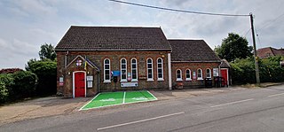
Highsted is a village near Sittingbourne in Kent, England. It is in the civil parish of Rodmersham.

<span class="mw-page-title-main">Painters Forstal</span> Human settlement in England

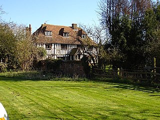
Painters Forstal is a village in the Swale district of the English county of Kent. It is 2 miles (3.2 km) south-west of the town of Faversham and is part of the civil parish of Ospringe. It lies just south of the M2 motorway, and has developed almost completely since the 1950s.

Gilbert Glanvill or Gilbert de Glanville was a medieval Bishop of Rochester.

<span class="mw-page-title-main">Norton, Buckland and Stone</span> Human settlement in England

Norton, Buckland and Stone is a small rural civil parish 1 mile (1.6 km) east of Teynham and 3 miles (4.8 km) west of the centre of Faversham in the borough of Swale, Kent, England. It is bypassed by the M2 to the south and traverses the historic A2, on the route of the Roman road of Watling Street.

<span class="mw-page-title-main">Horne's Place Chapel</span> Historic site

Horne's Place Chapel, is a late mediaeval timber-framed house with private chapel in Appledore, Kent England.

References

  1. 1 2 3 Hasted, Edward (1798). "Parishes". The History and Topographical Survey of the County of Kent. Institute of Historical Research. 6: 499–531. Retrieved 6 March 2014.
  2. History of Place project - Maison Dieu history http://historyof.place/story/maison-dieu-living-on-the-road-to-canterbury/#section=1
  3. Hasted, Edward (1798). "Parishes". The History and Topographical Survey of the County of Kent. Institute of Historical Research. 6: 324–336. Retrieved 6 March 2014.
  4. 1 2 3 Hasted, Edward (1798). "Parishes". Hospitals: Ospringe, A History of the County of Kent. Institute of Historical Research. 2: 222–224. Retrieved 14 March 2014.
  5. 1 2 Edward Jacob (1774) The history of the town and port of Faversham: in the county of Kent , p. 37, at Google Books
  6. Roy Kendall (2003) Christopher Marlowe and Richard Baines: Journeys Through the Elizabethan , p. 176, at Google Books
  7. Robert Turcan (11 November 2013) Faversham Through Time at Google Books
  8. "The Maison Dieu Museum, Faversham". www.britishlistedbuildings.co.uk. Retrieved 15 August 2014.
  9. "Faversham Stone Chapel (Our Lady of Elverton)". English Heritage. Retrieved 18 May 2012.