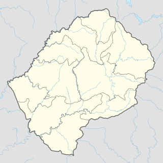
Makhalaneng | |
---|---|
Community Council | |
Coordinates: 29°38′53″S27°44′01″E / 29.64806°S 27.73361°E | |
Country | |
District | Maseru District |
Constituency | Makhaleng |
Elevation | 5,902 ft (1,799 m) |
Population (2006) | |
• Total | 13,146 |
Time zone | UTC+2 (CAT) |
Coordinates computed from Lesotho Villages file. [2] |
Makhalaneng is a community council located in the Maseru District of Lesotho. The population in 2006 was 13,146. [3]
The community of Makhalaneng includes the villages of Aupolasi, Bochabela, Borata, Ha Abele, Ha Chake, Ha Chere (Koung), Ha Dinizulu, Ha Fane, Ha Fokoane, Ha Joele, Ha Kali, Ha Kelebone, Ha Kori, Ha Kou (Maliphokoana), Ha Lefeko, Ha Leholi, Ha Lejaha, Ha Lekota, Ha Lekunutu, Ha Lesooana, Ha Letsema, Ha Lithathane, Ha Makhema, Ha Makoae, Ha Maloma, Ha Mammenyana, Ha Maphephe, Ha Maphoma, Ha Masakale, Ha Maseru (Aupolasi), Ha Matšaba, Ha Matšoana, Ha Metsing, Ha Mohale-a-Phala, Ha Moitšupeli, Ha Mojakane, Ha Mojakopo, Ha Mokheseng, Ha Mokhou, Ha Mokola, Ha Molahloe, Ha Moora, Ha Moshe, Ha Motale, Ha Mothibeli, Ha Motjotji, Ha Motlelepe, Ha Motsoafa, Ha Nako, Ha Nkabane, Ha Ntima, Ha Pelei, Ha Phathang, Ha Pholo, Ha Potiane, Ha Raboletsi, Ha Rakhati, Ha Raleqheka, Ha Ramosoeu, Ha Raqoane, Ha Sematle, Ha Seoloana, Ha Serabele, Ha Shoaepane, Ha Talasi, Ha Tlali, Ha Tlapana, Ha Toki (Moqoakong), Ha Tšehla, Ha Tsuu, Kena (Ha Matheatlala), Kena (Ha Mothibeli), Kena (Ha Tsola), Koqong, Koung, Likhoaleng, Liphakoeng, Lithabaneng, Maama, Maholong, Mantša-tlala, Matsoapong, Motlejoa, Motse-Mocha (Ha Lekunutu), Rabolinyane, Sekukurung, Terae, Thaba-Chitja and Tholang. [4]
Semonkong is a community council located in the Maseru District of Lesotho. Semonkong, meaning "Place of Smoke", was established in the 1880s as a refuge for Basotho displaced by the Gun War. It is located close to several major natural features, including the Maletsunyane Falls and the 3096-metre peak of Thaba Putsoa. The population in 2006 was 7,781.
Mazenod is a community council located in the Maseru District of western Lesotho. The population in 2006 was 27,553. It is located to the south-east of the capital Maseru. Points of interest include Moshoeshoe I International Airport, Lesotho's only international airport.
Makhoarane is a community council located in the Maseru District of Lesotho. Its population in 2006 was 26,674.
Makhaleng is a constituency located in the Maseru District of Lesotho. Its population in 2006 was 21,269.
Makolopetsane is a community council located in the Maseru District of Lesotho. Its population in 2006 was 7,415.
Mohlakeng is a community council located in the Maseru District of Lesotho. Its population in 2006 was 18,906.
Nyakosoba is a community council located in the Maseru District of Lesotho. Its population in 2006 was 10,893.
Mateanong is a community council located in the Mokhotlong District of Lesotho. Its population in 2006 was 7,387.
Pae-La-Itlhatsoa is a community council located in the Mokhotlong District of Lesotho. Its population in 2006 was 2,080.
Liphakoe is a community council located in the Quthing District of Lesotho. Its population in 2006 was 14,537.
Rapoleboea is a community council located in the Thaba-Tseka District of Lesotho. Its population in 2006 was 11,533.
Makheka is a community council located in the Maseru District of Lesotho. The population in 2006 was 5,473.
Mabote is a constituency and community council in the Maseru Municipality located in the Berea District of Lesotho. The population in 2006 was 38,047.
Abia is a constituency and community council in the Maseru Municipality located in the Maseru District of Lesotho. The population in 2006 was 17,449.
Lithabaneng is a constituency and community council in the Maseru Municipality located in the Maseru District of Lesotho. The population in 2006 was 28,371.
Lithoteng is a constituency and community council in the Maseru Municipality located in the Maseru District of Lesotho. The population in 2006 was 26,593.
Motimposo is a constituency and community council in the Maseru Municipality located in the Maseru District of Lesotho. The population in 2006 was 24,714.
Qoaling is a constituency and community council in the Maseru Municipality located in the Maseru District of Lesotho. The population in 2006 was 33,989.
Stadium Area is a constituency and community council within the Maseru Municipality, in the Maseru District of Lesotho. The population in 2006 was 21,906.
Maseru Central is a constituency and community council in the Maseru Municipality located in the Maseru District of Lesotho. The population in 2006 was 37,529.