Makhmutovo, Beloretsky District, Republic of Bashkortostan

Last updated
Makhmutovo
Махмутово
Village
Outline Map of Bashkortostan 2.svg
Red pog.svg
Makhmutovo
Russia administrative location map.svg
Red pog.svg
Makhmutovo
Coordinates: 54°19′N58°48′E / 54.317°N 58.800°E / 54.317; 58.800 [1]
CountryRussia
Region Bashkortostan
District Beloretsky District
Time zone UTC+5:00

Makhmutovo ( ‹See Tfd› Russian: Махмутово; Bashkir : Мәхмүт, Mäxmüt) is a rural locality (a village) in Nikolayevsky Selsoviet, Beloretsky District, Bashkortostan, Russia. The population was 264 as of 2010. [2] There are 5 streets.

Contents

Despite Makhmutovo's limited size, its locale has certain attractions to outsiders such natural landscapes. Furthermore, Makhmutovo favors a close proximity to the Abzakovo Ski Center.

Geography

Makhmutovo is located 52 kilometres northeast of Beloretsk (the district's administrative centre) by road. Nikolayevka is the nearest rural locality. [3]

Makhmutovo is situated in Southern Russia, close to the Kazakhstan border. Its neighbours include Orsk, Orenburg, and Chelyabinsk.

District

Alone, Makhmutovo constitutes a small part of the larger district of Beloretsky . Beloretsky District serves as both an administrative and municipal district (raion) in the Republic of Bashkortostan, Russia. It is one of the republic's fifty-four districts. The district is positioned in the eastern part of Bashkortostan, with borders adjoining Chelyabinsk Oblast to the north, Uchalinsky District to the east,Abzelilovsky District to the southeast, Burzyansky District to the south, Ishimbaysky District to the southwest, and Gafuriysky and Arkhangelsky Districts to the west. Covering an area of 11,302.58 square kilometers (4,363.95 sq mi), its administrative center is the town of Beloretsk, which is not included administratively as part of the district. The population of Beloretsky District was recorded as 38,442 in the 2010 Census. [4]

Beloretsky District is notable for its rich natural resources and diverse landscapes, which include parts of the Ural Mountains and numerous rivers and forests. The district has a strong industrial base, primarily centered around metalworking and mining, owing to the abundant mineral deposits in the region. Beloretsk, the administrative center, has a significant history as an industrial town dating back to the 18th century, when it was founded as a mining settlement. [5] The district also has a number of cultural and historical sites, including several museums, monuments, and traditional Bashkir architecture. The local economy benefits from a mix of industrial, agricultural, and tourism sectors. [6]

Related Research Articles

<span class="mw-page-title-main">Beloretsk</span> Town in Bashkortostan, Russia

Beloretsk is a town in the Republic of Bashkortostan, Russia, located on the Belaya River, 245 kilometers (152 mi) from Ufa. Population: 68,806 (2010 Census); 71,093 (2002 Census); 72,434 (1989 Soviet census).

<span class="mw-page-title-main">Beloretsky District</span> District in Republic of Bashkortostan, Russia

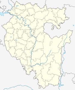
Beloretsky District is an administrative and municipal district (raion), one of the fifty-four in the Republic of Bashkortostan, Russia. It is located in the east of the republic and borders with Chelyabinsk Oblast in the north, Uchalinsky District in the east, Abzelilovsky District in the southeast, Burzyansky District in the south, Ishimbaysky District in the southwest, and with Gafuriysky and Arkhangelsky Districts in the west. The area of the district is 11,302.58 square kilometers (4,363.95 sq mi). Its administrative center is the town of Beloretsk. As of the 2010 Census, the total population of the district was 38,442.

Verkhnearshinsky is a rural locality in Nikolayevsky Selsoviet, Beloretsky District, Bashkortostan, Russia. The population was 119 as of 2010. There are 17 streets.

Verkhny Avzyan is a rural locality and the administrative centre of Verkhneavzyansky Selsoviet, Beloretsky District, Bashkortostan, Russia. The population was 2,024 as of 2010. There are 30 streets.

Yermotayevo is a rural locality in Tukansky Selsoviet, Beloretsky District, Bashkortostan, Russia. The population was 5 as of 2010. There are 6 streets.

Zheleznodorozhny is a rural locality and the administrative centre of Zheleznodorozhny Selsoviet, Beloretsky District, Bashkortostan, Russia. The population was 3,020 as of 2010. There are 41 streets.

Zigaza is a rural locality and the administrative centre of Zigazinsky Selsoviet, Beloretsky District, Bashkortostan, Russia. The population was 638 as of 2010. There are 10 streets.

<span class="mw-page-title-main">Zuyakovo</span> Selo in Bashkortostan, Russia

Zuyakovo is a rural locality and the administrative centre of Zuyakovsky Selsoviet, Beloretsky District, Bashkortostan, Russia. The population was 849 as of 2010. There are 10 streets.

Ishlya is a rural locality and the administrative centre of Ishlinsky Selsoviet, Beloretsky District, Bashkortostan, Russia. The population was 436 as of 2010. There are 8 streets.

Kagarmanovo is a rural locality in Uzyansky Selsoviet, Beloretsky District, Bashkortostan, Russia. The population was 432 as of 2010. There are 13 streets.

Katarysh is a rural locality in Uzyansky Selsoviet, Beloretsky District, Bashkortostan, Russia. The population was 14 as of 2010. There is 1 street.

Rysakayevo is a rural locality in Sosnovsky Selsoviet, Beloretsky District, Bashkortostan, Russia. The population was 379 as of 2010. There are 12 streets.

Safargulovo is a rural locality in Inzersky Selsoviet, Beloretsky District, Bashkortostan, Russia. The population was 99 as of 2010. There are 2 streets.

Sermenevo is a rural locality and the administrative centre of Sermenevsky Selsoviet, Beloretsky District, Bashkortostan, Russia. The population was 2,018 as of 2010. There are 25 streets.

Tukan is a rural locality and the administrative centre of Tukansky Selsoviet, Beloretsky District, Bashkortostan, Russia. The population was 723 as of 2010. There are 33 streets.

Uraltau is a rural locality in Abzakovsky Selsoviet, Beloretsky District, Bashkortostan, Russia. The population was 78 as of 2010. There is 1 street.

Utkalevo is a rural locality in Shigayevsky Selsoviet, Beloretsky District, Bashkortostan, Russia. The population was 396 as of 2010. There are 10 streets.

Chyorny Klyuch is a rural locality in Nikolayevsky Selsoviet, Beloretsky District, Bashkortostan, Russia. The population was 29 as of 2010. There is 1 street.

Shushpa is a rural locality in Nursky Selsoviet, Beloretsky District, Bashkortostan, Russia. The population was 43 as of 2010. There are 9 streets.

Yandek is a rural locality in Sermenevsky Selsoviet, Beloretsky District, Bashkortostan, Russia. The population was 23 as of 2010. There is 1 street.

References

  1. Карта Белорецкого района Башкортостана
  2. "Всероссийская перепись населения 2010 года. Численность населения по населённым пунктам Республики Башкортостан" (PDF). Archived from the original (PDF) on 2019-05-17. Retrieved 2019-06-13.
  3. Расстояние от Махмутова до Белорецка
  4. Радвани, Жан (2010). "Всероссийская Перепись Населения 2010 года: Заметки и Первые Впечатления". Ab Imperio. 2010 (4): 341–348. doi:10.1353/imp.2010.0063. ISSN   2164-9731.
  5. Galieva, Guzel Maratovna (2020-09-30). "Influence of economic development of municipal district on preschool education (case study of Republic of Bashkortostan)". Vestnik of Astrakhan State Technical University. Series: Economics. 2020 (3): 42–49. doi: 10.24143/2073-5537-2020-3-42-49 . ISSN   2073-5537.
  6. Bauer, Wilfried (1999-11-30). "First results of macro- and microfabric analyses in the metamorphic complex of Beloretsk (southern Ural)". Zeitschrift der Deutschen Geologischen Gesellschaft. 150 (3): 583–594. doi:10.1127/zdgg/150/1999/583. ISSN   0012-0189.