Malta Range was the original and former name for the combined Cotterel Mountains (on the north) and Jim Sage Mountains (on the south), [1] both of which are subranges of the Albion Mountains in Cassia County, Idaho, United States. However, it was later determined that they were two separate subranges, and the new names were applied accordingly. [2]

Idaho is a state in the Mountain West subregion of the United States. To the north, it shares a small portion of the Canada–United States border with the province of British Columbia. It borders the states of Montana and Wyoming to the east, Nevada and Utah to the south, and Washington and Oregon to the west. The state's capital and largest city is Boise. With an area of 83,570 square miles (216,400 km2), Idaho is the 14th largest state by land area, but with a population of approximately 1.8 million, it ranks as the 13th least populous and the 6th least densely populated of the 50 U.S. states.

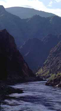
The Rocky Mountains, also known as the Rockies, are a major mountain range and the largest mountain system in North America. The Rocky Mountains stretch 3,000 miles in straight-line distance from the northernmost part of western Canada, to New Mexico in the southwestern United States. Depending on differing definitions between Canada and the U.S., its northern terminus is located either in northern British Columbia's Terminal Range south of the Liard River and east of the Trench, or in the northeastern foothills of the Brooks Range/British Mountains that face the Beaufort Sea coasts between the Canning River and the Firth River across the Alaska-Yukon border. Its southernmost point is near the Albuquerque area adjacent to the Rio Grande rift and north of the Sandia–Manzano Mountain Range. Being the easternmost portion of the North American Cordillera, the Rockies are distinct from the tectonically younger Cascade Range and Sierra Nevada, which both lie farther to its west.

The Bitterroot Range is a mountain range and a subrange of the Rocky Mountains that runs along the border of Montana and Idaho in the northwestern United States. The range spans an area of 24,223 square miles (62,740 km2) and is named after the bitterroot, a small pink flower that is the state flower of Montana.

Borah Peak, also known as Mount Borah or Beauty Peak, is the highest mountain in the U.S. state of Idaho and one of the most prominent peaks in the contiguous United States. It is located in the central section of the Lost River Range, within the Challis National Forest in eastern Custer County. On February 11, 2021, the USGS officially recognized Mt. Borah as Idaho's only active glacier.

The Uinta Mountains are an east-west trending chain of mountains in northeastern Utah extending a short distance into northwest Colorado and slightly into southwestern Wyoming in the United States. As a subrange of the Rocky Mountains, they are unusual for being the highest range in the contiguous United States running east to west, and lie approximately 100 miles (160 km) east of Salt Lake City. The range has peaks ranging from 11,000 to 13,528 feet, with the highest point being Kings Peak, also the highest point in Utah. The Mirror Lake Highway crosses the western half of the Uintas on its way to Wyoming. Utah state highway 44 crosses the east end of the Uintas between Vernal UT and Manila UT.

The Sangre de Cristo Mountains are the southernmost subrange of the Rocky Mountains. They are located in southern Colorado and northern New Mexico in the United States. The mountains run from Poncha Pass in South-Central Colorado, trending southeast and south, ending at Glorieta Pass, southeast of Santa Fe, New Mexico. The mountains contain a number of fourteen thousand foot peaks in the Colorado portion, as well as several peaks in New Mexico which are over thirteen thousand feet.

The Northern and Central Bitterroot Range, collectively the Bitterroot Mountains, is the largest portion of the Bitterroot Range, part of the Rocky Mountains and Idaho Batholith, located in the panhandle of Idaho and westernmost Montana in the northwestern United States. The mountains encompass an area of 4,862 square miles (12,593 km²).

The Purcell Mountains are a mountain range in southeastern British Columbia, Canada. They are a subrange of the Columbia Mountains, which includes the Selkirk, Monashee, and Cariboo Mountains. They are located on the west side of the Rocky Mountain Trench in the area of the Columbia Valley, and on the east side of the valley of Kootenay Lake and the Duncan River. The only large settlements in the mountains are the Panorama Ski Resort and Kicking Horse Resort, adjacent to the Columbia Valley towns of Invermere and Golden, though there are small settlements, such as Yahk and Moyie along the Crowsnest Highway, and residential rural areas dependent on the cities of Creston, Kimberley and Cranbrook, which are located adjacent to the range.

The Columbia Mountains are a group of mountain ranges along the Upper Columbia River in British Columbia, Montana, Idaho and Washington. The mountain range covers 135,952 km². The range is bounded by the Rocky Mountain Trench on the east, and the Kootenai River on the south; their western boundary is the edge of the Interior Plateau. Seventy-five percent of the range is located in Canada and the remaining twenty-five percent in the United States; American geographic classifications place the Columbia Mountains as part of the Rocky Mountains complex, but this designation does not apply in Canada. Mount Sir Sandford is the highest mountain in the range, reaching 3,519 metres (11,545 ft).

Boise National Forest is a National Forest covering 2,203,703 acres (8,918.07 km2) of the U.S. state of Idaho. Created on July 1, 1908, from part of Sawtooth National Forest, it is managed by the U.S. Forest Service as five units: the Cascade, Emmett, Idaho City, Lowman, and Mountain Home ranger districts.

The Needle Mountains are a subrange of the San Juan Mountains of the Rocky Mountains located in the southwestern part of the U.S. State of Colorado. Much of the range is protected in the Weminuche Wilderness of the San Juan National Forest. The range is notable for having some of the most rugged mountains in the state, and includes many technical climbs and scrambles. A small but dramatic east–west subrange in the northern section is known as the Grenadier Range.

The Clearwater Mountains are part of the Rocky Mountains, located in the panhandle of Idaho in the Western United States. The mountains lie between the Salmon River and the Bitterroot Range and encompass an area of 8,499 square miles (22,012 km2).

The Sawtooth Range is a mountain range of the Rocky Mountains in central Idaho, United States, reaching a maximum elevation of 10,751 feet (3,277 m) at the summit of Thompson Peak. It encompasses an area of 678 square miles (1,756 km2) spanning parts of Custer, Boise, Blaine, and Elmore counties, and is bordered to the east by the Sawtooth Valley. Much of the mountain range is within the Sawtooth Wilderness, part of the Sawtooth National Recreation Area and Sawtooth National Forest.
The Salmon River Mountains are a major mountain range covering most of the central part of the U.S. state of Idaho. The range is over 120 miles (190 km) long and its boundaries are usually defined by the Salmon River and its large tributary forks. Part of the central Rocky Mountains, the entire range lies west of the Continental Divide of the Americas and drains to the Snake River. The highest peak is White Mountain, at 10,442 feet (3,183 m) above sea level. There are five peaks over 10,000 feet (3,000 m) high, and there are three major subranges defined by other forks of the Salmon River: the West, Central and East Salmon River Mountains.
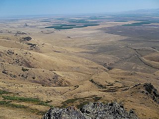
The Raft River Valley is a valley in Cassia County, Idaho and Box Elder County, Utah in the United States.

Sacajawea Peak is an 11,936-foot elevation (3,638 m) mountain summit in Custer County, Idaho, United States.
Cassia Creek is a stream in Cassia County, Idaho, United States, that is a tributary of the Raft River.
The Jim Sage Mountains are a small mountain range in Cassia County, Idaho, United States, that are subrange of the Albion Mountains.

The Cotterel Mountains are a small mountain range in Cassia County, Idaho, United States, that are subrange of the Albion Mountains.
The Upper Raft River Valley is a valley in Cassia County, Idaho and Box Elder County, Utah in the United States.
| | This Cassia County, Idaho state location article is a stub. You can help Wikipedia by expanding it. |