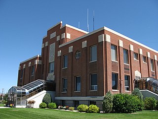
Cassia County is a county in the U.S. state of Idaho. As of the 2020 Census the county had a population of 24,655. The county seat and largest city is Burley. Cassia County is included in the Burley, ID Micropolitan Statistical Area.

The Raft River is a 108-mile-long (174 km) tributary of the Snake River located in northern Utah and southern Idaho in the United States. It is part of the Columbia River Basin.

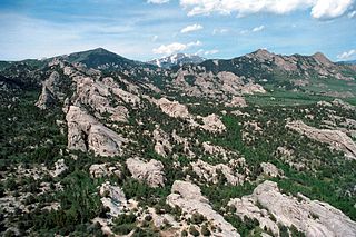
The Albion Mountains are a mountain range in the U.S. states of Idaho (~99%) and Utah (~1%), spanning Cassia County, Idaho and barely reaching into Box Elder County, Utah. The highest point in the range is Cache Peak at 10,339 feet (3,151 m), and the range is a part of the Basin and Range Province. Most of the mountains are part of the Albion Division of the Minidoka Ranger District of Sawtooth National Forest.

Cache Peak, at 10,339 feet (3,151 m) above sea level, is the highest peak in the Albion Mountains of Cassia County in Southern Idaho. Cache Peak is located in the central part of the range southeast of Oakley and north of Almo in the Albion Division of the Minidoka Ranger District of Sawtooth National Forest.

The Black Pine Mountains are a mountain range in the U.S. states of Idaho (~65%) and Utah (~35%), spanning Cassia County, Idaho and reaching into Box Elder County, Utah. The highest point in the range is known as Black Pine Mountains High Point, sometimes referred to as Black Peak, at 9,395 feet (2,864 m), and the range is a part of the Great Basin Divide and the Basin and Range Province. In Idaho, the mountains are part of the Black Pine Division of the Minidoka Ranger District of Sawtooth National Forest.
Black Pine Mountains High Point, at 9,289 feet (2,831 m) above sea level is the highest peak in the Black Pine Mountains of Cassia County in southern Idaho. The high point is sometimes referred to as "Black Peak" because of a benchmark on the peak that reads "Black".
The Sublett Range is a mountain range in the U.S. states of Idaho (~94%) and Utah (~6%), spanning Cassia, Oneida, and Power counties, Idaho and reaching into Box Elder County, Utah. The Phosphoria Formation reaches its greatest thickness beneath the mountains.

Mount Harrison, at 9,265 feet (2,824 m) is a peak in the northern Albion Mountains of Cassia County in southern Idaho. Mount Harrison is located in north of Cache Peak, south of Burley, northeast of Oakley, and west of Malta in the Albion Division of the Minidoka Ranger District of Sawtooth National Forest. Mount Harrison is in the watershed of tributaries of the Snake River, which itself is a tributary of the Columbia River. The peak can be reached via a paved road that runs all the way to its summit. Lake Cleveland is located in the basin north of the peak, and a small unnamed lake is located in the basin southeast of the peak.
Mount Independence is the second highest peak in the Albion Mountains of Idaho. The peak is located in Sawtooth National Forest and Cassia County. It is located about 1 mi (1.6 km) northwest of Cache Peak. The Independence Lakes are located in the basin to the east of the peak. Mount Independence supports one of the three populations of Cymopterus davisii, a plant that is endemic to the Albion Mountains. The Mount Independence population is considered a single population with Cache Peak. Mount Independence is 9,950 feet (3,030 m) above sea level.
Graham Peak is the fourth highest peak in the Albion Mountains of Idaho, at 8,867 feet (2,703 m) above sea level. The peak is located in the City of Rocks National Reserve and Cassia County less than 0.2 mi (0.32 km) south of the Sawtooth National Forest border. It is located 5.13 mi (8.26 km) south-southwest of Cache Peak. Forest road 707 leads directly to the summit. The peak contains the smallest of the three known populations of Cymopterus davisii, estimated at 500–1000 individuals.
Smoky Mountain, at 7,579 feet (2,310 m) above sea level is a peak in the Albion Mountains of Idaho. The peak is located in Cassia County about 0.35 mi (0.56 km) east of the border of City of Rocks National Reserve on land managed by the Bureau of Land Management. It is 4.7 mi (7.6 km) north of the Nevada border.
Thunder Mountain, at 7,455 feet (2,272 m) above sea level is a peak in the Albion Mountains of Idaho. The peak is located in Sawtooth National Forest and Cassia County. It is located about 2.7 mi (4.3 km) southeast of Cache Peak.

State Highway 77 (SH-77) is a 30.676-mile (49.368 km) state highway in Cassia County, Idaho, United States, that connects Idaho State Highway 81 (SH-81) in Malta with Interstate 84/U.S. Route 30 (I-84/US 30) north of Declo, via Albion. The highway also has a spur that runs from City of Rocks Road to SH-77 in Connor.

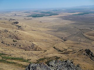
The Raft River Valley is a valley in Cassia County, Idaho and Box Elder County, Utah in the United States.

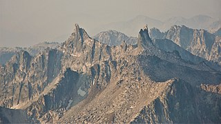
Monte Verita is a 10,140-foot elevation (3,091 m) mountain summit located in Boise County, Idaho, United States.

North Raker is a 9,970-foot elevation (3,039 m) mountain summit located in Boise County, Idaho, United States.
Cassia Creek is a stream in Cassia County, Idaho, United States, that is a tributary of the Raft River.
Malta Range was the original and former name for the combined Cotterel Mountains and Jim Sage Mountains, both of which are subranges of the Albion Mountains in Cassia County, Idaho, United States. However, it was later determined that they were two separate subranges, and the new names were applied accordingly.
The Jim Sage Mountains are a small mountain range in Cassia County, Idaho, United States, that are subrange of the Albion Mountains.
The Upper Raft River Valley is a valley in Cassia County, Idaho and Box Elder County, Utah in the United States.


