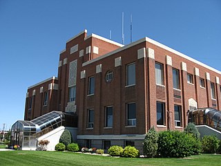
Cassia County is a county in the U.S. state of Idaho. As of the 2020 Census the county had a population of 24,655. The county seat and largest city is Burley. Cassia County is included in the Burley, ID Micropolitan Statistical Area.

The City of Rocks National Reserve, also known as the Silent City of Rocks, is a United States National Reserve and state park in south-central Idaho, approximately 2 miles (3.2 km) north of the border with Utah. It is widely known for its enormous granite rock formations and excellent rock climbing.

The Raft River is a 108-mile-long (174 km) tributary of the Snake River located in northern Utah and southern Idaho in the United States. It is part of the Columbia River Basin.

The Payette River is an 82.7-mile-long (133.1 km) river in southwestern Idaho and is a major tributary of the Snake River.

The Lochsa River is in the northwestern United States, in the mountains of north central Idaho. It is one of two primary tributaries of the Middle Fork of the Clearwater River in the Clearwater National Forest. Lochsa is a Nez Perce word meaning rough water. The Salish name is Ep Smɫí, "It Has Salmon."

The Salt River is an 84-mile-long (135 km) river draining a valley in Lincoln County in western Wyoming. It is named for several exposed beds of salt and briny salt springs of up 60% pure salt in Idaho that drains into the Salt River via Stump Creek. The Salt River valley was a popular destination for Indians and later pioneers seeking salt and game. The headwaters of the river are below 10,472-foot (3,192 m) Mount Wagner in the Salt River Range. The river flows west out of the mountains and then northward along the border of Wyoming and Idaho. It passes 6,600-foot (2,000 m) Smoot, Wyoming and then meanders through the mostly agricultural Star Valley, being joined by numerous creeks along the way, to its confluence with the Snake River near the town of Alpine.
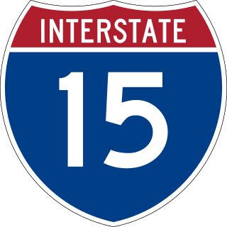
Interstate 15 (I-15) is a part of the Interstate Highway System that runs from San Diego, California, to Sweetgrass, Montana. In Idaho, the Interstate Highway runs exactly 196 miles (315 km) from the Utah state line near Woodruff north to the Montana state line at Monida Pass. I-15 is the primary north–south highway of Eastern Idaho. The Interstate Highway connects Pocatello and Idaho Falls, the fourth and fifth largest cities in Idaho, and the smaller county seats of Malad City, Blackfoot, and Dubois. I-15 connects all of those cities with Salt Lake City to the south and Butte to the north. The Interstate has business loops through McCammon, Inkom, Pocatello, Blackfoot, and Idaho Falls.

The historic 2,170-mile (3,490 km) Oregon Trail connected various towns along the Missouri River to Oregon's Willamette Valley. It was used during the 19th century by Great Plains pioneers who were seeking fertile land in the West and North.

The Juab Valley is a 40-mile (64 km) long valley located on the eastern edge of Juab County, Utah, United States.

The Albion Mountains are a mountain range in the U.S. states of Idaho (~99%) and Utah (~1%), spanning Cassia County, Idaho and barely reaching into Box Elder County, Utah. The highest point in the range is Cache Peak at 10,339 feet (3,151 m), and the range is a part of the Basin and Range Province. Most of the mountains are part of the Albion Division of the Minidoka Ranger District of Sawtooth National Forest.

The Black Pine Mountains are a mountain range in the U.S. states of Idaho (~65%) and Utah (~35%), spanning Cassia County, Idaho and reaching into Box Elder County, Utah. The highest point in the range is known as Black Pine Mountains High Point, sometimes referred to as Black Peak, at 9,395 feet (2,864 m), and the range is a part of the Great Basin Divide and the Basin and Range Province. In Idaho, the mountains are part of the Black Pine Division of the Minidoka Ranger District of Sawtooth National Forest.
Black Pine Mountains High Point, at 9,289 feet (2,831 m) above sea level is the highest peak in the Black Pine Mountains of Cassia County in southern Idaho. The high point is sometimes referred to as "Black Peak" because of a benchmark on the peak that reads "Black".
The Sublett Range is a mountain range in the U.S. states of Idaho (~94%) and Utah (~6%), spanning Cassia, Oneida, and Power counties, Idaho and reaching into Box Elder County, Utah. The Phosphoria Formation reaches its greatest thickness beneath the mountains.

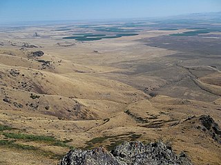
Goose Creek is a 123-mile (198 km) long tributary of the Snake River. Beginning at an elevation of 7,239 feet (2,206 m) in the Cassia Division of the Sawtooth National Forest in southwestern Cassia County, Idaho, it flows south into Elko County, Nevada, and loops back around into Cassia County, briefly crossing Box Elder County, Utah, in the process. It is impounded by Oakley Dam several miles south of Oakley, Idaho, forming Lower Goose Creek Reservoir. All of the creek's water is stored for irrigation, so its channel from the reservoir to its mouth near Burley, Idaho, is dry and largely obliterated by agriculture. Goose Creek has a 1,120-square-mile (2,901 km2) watershed. The California Trail followed Goose Creek from a point just north of the Idaho/Utah border southwest across northwestern Utah to Little Goose Creek in northeastern Elko County, Nevada.
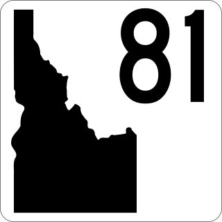
State Highway 81 (SH-81) is a state highway in Cassia County, Idaho. The highway runs for 33.978 miles (54.682 km) from SH-77 in Malta to U.S. Route 30 (US-30) in Burley. It also has a short spur route connecting the highway to Interstate 84 (I-84) at the Yale Interchange.

State Highway 77 (SH‑77) is a 30.676-mile (49.368 km) state highway in Cassia County, Idaho, United States, that connects Idaho State Highway 81 (SH‑81) in Malta with Interstate 84/U.S. Route 30 (I‑84/US 30) north of Declo, via Albion. The highway also has a spur that runs from City of Rocks Road to SH‑77 in Connor.
The Raft River Valley is a valley in Cassia County, Idaho and Box Elder County, Utah in the United States.
The Jim Sage Mountains are a small mountain range in Cassia County, Idaho, United States, that are subrange of the Albion Mountains.

The Cotterel Mountains are a small mountain range in Cassia County, Idaho, United States, that are subrange of the Albion Mountains.
The Upper Raft River Valley is a valley in Cassia County, Idaho and Box Elder County, Utah in the United States.

