A nature reserve is a protected area of importance for flora, fauna, funga, or features of geological or other special interest, which is reserved and managed for purposes of conservation and to provide special opportunities for study or research. They may be designated by government institutions in some countries, or by private landowners, such as charities and research institutions. Nature reserves fall into different IUCN categories depending on the level of protection afforded by local laws. Normally it is more strictly protected than a nature park. Various jurisdictions may use other terminology, such as ecological protection area or private protected area in legislation and in official titles of the reserves.

The River Blythe flows through the English Midlands from central Warwickshire, through the Borough of Solihull and on to Coleshill in north Warwickshire. It runs along the Meriden Gap in the Midlands Plateau, is fed by the River Cole and is a tributary of the River Tame beside the West Midland Bird Club's Ladywalk reserve. This then joins the River Trent, whose waters reach the North Sea via the Humber Estuary.

Warwickshire is a ceremonial county in the West Midlands of England. It is bordered by Staffordshire and Leicestershire to the north, Northamptonshire to the east, Oxfordshire and Gloucestershire to the south, and Worcestershire and the West Midlands county to the west. The largest settlement is Nuneaton and the county town is Warwick.

The Metropolitan Borough of Solihull is a metropolitan borough in West Midlands county, England. It is named after its largest town, Solihull, from which Solihull Metropolitan Borough Council is based. For Eurostat purposes it is a NUTS 3 region and is one of seven boroughs or unitary districts that comprise the "West Midlands" NUTS 2 region. Much of the large residential population in the north of the borough centres on the communities of Castle Bromwich, Kingshurst, Marston Green and Smith's Wood as well as the towns of Chelmsley Wood and Fordbridge. In the south are the towns of Shirley and Solihull, as well as the large villages of Knowle, Dorridge, Meriden and Balsall Common.
Warwickshire Wildlife Trust is a Wildlife Trust and Registered Charity covering the county of Warwickshire and Solihull and Coventry in the county of West Midlands, England. The Trust aims to protect and enhance wildlife, natural habitats and geology throughout Warwickshire, Coventry and Solihull.

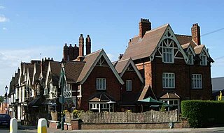
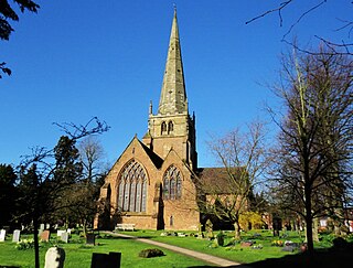
Dorridge is a large village in the Metropolitan Borough of Solihull in the West Midlands (county), England. Historically part of the historic county of Warwickshire, the village is encompassed within the electoral ward of Dorridge and Hockley Heath, which had a population of 11,140 in the 2011 census.
Kingshurst is a post-war village and civil parish in the Metropolitan Borough of Solihull, in the West Midlands, England. Historically part of the county of Warwickshire in the Meriden Rural District, It lies about 7 miles (11 km) north of Solihull town centre, 10 miles (16 km) east of Birmingham and 10 miles (16km) west of Coventry, it borders North Warwickshire to the east. The village is encompassed within the electoral ward Kingshurst & Fordbridge which had a population of 7,868 in the 2011 census.

Hockley Heath is a village and civil parish within the Metropolitan Borough of Solihull, West Midlands, England. The village is to the south of the West Midlands conurbation, 12 miles (19 km) southeast of Birmingham 5.5 miles (8.9 km) from Solihull town centre and 13 miles (21 km) north of Stratford-upon-Avon. Hockley Heath is in the Arden area and borders Warwickshire and the District of Stratford-on-Avon to the south, with some parts of the village on either side of the border. It incorporates the hamlet of Nuthurst, and has a history dating back to the year 705 AD as a wood owned by Worcester Cathedral. The 2011 Census gives the population of Hockley Heath civil parish as 2,038.

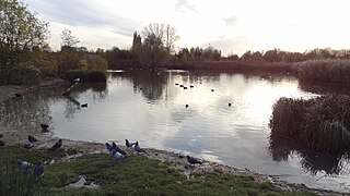
Kingfisher Country Park is a country park situated in the Metropolitan Borough of Solihull in England, straddling the historic border of Warwickshire and Worcestershire, mostly within the former. Initially designated as Project Kingfisher by Birmingham City Council, the park was formally declared a country park in July 2004. The country park is located along an 11 km (6.8 mi) stretch of the River Cole from Small Heath in Birmingham to Chelmsley Wood at the M6 motorway. It is a Local Nature Reserve.

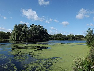
Babbs Mill Lake, sometimes called Kingshurst Lake, is a man-made lake in the Kingfisher Country Park in Kingshurst, Solihull in England. The lake was created as a balancing feature in times of flooding from the nearby River Cole.
Ashford Green Corridor is a green space that runs through the town of Ashford in Kent, England. The Green Corridor is made up of parks, recreation grounds and other green spaces alongside the rivers that flow through Ashford. It is a Local Nature Reserve.

Solihull is a market town and the administrative centre of the Metropolitan Borough of Solihull, in the West Midlands, England. Solihull is situated on the River Blythe in the Forest of Arden area. The town had a population of 126,577 at the 2021 Census, and its wider borough had a population of 216,240. The town is located 8 miles (12 km) southeast of Birmingham and 13 miles (21 km) west of Coventry.

Brandon Marsh is a Site of Special Scientific Interest (SSSI) and nature reserve in Warwickshire, England. It is situated adjacent to the River Avon, near the village of Brandon, a few miles east of Coventry.

Palmers Rough is a local nature reserve and park located in Shirley, Solihull. It covers an area of approximately 7.3 hectares and consists of two separate woodland blocks; Palmers Coppice to the east, and Squires Coppice to the west. They are separated by open grassland and include for two football pitches and a small children's playground. A wide range of plants and animals makes Palmers Rough an important urban space and was therefore granted local nature reserve status in 2000. The presence of Palmers Rough is noted within the Domesday Book, and suggests that the woodland dates back over 900 years.

Elmdon Park is a park and local nature reserve in Elmdon, Solihull, West Midlands. It was established in 1944 when the house and grounds of the derelict Elmdon Hall were bought up by the then Solihull Urban District Council. The house was used by the Home Guard during the war years, but the building subsequently became derelict, suffering from a rotten staircase and roof, and was demolished in 1956.

Sutcliffe Park is a 16.7-hectare (41-acre) public park in Eltham in the Royal Borough of Greenwich in London. It is located west of Eltham town centre, east of Lee Green, north of Horn Park and south of Kidbrooke.

Hockley Woods is a large woodland in south-east Essex. It is a Local Nature Reserve, and parts are a Site of Special Scientific Interest. It is owned and managed by Rochford District Council.

Longdon is a district of Solihull, in the West Midlands, England. Located in the east of the town, it was historically a distinct settlement that pre-dated the planted borough of Solihull, but is now mostly contiguous with Solihull town center.


