| Manadur | |
|---|---|
| city | |
 Manadur Location in Maharashtra, India | |
| Coordinates: 17°09′44″N73°53′38″E / 17.1622°N 73.8939°E Coordinates: 17°09′44″N73°53′38″E / 17.1622°N 73.8939°E | |
| Country | |
| State | Maharashtra |
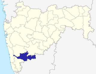
| District | Sangli |
| Population (2001) | |
| • Total | 3,920 |
| Languages | |
| • Official | Marathi |
| Time zone | IST (UTC+5:30) |
Manadur is a census town in Sangli district in the Indian state of Maharashtra.
A census town is a type of town that satisfies certain characteristics, depending on the country in which it is located.
Sangli District is a district of Maharashtra State in west-central India. Sangli City is the district headquarters. The district is 25.11% urban. Sangli and Miraj are the largest cities. The industrial town of Kirloskarwadi is also located in the Sangli District. Industrialist Laxmanrao Kirloskar started his first factory here. It is known as the sugar bowl of India due to its high sugarcane productivity. Sangli District is one of the most fertile and highly developed districts in Maharashtra. The District is very popular as a political power house in the state. Sangli District has provided many popular politicians and bureaucrats until now. Sangli has a rich history and cultural heritage. People often refers to Sangli District as the Heaven of Farmers.

India, also known as the Republic of India, is a country in South Asia. It is the seventh largest country by area and with more than 1.3 billion people, it is the second most populous country as well as the most populous democracy in the world. Bounded by the Indian Ocean on the south, the Arabian Sea on the southwest, and the Bay of Bengal on the southeast, it shares land borders with Pakistan to the west; China, Nepal, and Bhutan to the northeast; and Bangladesh and Myanmar to the east. In the Indian Ocean, India is in the vicinity of Sri Lanka and the Maldives, while its Andaman and Nicobar Islands share a maritime border with Thailand and Indonesia.


