Related Research Articles
Alexander Island, which is also known as Alexander I Island, Alexander I Land, Alexander Land, Alexander I Archipelago, and Zemlja Alexandra I, is the largest island of Antarctica. It lies in the Bellingshausen Sea west of Palmer Land, Antarctic Peninsula from which it is separated by Marguerite Bay and George VI Sound. The George VI Ice Shelf entirely fills George VI Sound and connects Alexander Island to Palmer Land. The island partly surrounds Wilkins Sound, which lies to its west. Alexander Island is about 390 kilometres (240 mi) long in a north–south direction, 80 kilometres (50 mi) wide in the north, and 240 kilometres (150 mi) wide in the south. Alexander Island is the second-largest uninhabited island in the world, after Devon Island.

Thurston Island is a largely ice-covered, glacially dissected island, 135 nautical miles long and 55 nautical miles wide, lying between Amundsen Sea and Bellingshausen Sea a short way off the northwest end of Ellsworth Land, Antarctica. The island is separated from the mainland by Peacock Sound, which is occupied by the west portion of Abbot Ice Shelf.

The Byrd Glacier is a major glacier in Antarctica, about 136 km (85 mi) long and 24 km (15 mi) wide. It drains an extensive area of the Antarctic plateau, and flows eastward to discharge into the Ross Ice Shelf.

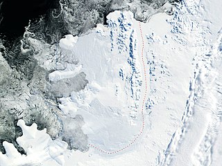
The Amery Ice Shelf is a broad ice shelf in Antarctica at the head of Prydz Bay between the Lars Christensen Coast and Ingrid Christensen Coast. It is part of Mac. Robertson Land. The name "Cape Amery" was applied to a coastal angle mapped on 11 February 1931 by the British Australian New Zealand Antarctic Research Expedition (BANZARE) under Douglas Mawson. He named it for William Bankes Amery, a civil servant who represented the United Kingdom government in Australia (1925–28). The Advisory Committee on Antarctic Names interpreted this feature to be a portion of an ice shelf and, in 1947, applied the name Amery to the whole shelf.

Prydz Bay is a deep embayment of Antarctica between the Lars Christensen Coast and Ingrid Christensen Coast. The Bay is at the downstream end of a giant glacial drainage system that originates in the East Antarctic interior. The Lambert Glacier flows from Lambert Graben into the Amery Ice Shelf on the south-west side of Prydz Bay. Other major glaciers drain into the southern end of the Amery Ice Shelf at 73° S where the marine part of the system starts at the modern grounding zone.

Lambert Glacier is a major glacier in East Antarctica. At about 80 km (50 mi) wide, over 400 km (250 mi) long, and about 2,500 m (8,200 ft) deep, it is the world's largest glacier. It drains 8% of the Antarctic ice sheet to the east and south of the Prince Charles Mountains and flows northward to the Amery Ice Shelf. It flows in part of Lambert Graben and exits the continent at Prydz Bay.
Fisher Glacier is a glacier in Mac. Robertson Land, Antarctica. It is a major tributary of the Lambert Glacier. The glacier is unusual in periodically surging.
Foundation Ice Stream is a major ice stream in the Pensacola Mountains of Antarctica. The ice stream drains northward for 150 nautical miles along the west side of the Patuxent Range and the Neptune Range to enter the Ronne Ice Shelf westward of Dufek Massif.
Sulzberger Bay is a bay indenting the front of the Sulzberger Ice Shelf between Fisher Island and Vollmer Island, along the coast of Marie Byrd Land, Antarctica.
On the continent of Antarctica, the Aramis Range is the third range south in the Prince Charles Mountains, situated 11 miles southeast of the Porthos Range and extending for about 30 miles in a southwest–northeast direction. It was first visited in January 1957 by Australian National Antarctic Research Expeditions (ANARE) southern party led by W.G. Bewsher, who named it for a character in Alexandre Dumas' novel The Three Musketeers, the most popular book read on the southern journey.
Bain Nunatak is one of the Manning Nunataks, on the east side of the Amery Ice Shelf. The nunataks were photographed by U.S. Navy Operation Highjump (1946–47) and Australian National Antarctic Research Expeditions (ANARE) (1957). They were visited by the Soviet Antarctic Expedition in 1965 and by the ANARE Prince Charles Mountains survey party in 1969. This feature was named for C.J. Bain, weather observer at Mawson Station in 1969 and a member of the 1969 ANARE survey party.
New Year Nunatak * is a nunatak in the central part of the Manning Nunataks in the southeast part of Amery Ice Shelf. Plotted from air photos taken by ANARE in 1957. So named by Antarctic Names Committee of Australia (ANCA) because the nunatak was visited by a geological party of the Soviet Antarctic Expedition on New Year's Day of 1966.

Nicholson Peninsula is a broad ice-covered peninsula about 15 nautical miles (28 km) long, between Couzens Bay and Matterson Inlet on the Shackleton Coast on the west side of the Ross Ice Shelf, Antarctica.
Mozart Ice Piedmont is an ice piedmont, 60 nautical miles (110 km) long-running in a NW-SE direction and 15 nautical miles (28 km) wide in its widest part, on the west coast of Alexander Island, Antarctica. Mapped from air photos taken by the Ronne Antarctic Research Expedition (RARE) in 1947, by Searle of the Falkland Islands Dependencies Survey (FIDS) in 1960. Named by the United Kingdom Antarctic Place-Names Committee (UK-APC) for Wolfgang Amadeus Mozart (1756–1791), famous Austrian composer. Some landforms within this area are named in association with the Mozart Ice Piedmont such as Figaro Nunatak, along with a few other landforms.
Pickering Nunatak is a prominent nunatak at the east side of the mouth of Lambert Glacier, situated 20 nautical miles (37 km) south-southwest of Manning Nunataks. Sighted on a flight by an ANARE Beaver aircraft over the Amery Ice Shelf on November 2, 1957. Named by Antarctic Names Committee of Australia (ANCA) for Flight Sgt. R. Pickering of the RAAF Antarctic Flight at Mawson Station, 1957.
Foster Nunatak is a horseshoe shaped rock outcrop in the south part of the Manning Nunataks, on the east side of the Amery Ice Shelf, Antarctica. The Manning Nunataks were photographed by U.S. Navy Operation Highjump (1946–47) and Australian National Antarctic Research Expeditions (ANARE) (1957). They were visited by the Soviet Antarctic Expedition in 1965 and ANARE in 1969. This nunatak was named by the Antarctic Names Committee of Australia for A.L. Foster, an electronics engineer at Mawson Station in 1970, and a member of an ANARE glaciological traverse party on the Amery Ice Shelf in January 1970.
The Linton-Smith Nunataks are a group of nunataks between Jennings Promontory and the Reinbolt Hills on the east side of the Amery Ice Shelf, Antarctica. They were first photographed by U.S. Navy Operation Highjump (1946–47), and the position was fixed by intersection from the Corry Rocks and Rubeli Bluff by Australian National Antarctic Research Expeditions (ANARE) surveyors in 1968. The group was named by the Antarctic Names Committee of Australia for N. Linton-Smith, senior technical officer with the Antarctic Division, Melbourne, a member of the ANARE Amery Ice Shelf glaciological traverse in 1970.
Tester Nunatak is the southernmost of a group of three nunataks in the northern part of the Manning Nunataks, in the east part of Amery Ice Shelf. The nunataks were photographed by U.S. Navy Operation Highjump (1946–47) and ANARE (1957). They were visited by the Soviet Antarctic Expedition in 1965 and by ANARE in 1969. Named by Antarctic Names Committee of Australia (ANCA) for J. Tester, aircraft engineer with the ANARE Prince Charles Mountains survey party in 1969.
Luff Nunatak is a narrow nunatak, 3 nautical miles (6 km) long, located west of Foster Nunatak in the Manning Nunataks of Antarctica, in the eastern part of the Amery Ice Shelf. The Manning Nunataks were photographed by U.S. Navy Operation Highjump (1946–47) and the Australian National Antarctic Research Expeditions (ANARE) (1957). They were visited by the Soviet Antarctic Expedition in 1965 and ANARE in 1969. The nunatak was named by the Antarctic Names Committee of Australia for T.S. Luff, a senior diesel mechanic at Mawson Station in 1970, and a member of the ANARE glaciological traverse party on the Amery Ice Shelf in January 1970.
References
- ↑ "Manning Nunataks". Geographic Names Information System . United States Geological Survey, United States Department of the Interior . Retrieved 2013-08-04.
![]() This article incorporates public domain material from "Manning Nunataks". Geographic Names Information System . United States Geological Survey.
This article incorporates public domain material from "Manning Nunataks". Geographic Names Information System . United States Geological Survey.
| | This Mac. Robertson Land location article is a stub. You can help Wikipedia by expanding it. |