Mansarovar (Jaipur)

Last updated

Mansarovar
Colony
JaipurMetrotrail.png
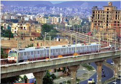
Metro line near Mansarovar
Mansarovar (Jaipur)
Location in Jaipur
Coordinates: 26°51′48″N75°45′59″E / 26.86333°N 75.76639°E / 26.86333; 75.76639
CountryFlag of India.svg  India
State Rajasthan
District Jaipur District
City Jaipur
Language
  Official Hindi [1]
  Additional official English [1]
Time zone UTC+5:30 (IST)
PIN
302020
Planning agency Jaipur Development Authority
Civic agency Jaipur Municipal Corporation
Website jaipur.rajasthan.gov.in

Mansarovar is a colony in southwest Jaipur, Rajasthan, India. Until 2010,[ how? ] it was the largest colony in Asia. On June 3, 2015, the Jaipur Metro began serving the area. A large number of people are looking to buy homes in this colony because it has great access to the rest of the city and is located in close proximity to the RIICO Industrial Area, which is recognized as one of the most important employment centers in the region. There are 134,935 people living in Mansarovar.[ citation needed ] Nine distinct areas make up Mansarovar. The total landmass encompasses around 12.28 square kilometers (4.7 sq mi).

Police stations

The following police stations of Jaipur police serve this area:

Related Research Articles

<span class="mw-page-title-main">Rajasthan</span> State in Northwestern India

Rajasthan is a state in northern India. It covers 342,239 square kilometres (132,139 sq mi) or 10.4 per cent of India's total geographical area. It is the largest Indian state by area and the seventh largest by population. It is on India's northwestern side, where it comprises most of the wide and inhospitable Thar Desert and shares a border with the Pakistani provinces of Punjab to the northwest and Sindh to the west, along the Sutlej-Indus River valley. It is bordered by five other Indian states: Punjab to the north; Haryana and Uttar Pradesh to the northeast; Madhya Pradesh to the southeast; and Gujarat to the southwest. Its geographical location is 23°.3' to 30°.12' North latitude and 69°.30' to 78°.17' East longitude, with the Tropic of Cancer passing through its southernmost tip.

<span class="mw-page-title-main">Jaipur</span> Capital of Rajasthan, India

Jaipur, formerly Jeypore, is the capital and largest city of the Indian state of Rajasthan. As of 2011, the city had a population of 3.1 million, making it the tenth most populous city in the country. Jaipur is also known as the Pink City, due to the dominant colour scheme of its buildings. It is also known as the Paris of India, and C. V. Raman called it the Island of Glory. It is located 268 km from the national capital New Delhi. Jaipur was founded in 1727 by the Kachhwaha Rajput ruler Jai Singh II, the ruler of Amer, after whom the city is named. It was one of the earliest planned cities of modern India, designed by Vidyadhar Bhattacharya. During the British Colonial period, the city served as the capital of Jaipur State. After independence in 1947, Jaipur was made the capital of the newly formed state of Rajasthan.

Sikar is a city and municipal council in the Sikar district of the state of Rajasthan in India. It is the administrative headquarters of the Sikar district. It is largest city of the Shekhawati region, which consists of Sikar, Churu and Jhunjhunu. After Kota, Sikar is one of the major coaching hubs in the country for competitive examination preparations and has a number of engineering and medical coaching institutes.

<span class="mw-page-title-main">Bhilwara</span> City in Rajasthan, India

Bhilwara is a city and administrative headquarters in Bhilwara district of the Mewar region of Rajasthan, India. It has been termed as 'Textile city'.

<span class="mw-page-title-main">Dharchula</span> City in Uttarakhand, India

Dharchula is a town in Pithoragarh district in the northern state of Uttarakhand, India, situated at an elevation of 940 m above sea level, surrounded by peaks from all sides and Kali river cutting through the middle, dividing the area into two towns on either bank of the river - one in India and the other in Nepal. River Kali originates from Lipulekh Pass and forms the border between India and Nepal. People of the two towns have similar traditions, culture, and lifestyle, and can move across the border without a passport or visa. The area has a mixture of Kumaouni and Rung language, traditions and culture. They move freely across the river as Indians and Nepalis do not need passport or visa to cross the soft border. Dharchula lies about 92 km (57 mi) north of Pithoragarh town, along the route of the Kailash-Mansarovar pilgrimage tour. It lies on the Pithoragagh-Lipulekh Pass Highway (PLPH).

<span class="mw-page-title-main">Sawai Madhopur</span> City in Rajasthan, India

Sawai Madhopur is a city and Municipal Council in the Sawai Madhopur District in Rajasthan state, India. It is the administrative headquarter of Sawai Madhopur District in Rajasthan. Ranthambore National Park which is 7 km from the railway station, and Ranthambore Fort, a UNESCO World Heritage Site are located near Sawai Madhopur.

<span class="mw-page-title-main">Chakradharpur</span> City in Jharkhand, India

Chakradharpur is a city in West Singhbhum district in the state of Jharkhand, India. It is the railway divisional headquarters of Chakradharpur (CKP) division of the South Eastern Railway. The city stands at an elevation of 227 metres and has urban area of 10 square kilometres bounded on the east by Jamshedpur (Tatanagar), on the west by Rourkela (Odisha), on the north by Ranchi and on the south by Chaibasa. Chakradharpur is close to boundaries of two neighbouring states, Odisha and West Bengal.

Pammal is a neighborhood in the city of Tambaram, situated within the Chennai Metropolitan Area, Tamil Nadu, India.

<span class="mw-page-title-main">Takhatgarh</span> City in Rajasthan, India

Takhatgarh is a town in Pali District of Rajasthan state in India. The town is one of the nine municipalities in the district, located near the district border. It is only about 160 years old.

<span class="mw-page-title-main">Shahdara district</span> District of Delhi in India

ShahdaraDistrict is an administrative and revenue district of Delhi, India, situated near the banks of Yamuna river. The district headquarters is Nand Nagri. The Shadara District is also a home for Shahdara area Which is closely located to Chandni chowk in Central Delhi, Situated close it's edge with Uttarpradesh state Ghaziabad District the area is commonly known as Apsara or Shahdara border.It is one of the oldest inhabited areas of Delhi and integral to what is known as Purani Dilli. Shahdara district was formed in 2012 and has a collectorate office at Nand Nagri, Delhi.

Neerja Modi School is a private co-educational K-12 day cum boarding school in Jaipur, Rajasthan, India. The school has been built by Shri Modi Shikshan Sansthan and has campuses spread across Rajasthan.

<span class="mw-page-title-main">Sukhadeo Thorat</span> Indian economist

Sukhadeo Thorat an Indian economist, educationist, professor and writer. He is the former chairman of the University Grants Commission. He is professor emeritus in Centre for the Study of Regional Development, Jawaharlal Nehru University. He is an expert on B. R. Ambedkar.

Kirti Nagar is a neighborhood in Delhi, India. Kirti Nagar is home to India's largest furniture market housing showrooms of multi-national home remodelling and fittings companies, the most reputed interior design boutiques, imported kitchen and bath brands as well as traditional carpentry furniture makers. Kirti nagar also hosts the biggest golf course and country club in North India.

<span class="mw-page-title-main">Jaipur Metro</span> Rapid transit system in the city of Jaipur, Rajasthan, India

The Jaipur Metro is a rapid transit system in the city of Jaipur, Rajasthan, India. Construction on the mostly elevated part of the first line, called Phase 1A, comprising 9.63 kilometres (5.98 mi) of route from Mansarovar to Chandpole Bazaar, started in November 2010, and was completed in 2014. The Jaipur Metro began commercial service between Chandpole and Mansarovar on 3 June 2015. The Jaipur Metro Rail system is India's sixth metro rail system after those in Kolkata, Delhi, Bangalore, Gurugram and Mumbai. The Jaipur Metro is the first metro in India to run on triple-storey elevated road and metro track. Phase 1-B, from Chandpole to Badi Chaupar, began operation on 23 September 2020.

<i>Bade Achhe Lagte Hain</i> 2011-14 Indian television soap opera

Bade Achhe Lagte Hain is a Hindi Indian soap opera that aired on Sony Entertainment Television from 30 May 2011 to 10 July 2014. Based on the Gujarati play Patrani by Imtiaz Patel, the soap opera was created and produced by Ekta Kapoor under the banner of Balaji Telefilms. The title of the show, along with the title-track, was derived from a song composed by R.D. Burman, from the soundtrack of the 1976 Bollywood film Balika Badhu. Ekta Kapoor had got the name, Bade Achhe Lagte Hain, registered about six years before the soap opera premiered.

<span class="mw-page-title-main">Pink Line (Jaipur Metro)</span> Metro line in Jaipur, India

The Pink Line of the Jaipur Metro is part of the rapid transit system in the city of Jaipur, India. It is also called East-West Corridor of Jaipur. It consists of 11 metro stations from Mansarovar in the West to Badi Chaupar in the East. The line with a length of 11.97 kilometers (7.44 mi) is mostly elevated and partially underground and has been laid to connect the oldest part of Jaipur to rest of it.

Mansarovar Ground or Jaipur District Cricket Association Ground or KL Saini Ground is situated in Mansarovar area of Jaipur, Rajasthan It is the home ground of the Rajasthan cricket team. It has a capacity of 5,000 people and was opened in 1990.

<span class="mw-page-title-main">Mansarovar metro station</span> Jaipur Metros Pink Line terminal metro station

Mansarovar is an elevated western terminal metro station on the East-West Corridor of the Pink Line of Jaipur Metro in Jaipur, India. This station was opened on 3 June 2015, which serves the Mansarovar colony.

Helencha is one of the largest colony village in the Bagdah CD block in the Bangaon subdivision of the North 24 Parganas district in the state of West Bengal, India. It is divided among many small area namely Old Helencha, Dakshin Helencha, Helencha 1 to 5 Colony.

References

  1. 1 2 "52nd REPORT OF THE COMMISSIONER FOR LINGUISTIC MINORITIES IN INDIA" (PDF). nclm.nic.in. Ministry of Minority Affairs. Archived from the original (PDF) on 25 May 2017. Retrieved 2 May 2019.
  2. "Varun Path Police Station".
  3. "Shipra path Police Station".