Related Research Articles

The Hai River, also known as the Peiho, Pei Ho, or Hai Ho, is a Chinese river connecting Beijing to Tianjin and the Bohai Sea.

The Loess Plateau,, is a 640,000 km2 (250,000 sq mi) plateau in north/northwest China with an elevation of 1,250–2,000 m (4,100–6,560 ft), located around the southern half of the Yellow River's Ordos Loop and the valleys of its two largest tributaries, the Wei and Fen Rivers. The Loess Plateau covers almost all of the provinces of Shaanxi and Shanxi and extends into parts of Henan, Gansu, Ningxia and Inner Mongolia. It was enormously important to Chinese history, as it formed one of the early cradles of Chinese civilization and its eroded silt is responsible for the great fertility of the North China Plain, along with the repeated and massively destructive floods of the Yellow River. Its soil has been called the "most highly erodible... on earth" and conservation efforts and land management are a major focus of modern Chinese agriculture.

Potton is a township municipality of about 1,850 people in the Memphrémagog Regional County Municipality. It is located on the western shore of Lake Memphremagog in the Estrie region of Quebec, and is one of the municipalities in Brome County. Potton is located about 125 kilometres (78 mi) southeast of Montreal, 30 kilometres (19 mi) to the southwest of the city of Magog, and next to the United States border, north of North Troy, Vermont.
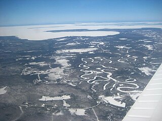
Unorganized North Algoma District is an unorganized area in northeastern Ontario, Canada, comprising all areas in Algoma District, north of the Sault Ste. Marie to Elliot Lake corridor, which are not part of an incorporated municipality or a First Nation. It covers 44,077.03 km2 (17,018.24 sq mi) of land, and had a population of 5739 in 2016.
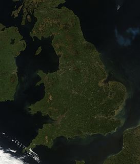
England comprises most of the central and southern two-thirds of the island of Great Britain, in addition to a number of small islands of which the largest is the Isle of Wight. England is bordered to the north by Scotland and to the west by Wales. It is closer to continental Europe than any other part of mainland Britain, divided from France only by a 33 km (21 mi) sea gap, the English Channel. The 50 km (31 mi) Channel Tunnel, near Folkestone, directly links England to mainland Europe. The English/French border is halfway along the tunnel.

Moresby Island is one of the Gulf Islands of British Columbia, located on the west side of Swanson Channel and east of the southern end of Saltspring Island. It is not to be confused with Moresby Island, the second largest of the Haida Gwaii Islands off the north coast of BC. It is currently a privately owned island, and is used by its current owners to raise beef cattle. The island is not open to the general public. Its current population is 3 persons.
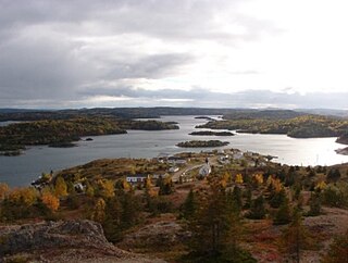
Pilley's Island is a town located on the island of the same name in the Canadian province of Newfoundland and Labrador. It is located in Division No. 8, Newfoundland and Labrador.
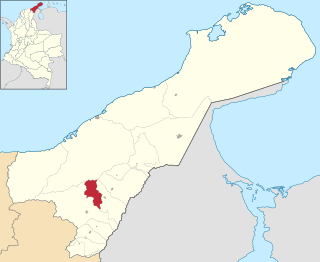
Distracción is a town and municipality in the Colombian Department of La Guajira. Founded in 1845 by a man from neighboring Barrancas named Antonio María Vidal on the right margin of the Ranchería River.
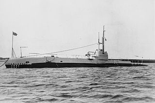
HMS Snapper was a second-batch S-class submarine built during the 1930s for the Royal Navy. Completed in 1935, the boat participated in the Second World War. Snapper is one of the 12 boats named in the song "Twelve Little S-Boats".
The Chemainus River is located on southern Vancouver Island, British Columbia, Canada. Its source is in the Vancouver Island Ranges, and it flows eastwards to the Strait of Georgia near the town of Chemainus, British Columbia. The valley that surrounds the river additionally includes the communities of Crofton and Westholme as well as the Halalt First Nation Reserve and several smaller reserves. Located on one of the largest islands at the mouth of the river, an old now-deserted village called Xulel-thw stands on the northeast corner; Coast Salish peoples lived there and in other now-deserted villages in the area, constantly moving throughout history.

Czaryż is a village in the administrative district of Gmina Secemin, within Włoszczowa County, Świętokrzyskie Voivodeship, in south-central Poland. It lies approximately 7 kilometres (4 mi) south-east of Secemin, 17 km (11 mi) south of Włoszczowa, and 55 km (34 mi) west of the regional capital Kielce.

Hornaday River is a waterway located above the Arctic Circle on the mainland of Northern Canada.
The Caddon Water is a small river by the village of Caddonfoot, in the Scottish Borders area of Scotland. It rises on Windlestraw Law, four miles north of Innerleithen, and flows through the Stantling Craig Reservoir. It joins the river Tweed at Caddonfoot, having completed its journey after 11 miles (18 km).
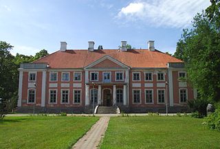
Sargvere is a village in Paide Parish, Järva County in northern-central Estonia.
Korela is a village in Setomaa Parish, Võru County in southeastern Estonia.
Lost Creek is a creek located in the Omineca Country region of British Columbia. The creek flows into the Manson River from the south and was discovered in 1871. Lost Creek has been mined by Europeans and Chinese miners.
Slate Creek is a creek located in the Omineca Country region of British Columbia. This creek is a tributary of the Manson River and flows into that river from the west. Slate Creek was discovered in 1871. The creek has been mined using wing-damming and hand-mining.

Aşağıdolay is suburban area in Bismil district of Diyarbakır Province, Turkey.
References
- ↑ "Manson River". BC Geographical Names.
- ↑ N.L. Barlee (1980), The Guide to Gold Panning, Revised Second Edition, Second Printing. Canada West Publications., ISBN 0-920164-04-8
Coordinates: 55°43′N123°53′W / 55.717°N 123.883°W