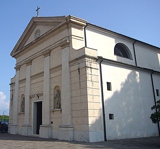
Fontanelle is a comune (municipality) in the province of Treviso, in the Italian region of Veneto, located about 45 kilometres (28 mi) north of Venice and about 25 kilometres (16 mi) northeast of Treviso.

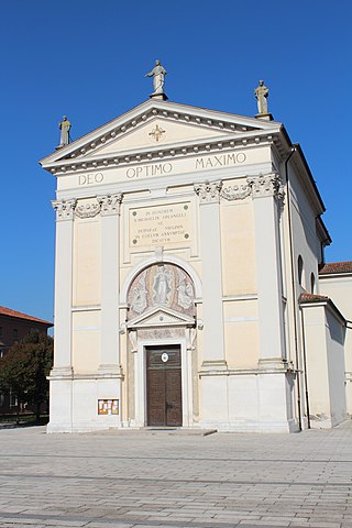
Gaiarine is a comune (municipality) in the province of Treviso, in the Italian region of Veneto, about 50 kilometres (31 mi) north of Venice and about 30 kilometres (19 mi) northeast of Treviso.
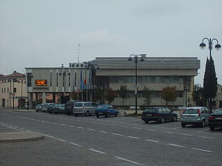
Gorgo al Monticano is a comune (municipality) in the province of Treviso, in the Italian region of Veneto, located about 40 kilometres (25 mi) northeast of Venice and about 25 kilometres (16 mi) northeast of Treviso.
Mareno di Piave is a comune (municipality) in the Province of Treviso in the Italian region Veneto, located about 45 kilometres (28 mi) north of Venice and about 20 kilometres (12 mi) northeast of Treviso.
Meduna di Livenza is a comune (municipality) in the province of Treviso, in the Italian region of Veneto, located about 45 kilometres (28 mi) northeast of Venice and about 30 kilometres (19 mi) northeast of Treviso.
Monastier di Treviso is a comune (municipality) in the Province of Treviso in the Italian region Veneto, located about 25 kilometres (16 mi) northeast of Venice and about 14 kilometres (9 mi) east of Treviso. As of 31 December 2004, it had a population of 3,732 and an area of 25.4 square kilometres (9.8 sq mi).
Ormelle is a comune (municipality) in the Province of Treviso in the Italian region Veneto, located about 40 kilometres (25 mi) north of Venice and about 20 kilometres (12 mi) northeast of Treviso.
Ponte di Piave is a comune (municipality) in the Province of Treviso in the Italian region Veneto, located about 35 kilometres (22 mi) northeast of Venice and about 20 kilometres (12 mi) northeast of Treviso.

Portobuffolé or Portobuffolè is a comune (municipality) in the province of Treviso, in the Italian region of Veneto, located about 50 kilometres (31 mi) northeast of Venice and about 30 kilometres (19 mi) northeast of Treviso on both the shores of the Livenza river.
Salgareda is a comune (municipality) in the Province of Treviso in the Italian region Veneto, located about 30 kilometres (19 mi) northeast of Venice and about 20 kilometres (12 mi) east of Treviso. As of 31 December 2004, it had a population of 6,102 and an area of 27.2 square kilometres (10.5 sq mi).

San Fior is a comune (municipality) in the Province of Treviso in the Italian region Veneto, located about 50 kilometres (31 mi) north of Venice and about 30 kilometres (19 mi) northeast of Treviso. As of 31 December 2004, it had a population of 6,357 and an area of 17.8 square kilometres (6.9 sq mi).
San Polo di Piave is a comune (municipality) in the Province of Treviso in the Italian region Veneto, located about 40 kilometres (25 mi) north of Venice and about 15 kilometres (9 mi) northeast of Treviso. As of 31 December 2004, it had a population of 4,845 and an area of 20.9 square kilometres (8.1 sq mi).

Vazzola is a comune (municipality) in the Province of Treviso in the Italian region Veneto, located about 45 kilometres (28 mi) north of Venice and about 20 kilometres (12 mi) northeast of Treviso.
Zenson di Piave is a comune (municipality) in the Province of Treviso in the Italian region Veneto, located about 30 kilometres (19 mi) northeast of Venice and about 20 kilometres (12 mi) east of Treviso. As of 31 December 2004, it had a population of 1,771 and an area of 9.5 square kilometres (3.7 sq mi).

Casarsa della Delizia or simply Casarsa is a comune (municipality) in the Regional decentralization entity of Pordenone in the Italian region of Friuli Venezia Giulia, located about 80 kilometres (50 mi) northwest of Trieste and about 15 kilometres (9 mi) east of Pordenone.
Castelnovo del Friuli is a comune (municipality) in the Regional decentralization entity of Pordenone, in the Italian region of Friuli-Venezia Giulia, located about 90 kilometres (56 mi) northwest of Trieste and about 30 kilometres (19 mi) northeast of Pordenone.
Cordenons is a comune (municipality) in the Regional decentralization entity of Pordenone in the Italian region of Friuli Venezia Giulia, located about 90 kilometres (56 mi) northwest of Trieste and about 4 kilometres (2.5 mi) northeast of Pordenone. As of 31 December 2004, it had a population of 17,738 and an area of 56.8 square kilometres (21.9 sq mi).
Meduno is a comune (municipality) in the Regional decentralization entity of Pordenone in the Italian region of Friuli Venezia Giulia, located about 100 kilometres (62 mi) northwest of Trieste and about 30 kilometres (19 mi) northeast of Pordenone. As of 31 December 2004, it had a population of 1,737 and an area of 31.2 square kilometres (12.0 sq mi).
Pasiano di Pordenone is a comune (municipality) in the Regional decentralization entity of Pordenone, in the Italian region of Friuli-Venezia Giulia, located about 90 kilometres (56 mi) northwest of Trieste and about 13 kilometres (8 mi) south of Pordenone.
Tramonti di Sotto is a comune (municipality) in the Regional decentralization entity of Pordenone, in the Italian region of Friuli Venezia Giulia. It is located about 110 kilometres (68 mi) northwest of Trieste and about 35 kilometres (22 mi) northeast of Pordenone. As of 31 December 2004, it had a population of 444 and an area of 84.6 square kilometres (32.7 sq mi).


