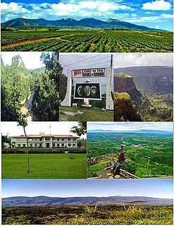
Bukidnon, officially the Province of Bukidnon is a landlocked province in the Philippines located in the Northern Mindanao region. Its capital is the city of Malaybalay. The province borders, clockwise from the north, Misamis Oriental, Agusan del Sur, Davao del Norte, Cotabato, Lanao del Sur, and Lanao del Norte. According to the 2020 census, the province is inhabited by 1,541,308 residents. The province is composed of 2 component cities and 20 municipalities. It is the third largest province in the country in terms of total area of jurisdiction behind Palawan and Isabela respectively.

Malaybalay, officially known as the City of Malaybalay, is a 1st class component city and capital of the province of Bukidnon, Philippines. According to the 2020 census, it has a population of 190,712 people.

Lantapan, officially the Municipality of Lantapan, is a 1st class municipality in the province of Bukidnon, Philippines. According to the 2020 census, it has a population of 65,974 people.
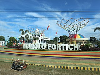
Manolo Fortich, officially the Municipality of Manolo Fortich, is a 1st class municipality in the province of Bukidnon, Philippines. According to the 2020 census, it has a population of 113,200 people.
The Sawaga River is a river in Central Bukidnon, Philippines on the island of Mindanao. A majority of its catchment area is located in Malaybalay City. Its source is from a watershed west of Mt. Tuminungan in Barangay Dalwangan. It flows shortly northward and then eastward into Patpat and Kalasungay, the river then flows southward into the Poblacion District, past Casisang, San Jose, and Laguitas. The Lower Sawaga Valley is located in its lower course from Barangay Linabo through Bangcud until it meets with the Manupali River and ends at Pulangi River in Kahaponan, Valencia City. The Sawaga River has a total length of about 64.5 km and the basin has a total of 42,692 hectares.
Casisang is the most populous of the 46 barangays of Malaybalay. It is the seat of government of the City of Malaybalay since the City Hall is located here. Situated in the South Highway District of Malaybalay, Casisang borders on the north with the Poblacion barangays of Barangay 11, Barangay 7, and Barangay 9, on the east with Can-ayan, on the south with San Jose, Magsaysay, and Mapayag, and on the West by Imbayao and Kalasungay. According to 2015 census Casisang has a population of 25,696 people.
Dalwangan is a barangay west of Malaybalay City situated on the foothills of the Kitanglad Range, 12 kilometers west of the city proper. It is bounded to the north by Impalutao of the municipality of Impasugong, to the east by Patpat and Kalasungay, to the south by Capitan Angel and the Mount Kitanglad Range Natural Park, and to the west by Kibenton of Impasugong. According to the 2015 census, Dalwangan has a population of 7,004 people.
Aglayan is an urban barangay of the City of Malaybalay in the Province of Bukidnon, Philippines. According to the 2015 census, Aglayan has a population of 7,594 people.

Can-ayan is a rural barangay in the North Highway District of Malaybalay City, Bukidnon, Philippines. According to the 2015 census, Can-ayan has a population of 5,870 people.
San Jose is an urban barangay in the South Highway District of Malaybalay, Bukidnon. According to the 2015 census, it has a population of 6,856. It is located 6 kilometres south of the city proper and bounded to the north by Casisang, to the east by Can-ayan, to the south by Laguitas and Linabo, and to the west by Magsaysay. San Jose is divided by the Sawaga River into a billowy plain to the west and a hilly and rugged east. It is politically subdivided into fifteen purok. Sitios under its jurisdiction include Santo Niño, Mabuhay, and Panamucan. Santo Niño is located to the west, bordering Barangay Magsaysay. Mabuhay is located along the Sawaga. Panamucan is located to the east on the Paiwaig River. Economy is mainly driven by agriculture, but commerce and industry are growing as a result of the urbanization of Malaybalay. There are many infrastructure, land development and housing projects, including a water reservoir and a diversion road by-passing the city proper and leading into Dalwangan.
Kalasungay is an urban barangay in the North Highway District of Malaybalay, Bukidnon, along the Sawaga River. According to the 2015 census, it has a population of 8,272 people.

Manalog is a rural barangay of the North Highway District of Malaybalay City, Bukidnon, in the Philippines. According to the 2015 census, it has a population of 969 people. It is the northernmost village in Malaybalay, bounded to the north by Barangay Dumalaguing and Barangay Bulonay of Impasugong, to the east by Busdi, to the south by Kibalabag, to the southwest by Kalasungay, and to the west by Barangay Bontongon of Impasugong. Its inhabitants are mostly native Higaunons who has a legal ancestral domain claim in the area. In fact, Manalog is entirely within the Bukidnon Higaonon Tribal Association's (BUHITA) Ancestral Domain.
Busdi is a rural barangay of the Upper Pulangi District of Malaybalay, Bukidnon, Philippines. According to the 2015 census, it has a population of 2,377 people. It is bounded to the north by Barangay Bulonay of Impasug-ong, to the east by the Municipality of La Paz, Agusan del Sur, to the south by Saint Peter and Kulaman, and to the west by Kibalabag and Manalog.
Caburacanan is a rural barangay of the Upper Pulangi District in Malaybalay City, Bukidnon, Philippines. According to the 2015 census, it has a population of 1,150 people, making it the least populated village in Upper Pulangi. It is bounded to the north by Kulaman, to the east by Saint Peter and Zamboanguita, to the south by Mapulo, and to the west by Can-ayan and Kibalabag. The western part of the village is mountainous with vast old-growth forests and the east is a valley along the Pulangi River, where the village proper is found. The population is mostly Higaunen. It had two sitios under its jurisdiction which are now abandoned: Sambukan, a hamlet to the north; and Talahidan, on the west. Caburacanan has one elementary school administered by the Department of Education, Division of Malaybalay City
Zamboanguita is a rural barangay in the Upper Pulangi District of the city of Malaybalay, Philippines. According to the 2015 census, it has a population of 1,667 people. It is bounded to the north by Saint Peter separated by the Tigpaniki Creek, to the east by the Municipality of La Paz, Agusan del Sur separated by the Pantaron Range, to the south by Indalasa separated by the Pagpag Creek and Mount Mintakdaw, and to the west by Caburacanan and Mapulo separated by the Pulangi River. Zamboanguita sits on a fertile valley between the Pulangi River and the Pantaron Range where most of its area is classified as forestland. It is primarily agricultural with a flourishing commercial activity. It has two sitios: Malilong and Kinuaw. Zamboanguita has one public elementary school, administered by the Department of Education, Division of Malaybalay
Capitán Ángel is a rural barangay in the North Highway District of the city of Malaybalay, Philippines. It is situated entirely within the foothills of the Kitanglad Range. Formerly a sitio of Kalasungay, it achieved barangayhood on 20 April 1963 by virtue of Republic Act no. 3590 and was named after Ángel Casinabe, then the teniente del barrio of Kalasungay. According to the 2015 census, it has a population of 1,160 people.
Imbayao is a rural barangay in Malaybalay, Philippines. It is located in the North Highway District and is almost entirely within the Kitanglad Mountain Range.
Indalasa is a rural barangay of Malaybalay, Philippines. It is located east of the city in the Upper Pulangi District. According to the 2015 census, it has a population of 1,690 people.
Linabo is an urban barangay in the Basakan District of Malaybalay, Philippines. According to the 2015 census, it has a population of 6,933 people.
Santo Niño is a rural barangay in the Basakan District of Malaybalay, Bukidnon, Philippines. According to the 2015 census, it has a population of 1,675 people. It is bordered to the north by Simaya and San Martin, to the east by Sinanglanan and Apo Macote, to the south by Nabag-o of the City of Valencia, and to the west by Bangcud and Mailag.
