Related Research Articles

The St. Lawrence Seaway is a system of locks, canals, and channels in Canada and the United States that permits oceangoing vessels to travel from the Atlantic Ocean to the Great Lakes of North America, as far inland as Duluth, Minnesota, at the western end of Lake Superior. The seaway is named for the St. Lawrence River, which flows from Lake Ontario to the Atlantic Ocean. Legally, the seaway extends from Montreal, Quebec, to Lake Erie, and includes the Welland Canal. Ships from the Atlantic Ocean are able to reach ports in all five of the Great Lakes.

The Lost Villages were ten communities in the Canadian province of Ontario, in the former townships of Cornwall and Osnabruck near Cornwall, which were permanently submerged by the creation of the Saint Lawrence Seaway in 1958.

Aultsville is a ghost town in the Canadian province of Ontario. It is one of Ontario's Lost Villages, which were permanently flooded by the creation of the St. Lawrence Seaway in 1958. The town was founded as Charlesville in 1787 by United Empire Loyalists and reached its peak in 1880, when it had 400 residents. It was the second largest town flooded by the new Seaway in 1958, with a population of 312 at the time. Before it was flooded, the abandoned buildings were burned to study the effects of fire on houses.

Dickinson's Landing is an underwater ghost town in the Canadian province of Ontario. It is one of Ontario's Lost Villages, which were permanently flooded by the creation of the St. Lawrence Seaway in 1958.

Farran's Point is an underwater ghost town in the Canadian province of Ontario. It is one of Ontario's Lost Villages, which were permanently flooded by the creation of the St. Lawrence Seaway in 1958.
Wales is a ghost town in the Canadian province of Ontario. It is one of Ontario's Lost Villages, which were permanently flooded by the creation of the St. Lawrence Seaway in 1958. The town was named for the Prince of Wales who visited the area during his Canadian tour of 1860. Wales was built on the land grant of Dr. James Stuart, of the King's Royal Regiment of New York. From 1810 to 1957, five generations of the Stuart family lived on this property.
Mille Roches is an underwater ghost town in the Canadian province of Ontario. It is one of Ontario's Lost Villages, which were permanently flooded by the creation of the St. Lawrence Seaway in 1958.

Moulinette, Ontario is an underwater ghost town in the Canadian province of Ontario. It is one of Ontario's Lost Villages, which were permanently flooded by the creation of the St. Lawrence Seaway in 1958. Families and businesses in Moulinette were moved to the new town of Long Sault before the seaway construction commenced. The village was located as a strip community along Highway 2, on the St. Lawrence River. At the time of the flooding, Moulinette had a population of around 311 residents. The community would have been located in what is now South Stormont township.
Woodlands is an underwater ghost town in the Canadian province of Ontario. It is one of Ontario's Lost Villages, which were permanently flooded by the creation of the St. Lawrence Seaway in 1958.
Santa Cruz is an underwater ghost town in the Canadian province of Ontario. It is one of Ontario's Lost Villages, which were permanently flooded by the creation of the St. Lawrence Seaway in 1958.
Sheek Island is an island in the St. Lawrence River in the Canadian province of Ontario. It is considered to be one of Ontario's Lost Villages, which were permanently flooded by the creation of the St. Lawrence Seaway in 1958. While much of the island has been flooded, a portion of it remains above water, but is not populated.

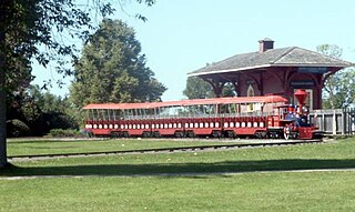
Upper Canada Village is a heritage park near Morrisburg, Ontario, which depicts a 19th-century village in Upper Canada.
There are many communities in Ontario, Canada named Maple Grove:

Long Sault was a rapid in the St. Lawrence River upstream and west of Cornwall, Ontario. Sault is the archaic spelling of the French word saut, meaning rapids.
South Stormont is a township in eastern Ontario, Canada, in the United Counties of Stormont, Dundas and Glengarry. It is located 53 kilometres (33 mi) southeast of Ottawa. South Stormont borders on, but does not include, the city of Cornwall.
The Long Sault Parkway is a group of eleven islands west of Cornwall in the Canadian province of Ontario, as well as the name of the 10.1-kilometre (6.3 mi) scenic parkway connecting them. The islands, which include two public beaches and three campgrounds, were created by the flooding of the Long Sault rapids during construction of the St. Lawrence Seaway. The parkway, the islands, and their amenities are maintained by the St. Lawrence Parks Commission.
New York State Route 37B (NY 37B) is an east–west state highway located in St. Lawrence County, New York, in the United States. It serves as a business route of NY 37 through the village of Massena. While NY 37B enters the village, NY 37 bypasses it to the south. The western terminus of the route is at an intersection with NY 37 in the town of Louisville. Its eastern terminus is at a junction with NY 37 just east of the village limits in the town of Massena. NY 37B intersects North Main Street, a state-maintained northward extension of NY 420, in Massena's central district.

Beauharnois is a city located in the Beauharnois-Salaberry Regional County Municipality of southwestern Quebec, Canada, and is part of the Greater Montreal Area. The city's population as of the Canada 2011 Census was 12,011. It is home to the Beauharnois Hydroelectric Power Station, as well as the Beauharnois Lock of the Saint Lawrence Seaway.
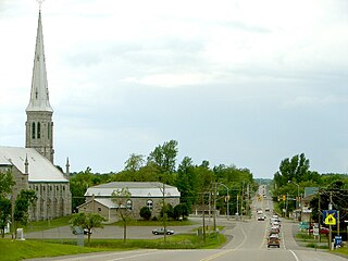
Morrisburg is an unincorporated community in the Municipality of South Dundas, located in Eastern Ontario, Canada.

The Cornwall Canal was built by the British government of Canada to bypass a troublesome rapids hindering navigation on the St. Lawrence at Cornwall, Ontario. Construction began in 1834 and was completed in 1843.
References
- ↑ Atherton, Tony (June 28, 2008). "After the Flood" . The Ottawa Citizen. pp. B1–B5. Retrieved April 16, 2021– via Newspapers.com.
- ↑ "Maple Grove". www.ghosttownpix.com. Retrieved 2021-11-22.