This article includes a list of general references, but it lacks sufficient corresponding inline citations .(January 2022) |
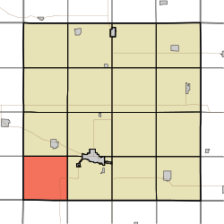
Maple Valley Township, Buena Vista County | |
|---|---|
 | |
| Coordinates: 42°36′20″N095°20′08″W / 42.60556°N 95.33556°W | |
| Country | |
| State | |
| County | Buena Vista |
| Area | |
• Total | 36.11 sq mi (93.53 km2) |
| • Land | 36.11 sq mi (93.53 km2) |
| • Water | 0 sq mi (0 km2) |
| Elevation | 1,348 ft (411 m) |
| Population (2000) | |
• Total | 259 |
| • Density | 7.3/sq mi (2.8/km2) |
| FIPS code | 19-92823 [2] |
| GNIS feature ID | 0468343 |
Maple Valley Township is one of eighteen townships in Buena Vista County, Iowa, United States. As of the 2000 census, its population was 259.
