
Aruppukottai is a town and a municipality in Virudhunagar district in the state of Tamil Nadu, India. Aruppukottai's classical name is "Sengattu Aravakotai". Aruppukottai is about 50 km from Madurai. It is in the middle of Madurai-Tuticorin National Highways NH-38. The villages and towns surrounding Aruppukottai makes this as a major town as well as a major transit hub and they are also famous for production of jasmine. Aruppukottai is always famous for producing yarn. Sri Ramana Maharishi was born in Tiruchuli near Aruppukottai town. Aruppukottai was part of king Sethupathi of Ramnad. King Sethupathi has Zamin Palace in Palyampatti. As of 2011, the town had a population of 87,722. The town also hosts two famous temples – Arulmigu Meenakshi Chokkanatha Swamy Temple built in 13th century by Pandiya King Maravarma Sundarapandiyan and Malaiyarasan Temple..

Sivaganga is a city and headquarters of the Sivaganga district in the Indian state of Tamil Nadu. Sivaganga is a rani velunachiyar kingdom of Tamil Nadu. It is an important city in this district for official and commercial purposes. Its nickname was Sivagangai Seemai.

Pudukkottai is the administrative headquarters of Pudukkottai District in the Indian state of Tamil Nadu. It is a large city located on the banks of the Vellar River. It has been ruled, at different times, by the Cholas, Early Pandyas, Thondaimans, and the British. It is situated about 395 kilometres (245 mi) southwest of the state capital Chennai and about 55 kilometres (34 mi) southeast of Tiruchirappalli. Tamil Nadu's first woman Asian Games competitor, Santhi Soundarajan, is from Pudukkottai.

Rayavaram is a village Panchayat in Pudukkottai district in Tamil Nadu, India.

Pudukkottai District is one of the 38 districts of Tamil Nadu state in southern India. The city of Pudukkottai is the district headquarters. It is also known colloquially as Pudhugai.
Aranthangi is a town chola Nadu in Pudukkottai district in the state of Tamil Nadu, India. As of 2011, it had a population of 40,814.
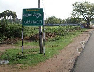
Karambakkudi is a panchayat town as well as Taluk in Pudukkottai district in the Indian state of Tamil Nadu. Karambakkudi is located about 40 km from Thanjavur and 40 km from Pudukkottai. This town is located on the border of the Thanjavur and Pudukkottai district in Tamil Nadu. The opinion of the people of this area is that this area should become an assembly constituency very soon, Here all higher secondary schools and Art's college is there.This area is covered by Delta Region.

Pattukkottai is a major town in Thanjavur district in the Indian state of Tamil Nadu and also important town in Delta districts and Commercial town of Thanjavur, Thiruvarur and Pudukkottai district Coastal areas. The town came to prominence throughout Southern India after the construction of the fort by Vanaji Pandithar, a feudatory of the Thanjavur Maratha ruler Shahuji I in 1686–87. The recorded history of Pattukkottai is known from the 17th century and has been ruled, at different times, by the Thanjavur Marathas and the British. It is the headquarters of the Pattukkottai taluk of Thanjavur district and is one of the two municipalities in the district.
Peravurani is a panchayat town in Thanjavur district in the Indian state of Tamil Nadu. It is the administrative headquarters of the Peravurani Taluk and Peravurani. It is declared as Selection Grade Town Panchayat.
Ponnamaravathi is a town in Pudukkottai district in the Indian state of Tamil Nadu. The town holds the status of Taluk. It is located 37 km from the district headquarter Pudukkottai and 410 km from state capital Chennai.

Usilampatti is a town and a second grade municipality in the Indian state of Tamil Nadu. It is also a designated taluk and revenue division.
Vellakovil is a municipal town in Kangeyam taluk of Tirupur District, in the Indian state of Tamil Nadu. It is located on National Highway 81 between Trichy and Coimbatore. The town is spread in an area of 64.75 km2. As of 2011, the town had a population of 40,359. Kannapuram village located near to this town is famous for Kangeyam breed cattle market that happens on every year during Mariyamman temple festival in the month of April. It is an industrialized town with traditional agriculture being the occupation for most of the people. It holds lot of Power looms weaving bedsheets, floor mats and cotton materials being exported to foreign countries via exporters present in Karur.
Gandarvakottai is a taluk under Pudukkottai district, Tamil Nadu, India. It is the big town between Pudukottai and Thanjavur. The nearest city is Thanjavur, 22 km away.
Manamelkudi taluk is a taluk of Pudukkottai district of the Indian state of Tamil Nadu. The headquarters of the taluk is the town of Manamelkudi
Kongudi is a village in the Aranthangi revenue block of Pudukkottai district, Tamil Nadu, India.

Vanniyan viduthy is a village located in the Pudukkottai District of South Tamil Nadu, India & Vanniyan Viduthy village is part of Arayappatti Panchayat. The village is located 07–10 km from Alangudi, Vadakadu, Silattur and Avanathankottai.
Eragudi is a small town in Thuraiyur taluk in Tiruchirappalli district in the Indian state of Tamil Nadu. It was upgraded to small town from village on 28 May 1994.
Kalathur.T is a Panchayat village in Karaikudi Assembly, Kannankudi union and Devakottai Taluk of Sivaganga district in the Indian state of Tamil Nadu.

Karisalkalampatti is a village in Near sivarakkottai NH7 Main road Thirumangalam Taluk in Madurai District of the Indian state of Tamil Nadu. It is located about 9 km from Thirumangalam, 30 km from Madurai and 520 km from State capital Chennai. As of 2011, the village population about 1158.

The Vellar River or South Vellar River is a non-perennial river in the Indian state of Tamil Nadu that flows southeast into the Palk Strait, part of the Bay of Bengal.


