Marcellus, Washington

Last updated

Marcellus is an unincorporated community in Adams County, in the U.S. state of Washington. [1]

Adams County, Washington County in the United States

Adams County is a county in the U.S. state of Washington. As of the 2010 census, the population was 18,728. The county seat is at Ritzville, and its largest city is Othello. The county was formed out of Whitman County in November 1883 and is named for the second President of the United States, John Adams.

U.S. state constituent political entity of the United States

In the United States, a state is a constituent political entity, of which there are currently 50. Bound together in a political union, each state holds governmental jurisdiction over a separate and defined geographic territory and shares its sovereignty with the federal government. Due to this shared sovereignty, Americans are citizens both of the federal republic and of the state in which they reside. State citizenship and residency are flexible, and no government approval is required to move between states, except for persons restricted by certain types of court orders. Four states use the term commonwealth rather than state in their full official names.
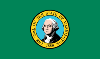
Washington (state) State of the United States of America

Washington, officially the State of Washington, is a state in the Pacific Northwest region of the United States. Named for George Washington, the first president of the United States, the state was made out of the western part of the Washington Territory, which was ceded by Britain in 1846 in accordance with the Oregon Treaty in the settlement of the Oregon boundary dispute. It was admitted to the Union as the 42nd state in 1889. Olympia is the state capital; the state's largest city is Seattle. Washington is sometimes referred to as Washington State to distinguish it from Washington, D.C., the capital of the United States.

History

A post office called Marcellus was established in 1911, and remained in operation until 1926. [2] The origin of the name Marcellus is obscure. [3]

Related Research Articles

White Hall, California Unincorporated community in California, United States

White Hall is a small unincorporated community in El Dorado County, California, United States. It is located on the South Fork of the American River 2.5 miles (4.0 km) east of Riverton, at an elevation of 3383 feet. The ZIP code is 95726. The community is inside area code 530.

Ruff is an unincorporated community in Grant County, in the U.S. state of Washington.

Paha is an unincorporated community in Adams County, Washington, United States. Paha is assigned the ZIP code 99169.

Pride is an unincorporated community in Ross County, in the U.S. state of Ohio.

Barneston, Washington former settlement near Selleck, Washington

Barneston is an extinct town in King County, in the U.S. state of Washington. The GNIS classifies it as a populated place.

Bluestem is an unincorporated community in Lincoln County, in the U.S. state of Washington.

Covada is an unincorporated community in Ferry County, in the U.S. state of Washington.

Drumheller is an extinct town in Franklin County, in the U.S. state of Washington.

Harper is an unincorporated community in Kitsap County, in the U.S. state of Washington.

Huntsville is an unincorporated community in Columbia County, in the U.S. state of Washington.

Lisabeula is an unincorporated community in King County, Washington, United States.

Magnolia Beach is an unincorporated community in King County, in the U.S. state of Washington.

Marengo is an unincorporated community in Adams County, in the U.S. state of Washington.

Martindale is an extinct town in Franklin County, in the U.S. state of Washington. The GNIS classifies it as a populated place.

Maud is an unincorporated community in Stevens County, in the U.S. state of Washington.

Miles is an unincorporated community in Lincoln County, in the U.S. state of Washington.

Rockwell is an extinct town in Adams County, in the U.S. state of Washington. The GNIS classifies it as a populated place.

Telford is an unincorporated community in Lincoln County, in the U.S. state of Washington.

Veazie is an unincorporated community in King County, in the U.S. state of Washington.

Weber is an unincorporated community in Adams County, in the U.S. state of Washington.

References

  1. U.S. Geological Survey Geographic Names Information System: Marcellus, Washington
  2. "Post Offices". Jim Forte Postal History. Retrieved 14 August 2016.
  3. Meany, Edmond S. (1923). Origin of Washington geographic names. Seattle: University of Washington Press. p. 158.

Coordinates: 47°14′01″N118°24′19″W / 47.23361°N 118.40528°W / 47.23361; -118.40528

Geographic coordinate system Coordinate system

A geographic coordinate system is a coordinate system that enables every location on Earth to be specified by a set of numbers, letters or symbols. The coordinates are often chosen such that one of the numbers represents a vertical position and two or three of the numbers represent a horizontal position; alternatively, a geographic position may be expressed in a combined three-dimensional Cartesian vector. A common choice of coordinates is latitude, longitude and elevation. To specify a location on a plane requires a map projection.