Servia is one of the main towns in the Kozani regional unit, West Macedonia, Greece. It is one of the most historical places in the region, with a 6th-century Byzantine castle and the Kamvounia mountain dominating the landscape. There are also a number of 10th century Byzantine cave hermitages and small churches located nearby, which add to the Byzantine atmosphere of the area.

Great Vlachia or Great Wallachia, also simply known as Vlachia, was a province and region in southeastern Thessaly in the late 12th century, and was used to denote the entire region of Thessaly in the 13th and 14th centuries. The name derives from the Vlachs (Aromanians), who had lived across much of the area.

Cavtat is a village in the Dubrovnik-Neretva County of Croatia. It is on the Adriatic Sea coast 15 kilometres south of Dubrovnik and is the centre and the main settlement of Konavle municipality.
Belgrade is an unincorporated community in south central Washington County, Missouri, United States. It is located on Missouri Supplemental Route C, approximately five miles (10 km) west of Caledonia and ten miles (16 km) south of Potosi.

Rekovac is a small town and municipality located in the Pomoravlje District of central Serbia. According to 2011 census, the population of the town is 1,587, while population of the municipality is 10,971. Rekovac is the center of small geographical region called Levač.
Servia or Servian refers to:

SS Servia, also known as RMS Servia, was a successful transatlantic passenger and mail steamer of revolutionary design, built by J & G Thomson of Clydebank and launched in 1881. She was the first large ocean liner to be built of steel instead of iron, and the first Cunard ship to have an electric lighting installation.

Count Čedomilj Mijatović was a Serbian statesman, economist, historian, writer and diplomat.
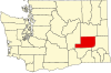
Servia is an unincorporated community in Chester Township, Wabash County, in the U.S. state of Indiana.
Washington Santana da Silva is a Brazilian professional footballer who plays for Portuguese club Feirense as a midfielder.
Names of the Serbs and Serbia are terms and other designations referring to general terminology and nomenclature on the Serbs and Serbia. Throughout history, various endonyms and exonyms have been used in reference to ethnic Serbs and their lands. Basic terms, used in Serbian language, were introduced via classical languages into other languages, including English. The process of interlingual transmission began during the early medieval period, and continued up to the modern times, being finalized in major international languages at the beginning of the 20th century.

The Sanjak of Scutari or Sanjak of Shkodra was one of the sanjaks of the Ottoman Empire. It was established after the Ottoman Empire acquired Shkodra after the siege of Shkodra in 1478–9. It was part of the Eyalet of Rumelia until 1867, when it became a part, together with the Sanjak of Skopje, of the newly established Scutari Vilayet. In 1912 and the beginning of 1913 it was occupied by members of the Balkan League during the First Balkan War. In 1914 the territory of Sanjak of Scutari became a part of the Principality of Albania, established on the basis of the peace contract signed during the London Conference in 1913.
Servia is an unincorporated community in Braxton County, West Virginia, United States. Servia is located on County Route 11 and Duck Creek near Interstate 79, 13.7 miles (22.0 km) west-southwest of Sutton.

Janjevo or Janjevë is a village or small town in the Lipjan municipality in eastern Kosovo.
Parliamentary elections were held in Serbia in November 1888, electing a Great National Assembly that would draft a new constitution. The result was a victory for the People's Radical Party.
Parliamentary elections were held in Serbia on 26 September 1889. The result was a victory for the People's Radical Party, which won 102 of the 117 seats in the National Assembly.
Parliamentary elections were held in Serbia in early March 1893. Although the People's Radical Party had won a large majority in the 1889 elections, by 1893 a Liberal government led by Prime Minister Jovan Avakumović was in place.
Parliamentary elections were held in Serbia on 20 February 1877 to elect members of the Grand National Assembly. The elections were called by Prince Milan on 13 February in order to convene a Grand National Assembly, which would have four times as many members as a normal National Assembly. The newly elected Assembly was to convene on 26 February in the National Theatre.
Parliamentary elections were held in Serbia on 12 December 1880 to elect members of the National Assembly. As expected, the elections resulted in a majority for the government, whose supporters won 94 seats, whilst Radicals won only 18 seats. By January 1881 the number of government supporters had risen to over 100, whilst the Radicals had split.

Relations between Serbia and Brazil have been very strong and well built since 1946 when relations were established between the Socialist Federal Republic of Yugoslavia and Brazil. Brazil does not recognize Kosovo as an independent state and has announced it has no plans to do so without an agreement with Serbia.