March Stones of Aberdeen

Last updated

Outer stone number 31 Boundary Marker 31, Wynford, Aberdeen,.jpg
Outer stone number 31

The March Stones of Aberdeen are boundary marker stones encircling the land owned by the Scottish royal burgh, dating from before 1525.

Contents

In the 1300s Robert the Bruce granted the Royal Burgh of Aberdeen unusually strong rights over the burgh itself and the open lands outside the city. The land was valuable and so the boundary was marked out by the March Stones, "march" being the word used to describe a border area. In their first incarnation the March Stones were large standing stones and the boundary line was augmented with cairns or it ran along natural features such as streams. Because Aberdeen is an eastern coastal town the 26-mile (42 km) line of stones only encircled it to the west. To discourage encroachment the bounds were regularly ridden around by burgesses in the "riding of the marches", the Scots equivalent of beating the bounds, but eventually this became merely a ceremonial matter.

The area marked out, the so-called Freedom Lands of Aberdeen, lay outside the "City Royalty" – the urban area itself and the crofts just on its outskirts. One line of outer stones ran along the outer boundary of the Freedom Lands and a second line, the inner stones, was added in the early 19th century, marking the division of the royalty from the Freedom Lands.

The March Stones of Aberdeen were first written about in 1525 in connection with a riding of the marches. As time went by the stones themselves became marked for identification and between 1790 and 1810 new stones were installed with inscribed sequence numbers, sometimes alongside the earlier ones. Most of these later stones are still to be found although some are later replacements.

Historical background

Freedom Lands, 1661 map by James Gordon of Rothiemay Aberdeen Freedom Lands, James Gordon 1661.png
Freedom Lands, 1661 map by James Gordon of Rothiemay

The inhabitants of the Royal Burgh of Aberdeen had sheltered King Robert the Bruce and supported him militarily in 1308 at the Battle of Barra so in 1313 he granted the burgh burgesses custodianship of the Royal Forest of the Stocket, an extensive area of rough land just to the west of the town. [note 1] although he retained his right for hunting and forestry. [3] Six years later Bruce granted Aberdeen ownership rights over the Royal Burgh and Forest of Stocket for an annual rent, or feu, of £213 6s 8d pound Scots. [4] [note 2] The city burgesses later purchased three other areas of land: Rubislaw (bought 1379), Cruives, now Woodside (1405) and Gilcomston (1680). This land, along with the Stocket Forest, became called the Freedom Lands. [note 3] In 1551 the burgesses obtained from Mary Queen of Scots the right to rent out these lands, by this time an area of some 25 square miles (65 km2), [note 4] so that they could become privately managed for annual payments to the burgesses. [note 5] Hence these lands became the right and responsibility of the burgesses of the Royal Burgh of Aberdeen with the income accruing to the Aberdeen Common Good Fund. [8]

Boundary markers

Outer March Stone locations numbered in black. Inner stones, marked CR, numbered in magenta. (see also interactive map ) Map of Aberdeen Boundary Stones with SVG numbering.svg
Outer March Stone locations numbered in black. Inner stones, marked CR, numbered in magenta. (see also interactive map )

In the 16th century a border region was called a march and the first boundary markers of the march of the Freedom Lands were probably natural features supplemented with small cairns. The earliest description of the marches was in 1525 concerning a "riding of the marches", the Scots equivalent of beating the bounds. This greatly ceremonial practice had its origins in ensuring the boundaries were not being encroached upon by neighbouring landowners. [4]

In 1525 there was no standard system of marking. Any large earthfast stones might have incorporated saucer shapes filled with lead sometimes embossed with the city's seal or might have a contained a varied number of holes. A 1578 description of March Stone 1 says the city's mark was engraved in the stone itself. After the 1673 riding, several cairns were ordered to be erected along part of the line of the marches. [4]

March Stones

Inner stone number 62 Aberdeen March Stone 62.png
Inner stone number 62
Outer stone number 42 Boundary Marker 42, Aberdeen (cropped).jpg
Outer stone number 42

After 1790 a new style of marking was adopted, one that the stones still display. The stones were inscribed with a sequential number followed by the letters "ABD" for Aberdeen. Aberdeen has two sets of march, or boundary, stones. The outer line surrounds the area of the Freedom Lands. The inner line of stones marks a smaller area: the boundary of the crofts immediately around the medieval Royal Burgh of Aberdeen. [4] The land occupied by the crofts was known as the Burgh Roods or the terrirtorium croftorum burgi. The inner area as a whole, including the town itself, was called the City Royalty and the inner stones marking its boundary were marked with an additional "CR". [9] This systematic style of marking was completed by 1810 but the new stones were not always in the same locations as the previous ones. In particular, where natural boundaries such as burns had wandered, the stones were moved to match. [4] Altogether there were 74 stones: the southernmost was inscribed Alpha, the northernmost Omega, and between them 65 had a number inscribed. Additionally seven others on the inner ring were simply lettered CR with no number. [4] [1] [note 7] The distance from Alpha to Omega along the outer line of stones is about 26 miles (42 km) extending from the estuary of the River Dee to that of the River Don. [10] [11] [note 8]

Individual stones

Cruickshank and Gunn, in their 1929 book The Freedom Lands and Marches of Aberdeen, provided details, photographs and a map of the individual March Stones. Their descriptions are accompanied by descriptions from Kennedy's Annals of Aberdeen. [13] In 2021 Aberdeen City Council produced an updated pamphlet with similar information. [4] [note 9] None of the stones standing are the originals but some have the original stones lying beside them. [note 10] In urban areas some stones have been laid flush to the ground. [4] The numbering of the selection of stones in this article follows that used in the publications mentioned.

Inner stones

City Royalty stones, from south to north
# stone
inscription [4]
Description
66
Ά ABD CR
Alpha stone: at southern end of inner ring of stones where Ferryhill Burn joins the River Dee at its north bank. Early 19th century replacement. [4] Kennedy's Annals (1818), when quoting from a 1698 source, did not mention such a stone. [15]
Boundary marker A, Aberdeen, landscape.jpg
1
CR 1 ABD
southern joining point of outer and inner rings. In 1525 "ane gret grey stane, with ane sawssir" [note 11] but replaced by late 18th century. [4]
Boundary stone 1, Aberdeen.jpg
68–74inscribed CR but without any number. Stone 73 pictured. [4]
Boundary marker, Jack's Brae, Aberdeen (cropped).jpg
61
61 ABD CR
northern joining point of outer and inner rings. [4]
Aberdeen March Stone 61 (cropped).png
67
Ω ABD CR
Omega stone: at northern end of inner ring of stones at the confluence of Tile Burn and the River Don, south bank. A stone was certainly at this location by 1698. [4] [16]
Aberdeen, Esplanade, Boundary Marker 'omega'.jpg

Outer stones

Freedom Lands stones, clockwise from south to north
# stone
inscription [4]
Description
3
3 ABD
in 1780 "a large earthfast stone". [4]
Boundary stone 3, Aberdeen (cropped).jpg
8
8 ABD
as recently as 1929 there was a saucer-marked stone. [4] [17]
Boundary stone 8, Aberdeen (cropped).jpg
27
27 ABD
called the "Ringing Stone". The distance of two miles to the next stone is demarked by the Brodiach burn. [4] In 1525 "And frathin to the Rigand Stane liand at the Furde beside the Ord" but now replaced. [18]
31
31 ABD
the "Doupin' Stone'. Once new burgesses were "doupit" (dropped) on the stone which now lies beside the current marked stone. [4]
Boundary Marker 31, Wynford, Aberdeen in situ.jpg
32
32 ABD
beside the stone lies the original with a saucer-shaped depression. [4]
Boundary stone 32, with original cupped stone behind, Aberdeen.jpg
38 & 39
present in 2011 when it was noticed they were very near to the then-proposed alignment of the Aberdeen Western Peripheral Route. [19] During survey work for the new road in May 2012 the stones (category B listed in the listed buildings in the parish of Newhills [20] ) could not be located and were reported missing. [21] [9]
Site of boundary Marker 38, Ashtown, Aberdeen (not found).jpg
Site of Boundary Marker 39, Ashtown, Aberdeen (missing).jpg
56
56 ABD
the sharp bend at this stone was to avoid the Den of Kittybrewster ("den" is ravine or glen) which had been filled in by 1929. [22]
Aberdeen, 39-55 Clifton Road, Boundary Marker 56.jpg

See also

Notes

  1. The medieval term "forest" meant a royal hunting ground rather than a wooded forest. [1] The Forest of Stocket is now the Midstocket part of the city. [2]
  2. £213 6s 8d pound sterling is often stated for what should be pounds Scots and indeed there was a confusion at the time, rectified in 1617 by a charter of James VI. The equivalent amount in pounds sterling would have been about £17 (equivalent to £15,563in 2021). [5] [6]
  3. Caprastone, now Hilton, was purchased in 1595 but never became part of the Freedom Lands. [4]
  4. The area including the royal burgh itself was about 30 square miles (78 km2). [7]
  5. Such estates maintain a current identity as Countesswells, Foresterhill, Hazlehead and Kingswells. [4]
  6. Clickable green discs mark locations where details and a photograph are on Wikidata. Red indicates a location lacking a photograph.
  7. Croly and the Aberdeen Council's trail pamphlets all say there are six unnumbered stones. However, the trails pamphlets actually list seven. [4] [1]
  8. In 1929 Cruickshank and Gunn noted "From the mouth of the Tile Burn the boundary runs to the Don mouth, thence along the Beach to Dee mouth, and up the Dee to the mouth of the Ferryhill Burn, where the inner marches start. During the last century the Inner Marches between Hardgate and the Spital were defined at Intervals by wall marks "C.R." of which there are known to remain one at March Lane and one in Alford Lane in the back wall of Holburn Parish Church." [12]
  9. The current pamphlet is anonymous but an earlier draft credits Chris Croly as historian. [14]
  10. According to Croly the stones with originals alongside are:16, 18, 23, 25, 29, 31, 32 and 33. [1]
  11. "Ane gret grey stane, with ane sawssir" (Scots) is "a great, grey stone with one saucer". Some of the stones had saucer-shaped indentations to mark them.

Related Research Articles

<span class="mw-page-title-main">Aberdeen</span> Third most populous city of Scotland

Aberdeen is a city in North East Scotland, and is the third most populous Scottish city. Aberdeen is one of Scotland's 32 local government council areas, and has a 2020 population estimate of 198,590 for the city of Aberdeen, and 227,430 for the local council area making it the United Kingdom's 39th most populous built-up area. The city is 93 mi (150 km) northeast of Edinburgh and 398 mi (641 km) north of London, and is the northernmost major city in the United Kingdom. Aberdeen has a long, sandy coastline and features an oceanic climate, with cool summers and mild, rainy winters.

<span class="mw-page-title-main">Irvine, North Ayrshire</span> Administrative centre, new town and former royal burgh in Scotland

Irvine is a town on the coast of the Firth of Clyde in North Ayrshire, Scotland. The 2011 Census recorded the town's population at 33,698 inhabitants, making it the largest settlement in North Ayrshire, and 22nd largest settlement in Scotland.

<span class="mw-page-title-main">Burgh</span> Former autonomous corporate entity in Scotland and Northern England

A burgh is an autonomous municipal corporation in Scotland and Northern England, usually a city, town, or toun in Scots. This type of administrative division existed from the 12th century, when King David I created the first royal burghs. Burgh status was broadly analogous to borough status, found in the rest of the United Kingdom. Following local government reorganisation in 1975, the title of "royal burgh" remains in use in many towns, but now has little more than ceremonial value.

<span class="mw-page-title-main">Crail</span> Coastal village in Fife, Scotland

Crail ; Scottish Gaelic: Cathair Aile) is a former royal burgh, parish and community council area in the East Neuk of Fife, Scotland.

<span class="mw-page-title-main">Caithness</span> Historic county in northern Scotland

Caithness is a historic county, registration county and lieutenancy area of Scotland.

Large burgh was a type of municipal structure in Scotland, which existed from 1930 to 1975.

The local government areas of Scotland were redefined by the Local Government (Scotland) Act 1973 and redefined again by the Local Government etc (Scotland) Act 1994.

<span class="mw-page-title-main">Anderston</span> Human settlement in Scotland

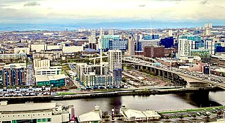
Anderston is an area of Glasgow, Scotland. It is on the north bank of the River Clyde and forms the south western edge of the city centre. Established as a village of handloom weavers in the early 18th century, Anderston was an independent burgh of barony from 1824 until it was incorporated into the City of Glasgow in 1846.

<span class="mw-page-title-main">Aberdeenshire (historic)</span> Historic county in Scotland

Aberdeenshire or the County of Aberdeen is a historic county and registration county of Scotland. The area of the county, excluding the Aberdeen City council area itself, is also a lieutenancy area. The county borders Kincardineshire, Angus and Perthshire to the south, Inverness-shire and Banffshire to the west, and the North Sea to the north and east. It has a coast-line of 65 miles (105 km). The county gives its name to the modern Aberdeenshire council area, which covers a larger area than the historic county.

<span class="mw-page-title-main">Aberdeen North (UK Parliament constituency)</span> Parliamentary constituency in the United Kingdom, 1885 onwards

Aberdeen North is a burgh constituency of the House of Commons of the Parliament of the United Kingdom and it elects one Member of Parliament (MP) by the first past the post system of election. It was first used in the 1885 general election, but has undergone various boundary changes since that date.

<span class="mw-page-title-main">Old Aberdeen</span> Human settlement in Scotland

Old Aberdeen is part of Aberdeen in Scotland. Old Aberdeen was originally a separate burgh, which was erected into a burgh of barony on 26 December 1489. It was incorporated into adjacent Aberdeen by Act of Parliament in 1891. It retains the status of a community council area.

<span class="mw-page-title-main">Local Government (Scotland) Act 1889</span> United Kingdom legislation

The Local Government (Scotland) Act 1889 is an Act of the Parliament of the United Kingdom which was passed on 26 August 1889. The main effect of the act was to establish elected county councils in Scotland. In this it followed the pattern introduced in England and Wales by the Local Government Act 1888.

<span class="mw-page-title-main">Mercat cross</span> Scottish historic structure

A mercat cross is the Scots name for the market cross found frequently in Scottish cities, towns and villages where historically the right to hold a regular market or fair was granted by the monarch, a bishop or a baron. It therefore served a secular purpose as a symbol of authority, and was an indication of a burgh's relative prosperity. Historically, the term dates from the period before 1707, when the Kingdom of Scotland was an independent state, but it has been applied loosely to later structures built in the traditional architectural style of crosses or structures fulfilling the function of marking a settlement's focal point. Historical documents often refer simply to "the cross" of whichever town or village is mentioned. Today, there are around 126 known examples of extant crosses in Scotland, though the number rises if later imitations are added.

<span class="mw-page-title-main">Burgh Muir</span>

<span class="mw-page-title-main">History of Aberdeen</span> Aspect of history

There has been a human presence in the area of Aberdeen since the Stone Age. Aberdeen as a city, grew up as two separate burghs: Old Aberdeen, the university and cathedral settlement, at the mouth of the River Don; and New Aberdeen, a fishing and trading settlement where the Denburn entered the Dee estuary.

The Freedom of the City of Aberdeen is an honour bestowed by the city of Aberdeen, Scotland.

Woodside is an area of Aberdeen. It came into existence as a quoad sacra parish within the parish of Old Machar in 1834, under an act of The General Assembly of the Church of Scotland of 31 May 1834, and was named for the principal residence of the area, Woodside House.

Local government areas covering the whole of Scotland were first defined by the Local Government (Scotland) Act 1889. As currently defined, they are a result, for the most part, of the Local Government etc (Scotland) Act 1994.

<span class="mw-page-title-main">City of Edinburgh Council</span> Local government body in Scotland

The City of Edinburgh Council is the local government authority covering the City of Edinburgh council area. Almost half of the council area is the area of Edinburgh, capital of Scotland. With a population of 526,470 in mid-2019, it is the second most populous local authority area in Scotland.

References

Citations

  1. 1 2 3 4 Croly (2007).
  2. Morgan (2009), pp. xiii, 64.
  3. Morgan (2009) , p. xi
    Keith (1972) , p. 31
  4. 1 2 3 4 5 6 7 8 9 10 11 12 13 14 15 16 17 18 19 20 21 22 23 Aberdeen City Council (2021).
  5. Morgan (2009), pp. xi–xii.
  6. Keith (1972), pp. 30–31.
  7. Keith (1972), p. 73.
  8. Croly (2007)
    Aberdeen City Council (2021)
    Keith (1972) , pp. 73–75
    Johnston (2008) , pp. 17–18
  9. 1 2 ACU/cpalmer (3 March 2022). "Historic Environment Record - Aberdeen City - NJ80 NE0051 - Gough Burn". Aberdeenshire Council. Archived from the original on 2 March 2022. Retrieved 3 March 2022.
    ACU/cpalmer (3 March 2022). "Historic Environment Record - Aberdeen City - - NJ80NE0053 - Ashtown Road". Aberdeenshire Council. Archived from the original on 2 March 2022. Retrieved 3 March 2022.
  10. "Freedom Lands of Aberdeen: Freedom Lands, Stocket Lands". Gazetteer for Scotland. 2022. Archived from the original on 14 May 2021. Retrieved 1 March 2022.
  11. "Royalty of Aberdeen". Doric Columns. Wordpress. 19 September 2017. Archived from the original on 30 December 2021. Retrieved 1 March 2022.
  12. Cruickshank & Gunn (1929), p. 34.
  13. Cruickshank & Gunn (1929) , pp. 25–34, 50–57, 65 which acknowledges Kennedy (1818) , pp. 381–384, volume I, book II, chapter I
  14. "March Stones Aberdeen Aberdeen's March Stones & Freedom Lands" (PDF). Visit Aberdeen. Aberdeen City Council. 2013. Archived (PDF) from the original on 28 May 2016. Retrieved 1 March 2022.
  15. Cruickshank & Gunn (1929), p. 25.
  16. Cruickshank & Gunn (1929), pp. 25, 34.
  17. Cruickshank & Gunn (1929), p. 26.
  18. Cruickshank & Gunn (1929), p. 29.
  19. "March Stones 37 to 39 ABD". Other Aberdeen. 14 January 2011. Archived from the original on 24 February 2020. Retrieved 1 March 2022.
  20. Historic Environment Scotland (16 April 1971). "March Stone No. 38 on the South Side of the road from Ashtown near the bridge where the Gouff Burn issues from the Moss of Brimmond (Category B Listed Building) (LB15657)" . Retrieved 1 March 2022.
    Historic Environment Scotland (16 April 1971). "March Stone No.39 on the north side of the road from Ashtown about 50 Yds east of no. 38. (Category B Listed Building) (LB15658)" . Retrieved 1 March 2022.
  21. Barbour, Ashleigh (21 January 2013). "Mystery as Bruce's March Stones go missing". Press and Journal. Archived from the original on 2 March 2022. Retrieved 1 March 2022.
  22. Cruickshank & Gunn (1929), p. 33.

Works cited

Locations of stones recorded on Wikidata
interactive map
Searchtool.svg Clickable green discs mark locations where details and a photograph are on Wikidata. Red indicates a location lacking a photograph.

57°08′19″N2°05′41″W / 57.13861°N 2.09472°W / 57.13861; -2.09472