
Aldersyde is a hamlet in Alberta, Canada within the Municipal District of Foothills No. 31. Located between Highway 2 and Highway 2A south of Highway 7, the hamlet is approximately 8 kilometres (5.0 mi) southeast of Okotoks, 10 kilometres (6.2 mi) north of High River and 25 kilometres (16 mi) south of Calgary. A Canadian Pacific Railway line runs through the hamlet.

Vyšehněvice is a small village in the Pardubice Region of the Czech Republic. It has around 220 inhabitants.

The Ducal Georgianum is a theological seminary of the Ludwig Maximilians University in Munich. It was founded in 1494. Pope Benedict XVI studied at the Seminary until 1951.
Wziąchowo Wielkie is a village in the administrative district of Gmina Milicz, within Milicz County, Lower Silesian Voivodeship, in south-western Poland. Prior to 1945 it was in Germany.
The canton of Outreau is a canton situated in the department of the Pas-de-Calais and in the Hauts-de-France region of northern France.

Dədəli is a village in the Fizuli Rayon of Azerbaijan.

Marianów is a village in the administrative district of Gmina Sędziszów, within Jędrzejów County, Świętokrzyskie Voivodeship, in south-central Poland. It lies approximately 4 kilometres (2 mi) west of Sędziszów, 21 km (13 mi) west of Jędrzejów, and 54 km (34 mi) south-west of the regional capital Kielce.
Papiernia is a village in the administrative district of Gmina Raków, within Kielce County, Świętokrzyskie Voivodeship, in south-central Poland. It lies approximately 13 kilometres (8 mi) west of Raków and 28 km (17 mi) south-east of the regional capital Kielce.
Maruszów is a village in the administrative district of Gmina Ożarów, within Opatów County, Świętokrzyskie Voivodeship, in south-central Poland. It lies approximately 10 kilometres (6 mi) east of Ożarów, 28 km (17 mi) east of Opatów, and 83 km (52 mi) east of the regional capital Kielce.
Momina is a village in the administrative district of Gmina Waśniów, within Ostrowiec County, Świętokrzyskie Voivodeship, in south-central Poland. It lies approximately 5 kilometres (3 mi) south-east of Waśniów, 11 km (7 mi) south-west of Ostrowiec Świętokrzyski, and 47 km (29 mi) east of the regional capital Kielce.
Gola is a village in the administrative district of Gmina Gostyń, within Gostyń County, Greater Poland Voivodeship, in west-central Poland. It lies approximately 4 kilometres (2 mi) west of Gostyń and 58 km (36 mi) south of the regional capital Poznań.
Otówko is a settlement in the administrative district of Gmina Gostyń, within Gostyń County, Greater Poland Voivodeship, in west-central Poland. It lies approximately 4 kilometres (2 mi) west of Gostyń and 58 km (36 mi) south of the regional capital Poznań.
Niwica is a village in the administrative district of Gmina Trzebiel, within Żary County, Lubusz Voivodeship, in western Poland, close to the German border. It lies approximately 7 kilometres (4 mi) south of Trzebiel, 21 km (13 mi) west of Żary, and 61 km (38 mi) south-west of Zielona Góra.
Czarna Woda is a village in the administrative district of Gmina Murów, within Opole County, Opole Voivodeship, in south-western Poland. It lies approximately 24 km (15 mi) north of the regional capital Opole.
Huta Żuławska is a village in the administrative district of Gmina Milejewo, within Elbląg County, Warmian-Masurian Voivodeship, in northern Poland. It lies approximately 5 kilometres (3 mi) north-east of Milejewo, 22 km (14 mi) north-east of Elbląg, and 80 km (50 mi) north-west of the regional capital Olsztyn.
Bartno is a village in the administrative district of Gmina Małdyty, within Ostróda County, Warmian-Masurian Voivodeship, in northern Poland. It lies approximately 12 kilometres (7 mi) west of Małdyty, 38 km (24 mi) north-west of Ostróda, and 63 km (39 mi) west of the regional capital Olsztyn.

Czarny Piec is a village in the administrative district of Gmina Jedwabno, within Szczytno County, Warmian-Masurian Voivodeship, in northern Poland. It lies approximately 24 kilometres (15 mi) west of Szczytno and 25 km (16 mi) south of the regional capital Olsztyn.
Izdebno is a settlement in the administrative district of Gmina Siemyśl, within Kołobrzeg County, West Pomeranian Voivodeship, in north-western Poland. It lies approximately 4 kilometres (2 mi) east of Siemyśl, 16 km (10 mi) south of Kołobrzeg, and 95 km (59 mi) north-east of the regional capital Szczecin.
Wierzbówek is a village in the administrative district of Gmina Myślibórz, within Myślibórz County, West Pomeranian Voivodeship, in north-western Poland.
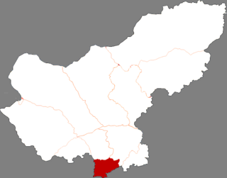
Taipusi Banner is a banner of Inner Mongolia, China, bordering Hebei province to the southeast, south, and west. It is under the administration of Xilin Gol League and is its southernmost county-level division.


