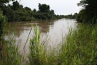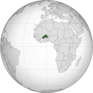
The W National Park or W Regional Park is a major national park in West Africa around a meander in the River Niger shaped like the letter W. The park includes areas of the three countries Niger, Benin and Burkina Faso, and is governed by the three governments. Until 2008, the implementation of a regional management was supported by the EU-funded project ECOPAS. The three national parks operate under the name W Transborder Park.. The section of W National Park lying in Benin, measuring over 8,000 km2 (3,100 sq mi), came under the full management of African Parks in June 2020. In Benin, W National Park is contiguous with Pendjari National Park which is also under the management of African Parks.

Lesbian, gay, bisexual, transgender (LGBT) persons in Burkina Faso may face legal issues not experienced by non-LGBT citizens. Same-sex sexual acts between men and between women are legal in Burkina Faso.

The Oti River or Pendjari River is an international river in West Africa. It rises in Benin, forms the border between Benin and Burkina Faso, flows through Togo, and joins the Volta River in Ghana.

Centre is one of Burkina Faso's 13 administrative regions. The population of Centre was 1,523,980 in 2006 and increased by 40.2% in 5 years to 2,136,581 in 2011 (est.). It is the most populous and urbanised region in Burkina Faso; in 2006 11.1% of Burkina's population lived in Centre. The region's capital is Ouagadougou, which also serves as the national capital. Centre region consists of only one province, Kadiogo.

The Mare aux Hippopotames is a lake and national park in Burkina Faso, created in 1937 and designated in 1977 as the only UNESCO Biosphere Reserve in the nation. The park was created around a freshwater lake and includes surrounding pools and marches in the flood plain of the Black Volta River, and surrounding forests. The park is home to about 100 hippos; about 1000 eco-tourists visit each year. It is located about 60 kilometers (37 mi) north of Bobo-Dioulasso, and is itself about 163 square kilometres (63 sq mi) in size.

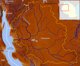
The Malagarasi River is a river in western Tanzania, flowing through Kigoma Region, although one of its tributaries comes from southeastern Burundi. It is the second-longest river in Tanzania behind the Rufiji—Great Ruaha, and has the largest watershed of any river flowing into Lake Tanganyika. The Malagarasi-Muyovozi Wetlands are a designated a Ramsar site. Local tribes have nicknamed the Malagarasi as "the river of bad spirits".

The Sankarani River is a tributary of the Niger River. Flowing northward from the Guinea Highlands of the Fouta Djallon in Guinea, it crosses into southern Mali, where it joins the Niger approximately 40 kilometres (25 mi) upstream of Bamako, the capital of Mali. It forms part of the Ivory Coast-Guinea and Guinea–Mali borders.

Lake Butrint is a salt lagoon south of Saranda, Albania, located in direct proximity of the Ionian Sea. It is surrounded by dense forested hills, rocky coast and complemented by saltwater and freshwater marshlands. The lake has a length of 7.1 km (4.4 mi) and a width of 3.3 km (2.1 mi), with a surface area of 16 km2 (6.18 sq mi). The maximum depth of the lake is 24.4 m (80 ft). At the south, the Vivari Channel connects the lagoon to the sea.

Assagny National Park or Azagny National Park is a national park in the south of Ivory Coast. It is situated on the coast some 75 km (47 mi) to the west of Abidjan, between the mouth of the Bandama River and the Ébrié Lagoon, and occupies an area of about 17,000 hectares.

Îles Ehotilé National Park is a national park of the Ivory Coast in the Sud-Comoé region. The park consists of a group of low islands and the intervening channels that separate Aby Lagoon from the Atlantic Ocean.

Lake Tengrela is a small lake near Banfora in Burkina Faso. It is known for its hippopotamuses. Locals believe that these hippopotamuses do not attack humans because they are sacred hippopotamuses. Crocodiles are almost never seen in this lake. It is 2 km long and 1.5 km wide.
Theatre of Burkina Faso combines traditional Burkinabé performance with the colonial influences and post-colonial efforts to educate rural people to produce a distinctive national theatre. Traditional ritual ceremonies of the many ethnic groups in Burkina Faso have long involved dancing with masks. Western-style theatre became common during colonial times, heavily influenced by French theatre. With independence came a new style of theatre inspired by forum theatre aimed at educating and entertaining Burkina Faso's rural people.

The Sylvo-Pastoral and Partial Faunal Reserve of the Sahel is the largest protected area of Burkina Faso, comprising an area of 16,000 km2. Within the area of the nature reserve are temporary lakes being important for migratory birds.

Lake Dem is a small lake in northern Burkina Faso, located to the north of Kaya, south of the Sahel Reserve and south-east of Lake Bam. It drains into the White Volta. It is 5 km long and 2 km wide. It lies at an elevation of 304 m. The lake has been designated as a Ramsar site since 2009.

Lake Higa is a small lake in eastern Burkina Faso, close to the border with Niger. It drains into the Babangou, which drains into the Niger. It has an area of 228 ha. It lies at an elevation of 271 m. In 2009 the site around Lake Higa was included in the List of Ramsar wetlands of international importance.

The Jagdishpur Reservoir is a reservoir in Jahadi Village Development Committee, Kapilvastu District, Nepal. With a surface area of 225 ha, it is the largest reservoir in the country and an important wetland site. It is situated at an altitude of 197 m (646 ft). The maximum water depth varies between 2 m (6.6 ft) in the dry season and 7 m (23 ft) in the monsoon season.

Iherir is a village in the commune of Bordj El Houasse, in Djanet District, Illizi Province, Algeria. It is in a river valley (wadi) named Oued Iherir near the center of the Tassili n'Ajjer mountain range, 121 kilometres (75 mi) south of the provincial capital Illizi. The area has been populated since Neolithic times; the population living in the valley has been continuously over 1000 during the 20th century.

The Oti Valley Faunal Reserve is a protected area in northeastern Togo, one of four Important Bird Areas (IBA) in the country. The site is mainly savanna and seasonally inundated floodplains on either side of the Oti River. It has a total area of 147,840 hectares and is located at 10°35'N and 0°40'E.


