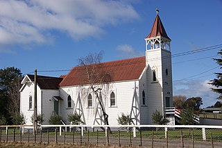
The suburb includes Marewa Park, a sports ground for soccer, cricket, athletics, marching and bowls, and Kennedy Park Resort, a popular family holiday accommodation provider.[3]
Marewa, comprising the statistical areas of Marewa West and Marewa East, had a population of 5,121 at the 2018 New Zealand census, an increase of 450 people (9.6%) since the 2013 census, and an increase of 507 people (11.0%) since the 2006 census. There were 1,980 households. There were 2,418 males and 2,700 females, giving a sex ratio of 0.9 males per female, with 1,140 people (22.3%) aged under 15 years, 1,011 (19.7%) aged 15 to 29, 2,214 (43.2%) aged 30 to 64, and 753 (14.7%) aged 65 or older.
Ethnicities were 74.0% European/Pākehā, 33.1% Māori, 4.4% Pacific peoples, 4.2% Asian, and 2.4% other ethnicities (totals add to more than 100% since people could identify with multiple ethnicities).
The proportion of people born overseas was 13.6%, compared with 27.1% nationally.
Although some people objected to giving their religion, 55.1% had no religion, 28.0% were Christian, 0.6% were Hindu, 1.1% were Muslim, 1.0% were Buddhist and 6.5% had other religions.
Of those at least 15 years old, 513 (12.9%) people had a bachelor or higher degree, and 891 (22.4%) people had no formal qualifications. The employment status of those at least 15 was that 1,845 (46.3%) people were employed full-time, 567 (14.2%) were part-time, and 189 (4.7%) were unemployed.[1]
Marewa School in the suburb is a co-educational state primary school,[6] with a roll of 200 as of March 2022.[7][8]
Related Research Articles
Clive is a small town, ten kilometres from the city centres of both Napier and Hastings in the Hawke's Bay region of New Zealand's North Island. It is close to the mouth of the Ngaruroro River.
Flaxmere is a township in the Hastings District and outlying suburb of Hastings City, in the Hawke's Bay Region of New Zealand's North Island. It consists of a series of cul-de-sacs, radiating from a main street.
Napier Hill is a limestone outcrop and suburb rising above the lowland districts of the city of Napier on New Zealand's North Island.
Waimārama is a seaside village in Hastings District, Hawke's Bay, New Zealand.
Nukuhau is a suburb of Taupo in the Waikato Region of New Zealand's North Island.
Onekawa is a suburb of the city of Napier, in the Hawke's Bay Region of the eastern North Island of New Zealand.
Maraenui is a suburb of the city of Napier, in the Hawke's Bay region of New Zealand's eastern North Island.
Mahora is a suburb of the city of Hastings, in the Hawke's Bay region of New Zealand's eastern North Island.
Tutira is a village to the north of Napier and is part of the Hawke's Bay Region in New Zealand's North Island. It is located on State Highway 2 between Wairoa and Napier.
Ahuriri is a suburb of the city of Napier, in the Hawke's Bay region of New Zealand's eastern North Island.
Westshore is a northern coastal suburb of the city of Napier in Hawke's Bay, New Zealand.
Eskdale is a rural settlement in the Hastings District and Hawke's Bay Region of New Zealand's North Island. It is located north of Napier on State Highway 5, near the mouth of the Esk River.
Tamatea is a suburb in the west of the city of Napier, in the Hawke's Bay Region of New Zealand's eastern North Island.
Poraiti is a semi-rural suburb of the city of Napier, in the Hawke's Bay region of New Zealand's eastern North Island.
Parkvale is a suburb of Hastings City, in the Hawke's Bay Region of New Zealand's North Island.
Akina is a suburb of Hastings City, in the Hawke's Bay Region of New Zealand's North Island.
Camberley is a suburb of Hastings City, in the Hawke's Bay Region of New Zealand's North Island.
Mayfair is a suburb of Hastings City, in the Hawke's Bay Region of New Zealand's North Island.
Hastings Central is the central suburb and business district of Hastings City, in the Hawke's Bay Region of New Zealand's North Island.
Napier South is a suburb of the city of Napier, in the Hawke's Bay region of New Zealand's eastern North Island.
This page is based on this Wikipedia article Text is available under the CC BY-SA 4.0 license; additional terms may apply. Images, videos and audio are available under their respective licenses.