Related Research Articles

Cowichan Bay is a bay and community located on the east coast of southern Vancouver Island near Duncan, in British Columbia, Canada. The mouth of the Cowichan River is near Cowichan Bay. Mount Tzouhalem with its hiking trails and ecological reserve stands to the north. The bay is known for its fishing and scenic value. The area's main industries are fishing and tourism.

The Cowichan River is a Canadian Heritage River on Vancouver Island, in British Columbia, Canada. Its headwater is Cowichan Lake. The river flows east over Skutz Falls and through Marie Canyon towards its mouth at Cowichan Bay. The river's drainage basin is 795 square kilometres (307 sq mi) in size.

Malahat is an unincorporated area in the Cowichan Valley, with municipal-type services delivered by the Cowichan Valley Regional District. What could be considered the hub of the community is a small collection of businesses that includes the Malahat Gas station and the Malahat Chalet and the Moon Water Lodge.

Cowichan River Provincial Park is a provincial park on Vancouver Island in British Columbia, Canada. It includes the Cowichan River in a 750-hectare area stretching almost 20 kilometres, from the village of Lake Cowichan to Glenora, just south of Duncan. Its paths are part of the Trans Canada Trail
Kluskoil Lake Provincial Park is a provincial park in British Columbia, Canada, located on the West Road River downstream from the Euchiniko Lakes.

Montague Harbour Marine Provincial Park is a provincial park in British Columbia, Canada, located on Galiano Island, one of the Gulf Islands off BC's South Coast in Canada. It is accessible by BC Ferries from Swartz Bay on Vancouver Island or Tsawwassen on the Mainland. The Island's ferry terminal is at Sturdies Bay, about 6 km (3.7 mi) from Montague.
Nuntsi Provincial Park, also known as Taseko Provincial Park, is a provincial park in British Columbia, Canada, located on the west side of the Taseko River in that province's Chilcotin District, flanking both sides of Nuntsi Creek.
Westholme is a community located in the Chemainus River Valley alongside the Island Highway, between Chemainus and Duncan in British Columbia, Canada. It is part of the Chemainus Land District in the District Municipality of North Cowichan. Westholme is one of the original settlements on Vancouver Island. Once a thriving mining and farming community, it is now filled with hobby farms and upscale private estates on large acreages, many of which are owned to this day by the descendants of original settlers to this area.
There are several lakes named Mud Lake within the Canadian province of Alberta.
The Ashcroft First Nation is a First Nations government Thompson Canyon area of the Central Interior of the Canadian province of British Columbia. Its Indian Reserves are located near the town of Ashcroft, British Columbia, it is a member of the Nlaka'pamux Nation Tribal Council.
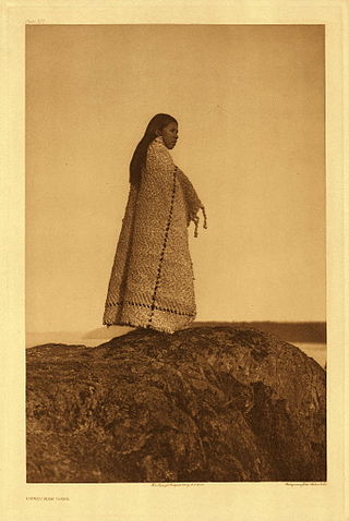
Cowichan Tribes is the band government of the Cowichan, a group of Coast Salish peoples who live in the Cowichan Valley region on Vancouver Island. With over 3,800 registered members, it is the single largest First Nations band in British Columbia.

Lava Canyon is a canyon on the Chilko River in the Chilcotin District of the Interior of British Columbia, Canada, located about 35 kilometres below the Chilko's outflow from the foot of Chilko Lake.
Skutz Falls is a waterfall on the Cowichan River on Vancouver Island, British Columbia, Canada. It is located just above Marie Canyon. The name was originally Skwets or Squitz, meaning "waterfall" in the Cowichan dialect of Halkomelem.
The Nazko First Nation is a First Nations government of the Dakelh people in the north-central Interior of British Columbia. Its reserves are located around the community of Nazko, British Columbia, which is 120 km west of Quesnel and southwest of Prince George.
The Tahltan First Nation, also known as the Tahltan Indian Band, is a band government of the Tahltan people. Their main community and reserves are located at Telegraph Creek, British Columbia. Their language is the Tahltan language, which is an Athabaskan language also known as Nahanni, is closely related to Kaska and Dunneza. Their Indian and Northern Affairs Canada band number is 682. The Tahltan First Nation is joined with the Iskut First Nation in a combined tribal council-type organization known as the Tahltan Nation.
The Tseycum First Nation is a First Nations government located on Vancouver Island. In the 1850s they were signatories to the Douglas Treaties.

Cowichan was a steamship which was operated in British Columbia under the ownership of the Union Steamship Company. Cowichan sank in 1925 following a collision with another ship.
Koksilah is a community located just southeast of the City of Duncan, British Columbia, Canada. Its name is derived, via that of the Koksilah River, from that of the Hwulqwselu people, one of the Hǝn̓q̓ǝmin̓ǝm̓-speaking peoples of the area today organized as the Cowichan Tribes and government.

The Koksilah River is a river on Vancouver Island, British Columbia, Canada, flowing northeast to enter Cowichan Bay just southeast of the City of Duncan. Part of the river is protected as Koksilah River Provincial Park. It is the namesake of the community of Koksilah, which is just southeast of Duncan. Kinsol Trestle is built across the river.

The Cree Nation of Chisasibi is a Cree First Nation in Quebec, Canada. It is headquartered at the Cree village of Chisasibi in the Eeyou Istchee territory in Northern Quebec. The nation also has a terre réservée crie or Cree reserved land of the same name covering 776 square kilometres (300 sq mi) around the village. As of November 2016, the Nation is in negotiation with the government of Canada to obtain its self-governance. As of 2016, it has a registered population of 4,585 members.
References
- ↑ Paterson, T.W. "Chronicles: A name is a name...so long as it's spelled right". Archived from the original on 2013-08-20.
| | This article about a location on the Coast of British Columbia, Canada is a stub. You can help Wikipedia by expanding it. |