Ping Shan is an area in the New Territories, Hong Kong. It is located west of Yuen Long Town and Shui Pin Wai, and south of Tin Shui Wai. Administratively, it is part of the Yuen Long District.

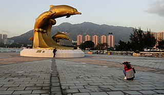
Tuen Mun or Castle Peak is a city near the mouth of Tuen Mun River and Castle Peak Bay in the New Territories, Hong Kong. It was one of the earliest settlements in what is now Hong Kong and can be dated to the Neolithic period. In the more recent past, it was home to many Tanka fishermen who gathered at Castle Peak Bay. Tuen Mun is now a modern, mainly residential area in the north-west New Territories. As of 2011, 487 546 live in Tuen Mun and over 95% of them are Chinese.

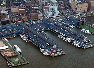
Tuen Mun Ferry Pier (屯門碼頭), or Tuen Mun Ferry Terminal, is a public pier located in the southern area of Tuen Mun, Hong Kong.
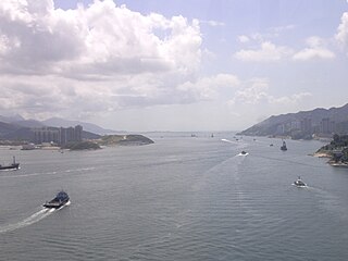
Urmston Road is a broad body of water between Lantau Island and Tuen Mun in Hong Kong. It forms an inshore passage between the northwest end of Victoria Harbour and the mouth of the Pearl River. At its eastern end it connects to the Western Working Anchorage through the Ma Wan Channel and the narrower Kap Shui Mun channel to the west of Ma Wan.

Hong Kong China Ferry Terminal is a ferry terminal, located at China Hong Kong City, 33 Canton Road, Tsim Sha Tsui, Kowloon, Hong Kong. It is one of three cross-border ferry terminals in Hong Kong.

Lam Tei is an area in the Tuen Mun District of the New Territories, Hong Kong. The region lies at the north end of Tuen Mun city. It is highly rural, with Miu Fat Buddhist Monastery being a landmark of the region. The Sherwood (豫豐花園) and Botania Villa (綠怡居) are two residential estates in Lam Tei.
Braemar Hill is a hill at the south of North Point on the Hong Kong Island, Hong Kong. The hill was likely named after the Scottish village of Braemar by the British officials.
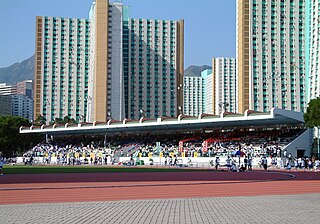
Tuen Mun Tang Shiu Kin Sports Ground is a multi-use stadium in Hong Kong. It is operated by Leisure and Cultural Services Department of Hong Kong. It is currently used mostly for football matches. The stadium holds 2,500.
Tsing Lung Tau is a built-up area in the southwest coast of the New Territories in Hong Kong.

Affluence, formerly Ho King, is an at-grade MTR Light Rail stop located between Affluence Garden and Tuen Mun River in Tuen Mun District. It began service on 23 September 1988 and belongs to Zone 2.

On Ting is an MTR Light Rail stop located at ground level at Tuen Mun Heung Sze Wui Road between On Ting Estate and Yau Oi Estate, in Tuen Mun District. It began service on 18 September 1988 and belongs to Zone 2.
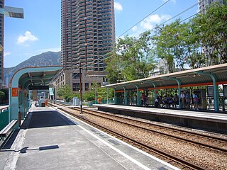
Goodview Garden is an MTR Light Rail stop located at ground level between Hoi Chu Road and Hang Fu Street, south of Goodview Garden and east of Oceania Heights in Tuen Mun District. It began service on 17 November 1991 and belongs to Zone 1. It serves Goodview Garden, Oceania Heights and nearby areas.
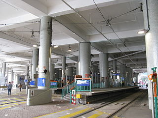
Tuen Mun Ferry Pier is an MTR Light Rail terminus located at ground level inside Pierhead Garden, Tuen Mun Ferry Pier, Wu Chui Road in Tuen Mun, Tuen Mun District. It began service on 18 September 1988, and belongs to Zone 1. It serves Tuen Mun Ferry Pier and nearby residential buildings.

Sham Shui Po Ferry Pier was a ferry pier in Sham Shui Po, Kowloon, Hong Kong that operated from 1924 to 1992. It was one of the important ferry piers in West Kowloon and had a bus terminus nearby.

Tung Chung New Development Ferry Pier or Tung Chung New Ferry Pier is a ferry pier in Tung Chung Waterfront Road, Tung Chung, Lantau Island, New Territories, Hong Kong. It was built to replace Tung Chung Old Ferry Pier in Ma Wan Chung.

Skypier is a cross-boundary ferry pier integrated within Hong Kong International Airport, Chek Lap Kok, New Territories, Hong Kong. It is operated by Hong Kong International Airport Ferry Terminal Services Limited, a joint-venture company between Chu Kong Passenger Transport Co., Ltd and Shun Tak-China Travel Ship Management Limited. At this pier, passengers abroad can transit from Hong Kong International Airport to piers in the Pearl River Delta of Guangdong Province or vice versa, without immigration and customs clearance through Hong Kong.
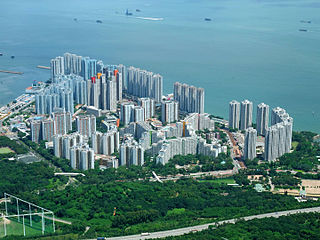
Hong Kong Gold Coast is a private housing estate served by Castle Peak Road, near Castle Peak Bay, in So Kwun Wat, Tuen Mun, New Territories, Hong Kong. Developed by Sino Group, it includes 20 residential buildings completed in two phases, a resort hotel, a shopping mall, a yacht and country club, a marina and a beach.
The following is an overview of public housing estates in Tuen Mun, Hong Kong, including Home Ownership Scheme (HOS), Private Sector Participation Scheme (PSPS), Sandwich Class Housing Scheme (SCHS), Flat-for-Sale Scheme (FFSS), and Tenants Purchase Scheme (TPS) estates.

Tuen Mun Town Plaza is the largest shopping mall in the NW New Territories of Hong Kong. Established in 1988 and located in the town of Tuen Mun, it was developed by the Sino Group. It provides a large range of merchandise, offering residents a myriad of shopping, dining and entertainment facilities.

Miami Beach Towers is a private housing estate located in Tuen Mun, New Territories, Hong Kong. It was built by Sino Land on land reclaimed from Castle Peak Bay.