
Hong Kong has a highly developed transport network,encompassing both public and private transport. Based on Hong Kong Government's Travel Characteristics Survey,over 90% of daily journeys are on public transport,the highest rate in the world. However,in 2014 the Transport Advisory Committee,which advises the Government on transportation issues,issued a report on the much-worsened congestion problem in Hong Kong and pointed at the excessive growth of private cars during the past 10–15 years.

Tsing Yi,sometimes referred to as Tsing Yi Island,is an island in the New Territories of Hong Kong,to the northwest of Hong Kong Island and south of Tsuen Wan. With an area of 10.69 km2 (4.13 sq mi),the island has been extended drastically by reclamation along almost all its natural shore and the annexation of Nga Ying Chau (牙鷹洲) and Chau Tsai. Three major bays or harbours,Tsing Yi Lagoon,Mun Tsai Tong,and Tsing Yi Bay (青衣灣) in the northeast,have been completely reclaimed for new towns.
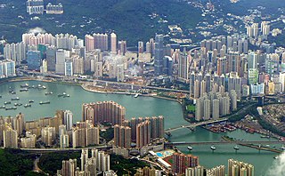
Tsuen Wan District is one of the 18 districts of Hong Kong. It is located in the New Territories and is served by the Tsuen Wan line of the MTR metro system. Its area is 60.7 km2. Its residents,who mostly live in Tsuen Wan Town,enjoy the highest income in the New Territories.

The Tsuen Wan line is one of the ten lines of the metro network in Hong Kong's MTR. It is indicated in red on the MTR map.

Victoria Harbour is a natural landform harbour in Hong Kong separating Hong Kong Island in the south from the Kowloon Peninsula to the north. The harbour's deep,sheltered waters and strategic location on South China Sea were instrumental in Hong Kong's establishment as a British colony in 1841 and its subsequent development as a trading centre.
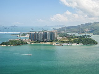
Ma Wan is an island of Hong Kong,located between Lantau Island and Tsing Yi Island,with an area of 0.97 square kilometres. Administratively,it is part of Tsuen Wan District.

Rambler Channel is a body of water in Hong Kong that separates Tsing Yi Island from Tsuen Wan and Kwai Chung in the New Territories. The channel separates the two landmasses by 900 metres at its widest point.

Park Island Transport Company Limited (PITCL) is a non-franchised bus company in Hong Kong. Established in 2002,it operates bus and ferry services between Ma Wan Island and other parts of Hong Kong territory. It is now a wholly-owned subsidiary of Sun Hung Kai Properties,the conglomerate which developed the major private housing estate Park Island on Ma Wan island.

Central is an MTR station located in the Central area of Hong Kong Island. The station's livery is firebrick red but brown on the Tsuen Wan line platforms. The station is the southern terminus of the Tsuen Wan line,a stop on the Island line,and connects to Hong Kong station,which serves the Tung Chung line and the Airport Express.
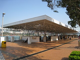
Tsing Yi Pier or Tsing Yi Ferry Terminus (青衣渡輪碼頭) was a ferry pier on Tsing Yi Island,Hong Kong. It replaced Tsing Yi Town old pier that was buried during land reclamation. There were ferries to Tsuen Wan and Central. The service ceased to exist and the pier was free for public use thereafter.

The Wan Chai Pier,or Wan Chai Ferry Pier,is a pier at the coast of Wan Chai North on the Hong Kong Island of Hong Kong. The pier is operated by Star Ferry,and provides ferry services to Tsim Sha Tsui. The pier is near the Hong Kong Convention and Exhibition Centre.

Park Island is a private housing estate located at Ma Wan,an island in Tsuen Wan,New Territories,Hong Kong. It was mainly developed by Sun Hung Kai Properties as part of the Ma Wan Development joint venture project and completed from 2002 to 2006 in six phases. There are around 10,000 to 15,000 residents.

Tsuen Wan is a town built on a bay in the western New Territories of Hong Kong,opposite of Tsing Yi Island across Rambler Channel. The market town of Tsuen Wan emerged from the surrounding villages and fleets of fishing boats in the area. The now-crowded city is around the present-day Tsuen Wan station of the MTR. Its coastline was further extended through land reclamation.

Kwai Chung Road is a throughway in Kwai Chung of the New Territories in Hong Kong. It is one of the busiest roads in Hong Kong. The Transport Department has classified it as a trunk road.
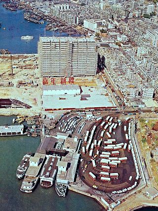
Jordan Road Ferry Pier or Ferry Point (1924–1998) is a demolished pier originally located at Jordan Road,Jordan,Hong Kong.
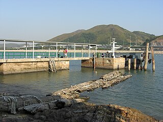
Luk Keng Pier is a small public pier adjoining Luk Keng Village,Yam O,Lantau Island,Hong Kong. There is only a kai-to ferry route to and from Tsing Lung Tau in Tsuen Wan for villagers to travel to the urban area. This closed transportation relationship between Yam O and Tsing Lung Tau explains why Northeast Lantau is part of the Tsuen Wan District,instead of the Islands District. It was the only public transportation for Luk Keng Village and the whole of Yam O before Sunny Bay station on the MTR opened.

Sham Shui Po Ferry Pier was a ferry pier in Sham Shui Po,Kowloon,Hong Kong that operated from 1919 to 1992. It was one of the important ferry piers in West Kowloon and had a bus terminus nearby.

Ta Shui Wan was a bay in Yam O,Lantau Island,New Territories,Hong Kong,located between Tai Yam Teng (大陰頂) and Ngong Shuen Au (昂船凹). The bay was reclaimed to construct MTR Sunny Bay station.
Tsing Yi Hui was a town on Tsing Yi Island,Hong Kong. Many people at that time referred to the town as Tsing Yi Main Street (青衣大街),namely the main street of the town.

Tsuen Wan Transport Complex was a large transport hub in Tsuen Wan,Hong Kong. There was a bus terminus and taxi stand on the ground floor;on top sat a multi-storey car park.


