
Kwai Tsing is one of the 18 districts of Hong Kong. It consists of two parts - Kwai Chung and Tsing Yi Island. Kwai Tsing is part of the New Territories. It had a population of 520,572 in 2016. The district has the third least educated residents and their income is below average.

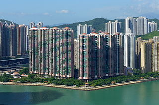
Tsing Yi, sometimes referred to as Tsing Yi Island, is an island in the urban area of Hong Kong, to the northwest of Hong Kong Island and south of Tsuen Wan. With an area of 10.69 km2 (4.13 sq mi), the island has extended drastically by reclamation along almost all its natural shore and the annexation of Nga Ying Chau (牙鷹洲) and Chau Tsai. Three major bays or harbours, Tsing Yi Lagoon, Mun Tsai Tong and Tsing Yi Bay (青衣灣) in the northeast, have been completely reclaimed for new towns.

Kwai Chung is an urban area within Tsuen Wan New Town in the New Territories of Hong Kong. Together with Tsing Yi Island, it is part of the Kwai Tsing District District of Hong Kong. Kwai Chung is the site of the container port. It is also part of Tsuen Wan New Town. In 2000, it had a population of 287,000. Its area is 9.93 km². Areas within Kwai Chung include: Kwai Fong, Kwai Hing, Lai King, Tai Wo Hau.

Tsuen Wan New Town is a new town in Hong Kong. It spans Tsuen Wan, Kwai Chung and the eastern part of Tsing Yi Island. Traditionally, the administrative officials of Tsuen Wan managed the area of Tsuen Wan proper, Kwai Chung, Tsing Yi Island, Ma Wan and Northeast Lantau Island.

Rambler Channel is a body of water in Hong Kong that separates Tsing Yi Island from Tsuen Wan and Kwai Chung in the New Territories. The channel separates the two landmasses by 900 metres at its widest point.

Tsing Yi South Bridge, opened as the Tsing Yi Bridge in 1974, was the first bridge to Tsing Yi, Hong Kong. It spans Rambler Channel, linking Tsing Yi Island to the former Pillar Island, Kwai Chung. The bridge spans 610 metres and is 26 metres (85 feet) high. It contributed significantly to the development of Tsing Yi, particularly in the 1970s and 1980s. The name "Tsing Yi South Bridge" was adopted following the 1987 opening of the second bridge to Tsing Yi, the Tsing Yi North Bridge.
Tsing Chau or Pillar Island was an island in the Kwai Chung area of Hong Kong, sitting at the mouth of Gin Drinker's Bay, by the side of the Rambler Channel, opposite Tsing Yi Island.

Tsing Kwai Highway is a section of Route 3 in Hong Kong, previously known as Route 3 - Kwai Chung Section. From its junction with West Kowloon Highway at Mei Foo Roundabout, the expressway runs in the form of a 3 km dual-4 lane viaduct atop Kwai Chung Road and Kwai Tai Road, circumscribing the container terminals to reach the Rambler Channel. Then, the highway crosses the channel along a 500 m bridge known as Cheung Tsing Bridge, and ends at its junction with the Cheung Ching Tunnel. Tsing Kwai Highway was opened on 19 February 1997.

Ma Wan Channel is a channel between Ma Wan and Tsing Yi islands in Hong Kong. The north end of the channel is Ting Kau where it joins the Rambler Channel. To the west it joins with the Kap Shui Mun channel running to the south of Ma Wan, leading into Urmston Road. To the east it divides into the Tsing Yi Channel and the Rambler Channel, leading to Tsuen Wan and Kwai Chung. To the south is the Western Working Anchorage of Victoria Harbour.
Villa Esplanada is a private housing estate developed by Sun Hung Kai Properties, China Resources and Cheung Kong on Tsing Yi island in Hong Kong. It locates on the relocated oil depots on the former island Nga Ying Chau. It is close to Ching Wang Court, Tsing Yi Station of MTR and Airport Express. The flats were sold in three phases.
Tsing Yi Nature Trail, also known as Kwai Tsing Reunification Health Trail is a hiking trail on Tsing Yi Island, New Territories, Hong Kong.

Cheung Tsing Bridge, formerly Rambler Channel Bridge, is a bridge crossing Rambler Channel in Hong Kong, connecting Cheung Tsing Tunnel on Tsing Yi Island and Kwai Chung section of Tsing Kwai Highway. It is part of Tsing Kwai Highway of Route 3.

The Airport Core Programme (ACP) was a series of infrastructure projects centred on the new Hong Kong International Airport during the early 1990s. The programme was part of the Port and Airport Development Strategy, commonly known as the Rose Garden Project.
Gin Drinkers Bay or Gin Drinker's Bay, also known as Lap Sap Wan, was a bay in Kwai Chung, Hong Kong.

Container Terminal 9 or CT9 is the 9th container terminal in Hong Kong. It is located on Tsing Yi Island, facing Rambler Channel. It is part of the Kwai Tsing Container Terminals. The total site area is 1.5 square kilometres and the terminal itself comprises an area 0.68 km² and as long as 1.9 kilometres. The rest of land is for logistics and storage. When the terminal was built the sea bed was dredged to accommodate the largest container vessels.

Route 3 is a series of expressways in Hong Kong that runs from Sai Ying Pun on Hong Kong Island to Yuen Long in the New Territories, linking West Kowloon, Kwai Chung and Tsing Yi. It was built as part of the Airport Core Programme to provide access to Hong Kong International Airport from the city, and to relieve congestion in the New Territories. The Western Harbour Crossing and Tai Lam Tunnel that form part of the route are tollways.

Cheung Tsing Highway is a highway of Route 3 between Cheung Tsing Tunnel and North West Tsing Yi Interchange on Tsing Yi Island, Hong Kong. It was built as part of the Airport Core Programme together with the rest of Route 3 to provide a new highway link from North Western New Territories towards Hong Kong Island, and connects with Route 8 to provide access to the new Hong Kong International Airport.

Kwai Chung Road is a throughway in Kwai Chung of the New Territories in Hong Kong. It is one of the busiest roads in Hong Kong. The Transport Department has classified it as a trunk road.

Tsing Yi Peak or Sam Chi Heung (三支香) is a hill with three peaks occupying the southern half of the Tsing Yi Island, Hong Kong. The hill is situated on the western half of Victoria Harbour. Its peaks are good locations to observe the harbour and the channels among harbour islands. While situated in the south, a short hill Liu To Shan occupied the northwest of the island.

Kwai Tsing Container Terminals is the main port facilities in the reclamation along Rambler Channel between Kwai Chung and Tsing Yi Island, Hong Kong. It evolved from four berths of Kwai Chung Container Port completed in the 1970s. It later expanded with two berths in the 1980s. Two additional terminals are added adjoining to Stonecutters Island in the 1990s and was renamed Kwai Chung Container Terminals. In the 2000s, when Container Terminal 9 on the Tsing Yi Island and was renamed to Kwai Tsing Container Terminals.

