
Kwai Tsing is one of the 18 districts of Hong Kong. It consists of two parts - Kwai Chung and Tsing Yi Island. Kwai Tsing is part of the New Territories. It had a population of 520,572 in 2016. The district has the third least educated residents and their income is below average.

Tsing Yi, sometimes referred to as Tsing Yi Island, is an island in the urban area of Hong Kong, to the northwest of Hong Kong Island and south of Tsuen Wan. With an area of 10.69 km2 (4.13 sq mi), the island has extended drastically by reclamation along almost all its natural shore and the annexation of Nga Ying Chau (牙鷹洲) and Chau Tsai. Three major bays or harbours, Tsing Yi Lagoon, Mun Tsai Tong and Tsing Yi Bay (青衣灣) in the northeast, have been completely reclaimed for new towns.

Rambler Channel is a body of water in Hong Kong that separates Tsing Yi Island from Tsuen Wan and Kwai Chung in the New Territories. The channel separates the two landmasses by 900 metres at its widest point.

Route 8 of Hong Kong is a dual 3-lane carriageway motorway that links Lantau Island, Tsing Yi Island, Cheung Sha Wan in West Kowloon, and Sha Tin in the southeast New Territories of Hong Kong. It is a combination of many sections.

Tsing Yi South Bridge, opened as the Tsing Yi Bridge on 28 February 1974, was the first bridge to Tsing Yi, Hong Kong. It spans Rambler Channel, linking Tsing Yi Island to the former Pillar Island, Kwai Chung. The bridge spans 610 metres and is 26 metres (85 feet) high. It contributed significantly to the development of Tsing Yi, particularly in the 1970s and 1980s. The name "Tsing Yi South Bridge" was adopted following the 1987 opening of the second bridge to Tsing Yi, the Tsing Yi North Bridge.
Pillar Island or Tsing Chau was an island in the Kwai Chung area of Hong Kong, sitting at the mouth of Gin Drinkers Bay, by the side of the Rambler Channel, opposite Tsing Yi Island.

Tsing Kwai Highway is a section of Route 3 in Hong Kong, previously known as Route 3 - Kwai Chung Section. From its junction with West Kowloon Highway at Mei Foo Roundabout, the expressway runs in the form of a three-kilometre dual-four-lane viaduct atop Kwai Chung Road and Kwai Tai Road, circumscribing the container terminals to reach the Rambler Channel. Then, the highway crosses the channel along a 500-m bridge known as Cheung Tsing Bridge, and ends at its junction with the Cheung Tsing Tunnel. Tsing Kwai Highway was opened on 19 February 1997.

Rambler Crest is a housing development on Tsing Yi Island, Hong Kong, which includes a private housing estate, shopping mall and 3 hotels, namely Rambler Garden Hotel (華逸酒店), Rambler Oasis Hotel (青逸酒店) and Winland 800 Hotel (永倫800酒店). It was developed by Cheung Kong Holdings. The name Rambler comes from the name of nearby channel, Rambler Channel.

Ma Wan Channel is a channel between Ma Wan and Tsing Yi islands in Hong Kong. The north end of the channel is Ting Kau where it joins the Rambler Channel. To the west it joins with the Kap Shui Mun channel running to the south of Ma Wan, leading into Urmston Road. To the east, it divides into the Tsing Yi Channel and the Rambler Channel, leading to Tsuen Wan and Kwai Chung. To the south is the Western Working Anchorage of Victoria Harbour.

Cheung Tsing Tunnel, also spelled Cheung Ching Tunnel, is a dual tube 3-lane tunnel on Tsing Yi Island, Hong Kong. It is part of Route 3. Its east end connects to Cheung Tsing Bridge and west Cheung Tsing Highway. The tunnel was opened on 22 May 1997 and is the second toll-free tunnel in Hong Kong. Its length is about 1.6 kilometres.

The Airport Core Programme was a series of infrastructure projects centred on the new Hong Kong International Airport during the early 1990s. The programme was part of the Port and Airport Development Strategy, commonly known as the Rose Garden Project.
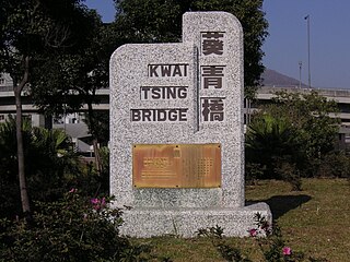
Duplicate Tsing Yi South Bridge or Duplicate Tsing Yi Bridge or Kwai Tsing Bridge is a 640-metre long bridge connecting Tsing Yi Island and Kwai Chung over the Rambler Channel of Hong Kong in parallel to Tsing Yi Bridge, which deteriorated owing to years of heavy usage. The duplicated bridge was built to relieve the overburdened Tsing Yi Bridge and opened on 26 July 1999 before the commencement of Tsing Yi Bridge renovation. This is the fourth vehicular bridge connecting Kwai Chung and Tsing Yi.

Route 3 is a series of expressways in Hong Kong that runs from Sai Ying Pun on Hong Kong Island to Yuen Long in the New Territories, linking West Kowloon, Kwai Chung and Tsing Yi. It was built as part of the Airport Core Programme to provide access to Hong Kong International Airport from the city, and to relieve congestion in the New Territories. The Western Harbour Crossing and Tai Lam Tunnel that form part of the route are tollways.

Cheung Tsing Highway is a highway of Route 3 between Cheung Tsing Tunnel and North West Tsing Yi Interchange on Tsing Yi Island, New Territories, Hong Kong. It was built as part of the Airport Core Programme together with the rest of Route 3 to provide a new highway link from North Western New Territories towards Hong Kong Island, and connects with Route 8 to provide access to the new Hong Kong International Airport.

Tsing Long Highway is an expressway of Route 3 from North West Tsing Yi Interchange on Tsing Yi Island to Yuen Long, in Hong Kong. Ting Kau Bridge and Tai Lam Tunnel are part of the expressway. It connects with Cheung Tsing Highway and Lantau Link at its southern end, and San Tin Highway and Yuen Long Highway at its northern end. Its speed limit at parts south of Tai Lam Tunnel and Tai Lam Tunnel is 80 km/h and parts north of Tai Lam Tunnel is 100 km/h.

Kwai Chung Road is a throughway in Kwai Chung of the New Territories in Hong Kong. It is one of the busiest roads in Hong Kong. The Transport Department has classified it as a trunk road.

Tsing Yi Peak, also known as Sam Chi Heung, is a hill with three peaks occupying the southern half of the Tsing Yi Island, Hong Kong. The hill is situated on the western half of Victoria Harbour. Its peaks are good locations to observe the harbour and the channels among harbour islands. While situated in the south, a short hill Liu To Shan occupies the northwest of the island.

Kwai Tsing Container Terminals is the main port facilities in the reclamation along Rambler Channel between Kwai Chung and Tsing Yi Island, Hong Kong. It evolved from four berths of Kwai Chung Container Port completed in the 1970s. It later expanded with two berths in the 1980s. Two additional terminals are added adjoining to Stonecutters Island in the 1990s and was renamed Kwai Chung Container Terminals. In the 2000s, Container Terminal 9 on the Tsing Yi Island was completed and the entire facility was renamed to Kwai Tsing Container Terminals.

Tsing Ma Control Area is an area covering Lantau Link and related road networks in the New Territories, Hong Kong, including Tsing Ma Bridge, Kap Shui Mun Bridge, Ma Wan Viaduct, Cheung Tsing Highway, Cheung Tsing Tunnel, Cheung Tsing Bridge, Ting Kau Bridge, North West Tsing Yi Interchange, Tsing Kwai Highway and North Lantau Highway, but excluding the area of rails managed by the MTRCL.
Tsing Sha Highway is a major expressway in Hong Kong, which links the island of Tsing Yi to Sha Tin. The road is part of Route 8, which starts in Sha Tin and terminates in Tung Chung. It was opened in March 2008 and extended in December 2009.


