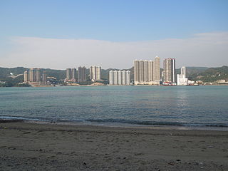
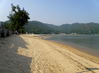
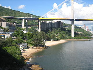
Hong Kong has a long coastline that is full of twists and turns with many bays and beaches. Many of them are well sheltered by mountains nearby,as Hong Kong is a mountainous place. As a result,large waves seldom appear at the bays,making them suitable for human swimming.

Tsing Yi,sometimes referred to as Tsing Yi Island,is an island in the urban area of Hong Kong,to the northwest of Hong Kong Island and south of Tsuen Wan. With an area of 10.69 km2 (4.13 sq mi),the island has been extended drastically by reclamation along almost all its natural shore and the annexation of Nga Ying Chau (牙鷹洲) and Chau Tsai. Three major bays or harbours,Tsing Yi Lagoon,Mun Tsai Tong and Tsing Yi Bay (青衣灣) in the northeast,have been completely reclaimed for new towns.

Ma Wan Tung Wan Beach is a gazetted beach near Noah's Ark on Ma Wan island,Hong Kong. The beach is managed by the Leisure and Cultural Services Department of the Hong Kong Government. The beach is 140 metres long and is rated as Grade 2 by the Environmental Protection Department for its water quality. It is the only gazetted beach in Ma Wan and offers views of Ting Kau Bridge as well as Tsing Ma Bridge.

Rambler Channel is a body of water in Hong Kong that separates Tsing Yi Island from Tsuen Wan and Kwai Chung in the New Territories. The channel separates the two landmasses by 900 metres at its widest point.

Ting Kau is an area in west Tsuen Wan District,New Territories,Hong Kong. Ting Kau Village is a village near the shore. Ting Kau is famous for the Ting Kau Bridge,spanning the Rambler Channel,from Ting Kau to Tsing Yi Island.

Sham Tseng is a coastal area in Tsuen Wan District,Hong Kong,between Ting Kau and Tsing Lung Tau.
Tsuen Wan Rural Committee (荃灣鄉事委員會) is a rural committee representing the interest of villages in Tsuen Wan and Kwai Chung,Hong Kong.

Tsing Yi Peak,also known as Sam Chi Heung,is a hill with three peaks occupying the southern half of the Tsing Yi Island,Hong Kong. The hill is situated on the western half of Victoria Harbour. Its peaks are good locations to observe the harbour and the channels among harbour islands. While situated in the south,a short hill Liu To Shan occupies the northwest of the island.

Silver Mine Bay Beach or Silvermine Bay Beach is a gazetted beach located facing Silver Mine Bay on Tung Wan Tau Road in Mui Wo,Lantau Island,Hong Kong. The beach has barbecue pits and is managed by the Leisure and Cultural Services Department of the Hong Kong Government. The beach is 210 metres long and is rated as good to fair by the Environmental Protection Department for its water quality in the past twenty years. The beach offers views of Hei Ling Chau.
Articles related to Hong Kong include:

The Drainage Services Department (DSD) is a department of the Hong Kong Government responsible for drainage and sewerage. Since 2007 it has been subordinate to the Development Bureau.

Lido Beach is located on Castle Peak Road in Ting Kau,New Territories,Hong Kong. It is a gazetted beach,meaning it is managed by the Leisure and Cultural Services Department,which provides lifeguards during the summer months.

Ting Kau Beach is a gazetted beach located at the northwest end of Victoria Harbour on Castle Peak Road in Ting Kau,New Territories,Hong Kong. The beach is managed by the Leisure and Cultural Services Department of the Hong Kong Government. The beach is rated as Grade 2 by the Environmental Protection Department for its water quality.

Approach Beach is a gazetted beach located near Yau Kom Tau on Castle Peak Road in Ting Kau,New Territories,Hong Kong. The beach has barbecue pits and is managed by the Leisure and Cultural Services Department of the Hong Kong Government. The beach is rated as Grade 2 by the Environmental Protection Department for its water quality.


