
Peng Chau is a small island located off the north-eastern coast of Lantau Island, Hong Kong. It is known locally for its temples, fishing industry and seafood.

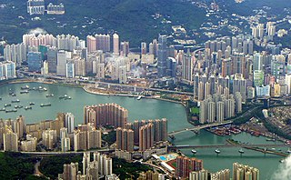
Hong Kong Island is an island in the southern part of Hong Kong. Known colloquially and on road signs simply as Hong Kong, the island had a population of 1,289,500 and a population density of 16,390 per square kilometre (42,400/sq mi), as of 2008. The island had a population of about 3,000 inhabitants scattered in a dozen fishing villages when it was occupied by the United Kingdom in the First Opium War (1839–1842). In 1842, the island was formally ceded in perpetuity to the UK under the Treaty of Nanking and the City of Victoria was then established on the island by the British Force in honour of Queen Victoria. The Central area on the island is the historical, political and economic centre of Hong Kong. The northern coast of the island forms the southern shore of the Victoria Harbour, which is largely responsible for the development of Hong Kong due to its deep waters favoured by large trade ships.

The Islands District is one of the 18 districts of Hong Kong. It is part of the New Territories. It had a population of 170,900 in 2018.
Hong Kong has a long coastline that is full of twists and turns with many bays and beaches. Many of them are well sheltered by mountains nearby, as Hong Kong is a mountainous place. As a result, large waves seldom appear at the bays, making them suitable for human swimming.

Tai Po District is one of the 18 districts of Hong Kong. The suburban district covers the areas of Tai Po New Town, Tai Po Tau, Tai Po Kau, Hong Lok Yuen, Ting Kok, Plover Cove, Lam Tsuen Valley, Tai Mei Tuk and other surrounding areas, and its exclaves Sai Kung North, in the northern part of the Sai Kung Peninsula and including islands such as Grass Island, and Ping Chau. Tai Po proper and Sai Kung North are divided by the Tolo Channel and the Tolo Harbour. The district is located in the Eastern New Territories. The de facto administrative centre of the district is Tai Po New Town.
Tsuen Wan District is one of the 18 districts of Hong Kong. It is located in the New Territories and is served by the Tsuen Wan line of the MTR metro system. Its area is 60,7 km². Its residents, who mostly live in Tsuen Wan Town, enjoy the highest income in the New Territories.

Hong Kong counts approximately 600 temples, shrines and monasteries. While Buddhism and Christianity are the most widely practiced religions, most religions are represented in the Special Administrative Region.

Tung Lung Chau, previously known as Nam Tong Island or Nam Fat Tong is an island located off the tip of the Clear Water Bay Peninsula in the New Territories of Hong Kong. It is also referred by Hong Kong people as Tung Lung To or Tung Lung Island (東龍島). The island is largely uninhabited. Administratively, it belongs to Sai Kung District.
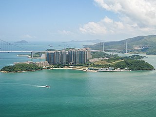
Ma Wan is an island of Hong Kong, located between Lantau Island and Tsing Yi Island, with an area of 0.97 square kilometres. Administratively, it is part of Tsuen Wan District.
Declared monuments of Hong Kong are places, structures or buildings legally declared to receive the highest level of protection. In Hong Kong, declaring a monument requires consulting the Antiquities Advisory Board, the approval of the Chief Executive of Hong Kong as well as the publication of the notice on the Hong Kong Government Gazette.

Waglan Island is a member of the Po Toi group of islands in Hong Kong. It hosts a ground of meteorological observation and recording.

Green Island is an island off the northwest coast of Kennedy Town, Hong Kong Island, separated by the Sulphur Channel. A smaller island nearby to the east, uninhabited, is called Little Green Island (小青洲). Administratively, the two islands are part of Central and Western District.

Cape D'Aguilar is a cape on Hong Kong Island, Hong Kong. The cape is on the southeastern end of D'Aguilar Peninsula. To its north are Shek O and D'Aguilar Peak.
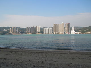
Sham Tseng is a coastal area in Tsuen Wan District, Hong Kong, between Ting Kau and Tsing Lung Tau.

Tsing Yi Peak, also known as Sam Chi Heung, is a hill with three peaks occupying the southern half of the Tsing Yi Island, Hong Kong. The hill is situated on the western half of Victoria Harbour. Its peaks are good locations to observe the harbour and the channels among harbour islands. While situated in the south, a short hill Liu To Shan occupies the northwest of the island.

Tsing Lung Tau is a coastal residential area in the southwest coast of the New Territories in Hong Kong.
Luk Keng Village or Luk Keng Tsuen is a village located on the Yam O peninsula on Lantau Island in the New Territories of Hong Kong, which links to Cheung Sok, a nearby uninhabited island, via a sandbank. Although nearby areas including Sunny Bay station have been developed, Luk Keng Village is still preserved as an undeveloped rural heritage area.

Tsuen Wan Pier, Tsuen Wan Ferry or Tsuen Wan Ferry Pier is a public pier at the south of Tsuen Wan, New Territories, Hong Kong, which is adjacent to the MTR Tsuen Wan West station. It provided ferry service to Central via Tsing Yi, but the service ceased operation in 2000 after Western Harbour Crossing and MTR Tung Chung line were commissioned to provide faster route between New Territories West and Hong Kong Island.


