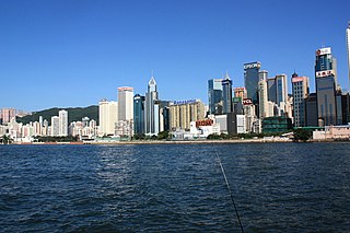
Wan Chai District is one of the 18 districts of Hong Kong. Of the four on Hong Kong Island,it is north-central,and had 166,695 residents in 2021,an increase from 152,608 residents in 2011. The district has the second-highest educationally qualified residents with the highest-bracket incomes,the second-lowest population and the third-oldest quotient. It is a relatively affluent district,with one in five persons having liquid assets of more than HKD 1 million.
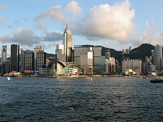
Wan Chai is situated at the western part of Wan Chai District on the northern shore of Hong Kong Island,in Hong Kong. Its other boundaries are Canal Road to the east,Arsenal Street to the west and Bowen Road to the south. The area north of Gloucester Road is often referred to as Wan Chai North.

Hong Kong Island is an island in the southern part of Hong Kong. Known colloquially and on road signs simply as Hong Kong,the island had a population of 1,289,500 and a population density of 16,390 per square kilometre (42,400/sq mi),as of 2008. The island had a population of about 3,000 inhabitants scattered in a dozen fishing villages when it was occupied by the United Kingdom in the First Opium War (1839–1842). In 1842,the island was formally ceded in perpetuity to the UK under the Treaty of Nanking and the City of Victoria was then established on the island by the British Force in honour of Queen Victoria. The Central area on the island is the historical,political and economic centre of Hong Kong. The northern coast of the island forms the southern shore of the Victoria Harbour,which is largely responsible for the development of Hong Kong due to its deep waters favoured by large trade ships.
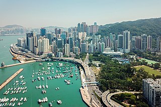
Causeway Bay is an area and a bay on Hong Kong Island,Hong Kong,straddling the border of the Eastern and the Wan Chai districts. It is a major shopping,leisure and cultural centre in Hong Kong,with a number of major shopping centres. The rents in the shopping areas of Causeway Bay were ranked as the world's most expensive for the second year in a row in 2013,after overtaking New York City's Fifth Avenue in 2012. When referring to the area,the Cantonese name is never written in English as "Tung Lo Wan".

Victoria Harbour is a natural landform harbour in Hong Kong separating Hong Kong Island in the south from the Kowloon Peninsula to the north. The harbour's deep,sheltered waters and strategic location on South China Sea were instrumental in Hong Kong's establishment as a British colony in 1841 and its subsequent development as a trading centre.
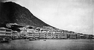
The City of Victoria,often called Victoria City or simply Victoria,was the de facto capital of Hong Kong during its time as a British dependent territory. It was initially named Queenstown but was soon known as Victoria. It was one of the first urban settlements in Hong Kong and its boundaries are recorded in the Laws of Hong Kong. All government bureaux and many key departments still have their head offices located within its limit.

The Royal Hong Kong Yacht Club is a Hong Kong watersports club for sailing and rowing including paddling.
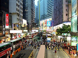
East Point was a spit on the northern shore of Hong Kong Island,Hong Kong. It extended from East Point Hill,i.e. Lee Garden towards Kellett Island and marked the eastern limits of the early City of Victoria. The piece of land separated Causeway Bay in the east and Wong Nai Chung in the west. Streams and muds from Tai Hang and Wong Nai Chung shaped the spit.

Canal Road East,Canal Road West (堅拿道西) and the Canal Road Flyover (堅拿道天橋) are important roads in the Wan Chai District of Hong Kong Island,between the areas of East Point near Causeway Bay,and Morrison Hill near Wan Chai.

Gloucester Road is a major highway in Hong Kong. It is one of the few major roads in Hong Kong with service roads. It was named on 14 June 1929 after Prince Henry,Duke of Gloucester,to commemorate his visit to Hong Kong that year. The road is 2.2 kilometres in length and has a speed limit of 70 km/h.

The Island Eastern Corridor (IEC) is an expressway built along the northeastern shore of Hong Kong Island in Hong Kong. It starts from Causeway Bay in the west and ends in Chai Wan in the east. It is mostly part of Route 4. The section between Causeway Bay and Quarry Bay consists mainly of viaducts built along Victoria Harbour.

Queen's Road East is a street in Wan Chai,in the north of Hong Kong Island,Hong Kong,connecting Admiralty in the west to Happy Valley in the east. Queen's Road East is one of the four sections of Queen's Road,and historically included Queensway.

The Wan Chai Cargo Handling Basin is situated in Wan Chai,Hong Kong Island,Hong Kong. A prime site along Victoria Harbour,it is adjacent to the Wan Chai Sports Ground and located between the Hong Kong Convention and Exhibition Centre and the Royal Hong Kong Yacht Club. The site has been earmarked under the Central and Wan Chai Reclamation project for the construction of a highway linking Central with Causeway Bay,aimed at easing traffic congestion along the northern coast of Hong Kong Island.

Kellett Bay,or Kai Lung Wan (雞籠灣) is a bay on southwestern Hong Kong Island in Hong Kong,to the southeast of Waterfall Bay.

Tonnochy Road is a street in Wan Chai on the Hong Kong Island of Hong Kong. It runs from Hennessy Road,across Lockhart Road,Jaffe Road,Gloucester Road,to Hung Hing Road near Victoria Harbour. The wide Gloucester Road divides Tonnochy Road into a north and a south sections. Gloucester Road has a flyover to turn into the road at the north.
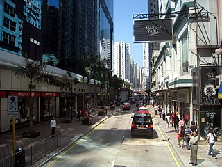
Electric Road is a street in the north of Hong Kong Island in the Eastern District of Hong Kong. It spans from the Tin Hau area of Causeway Bay,across Fortress Hill of North Point and connects east onto Java Road in North Point.

Central and Wan Chai Reclamation is a project launched by the government of Hong Kong since the 1990s to reclaim land for different purposes. This includes transportation improvements such as the Hong Kong MTR station,Airport Express Railway &Central-Wan Chai Bypass,as well as public recreation space such as the Central Harbourfront Event Space,Tamar Park and the Hong Kong Observation Wheel.

Causeway Bay Typhoon Shelter is a typhoon shelter located in Causeway Bay,Hong Kong,between the Hong Kong Island entrance of Cross-Harbour Tunnel on Kellett Island and Island Eastern Corridor. It was the first typhoon shelter in Hong Kong. It is roughly 17 hectares in area.
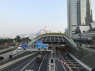
The Central–Wan Chai Bypass is a 4-kilometre (2.5 mi) trunk road running between Sheung Wan and Fortress Hill on Hong Kong Island. The original design consists of a 2.3 km dual three-lane tunnel running under new reclamation areas provided by the Central and Wan Chai Reclamation project,and also connections to Connaught Road West flyover and Island Eastern Corridor. It substitutes Connaught Road Central,Harcourt Road,Gloucester Road and Victoria Park Road to be part of Route 4.

Victoria Park Road is a road in Causeway Bay,Hong Kong. Its western section between Gloucester Road and Island Eastern Corridor before the completion of Central–Wan Chai Bypass,served as a portion of Route 4. It starts at the junction of Route 1 and ends in Hing Fat Street. The road is 750 metres long and was built in 1972 by reclamation following the shoreline,along with the Cross-Harbour Tunnel. Its northern side abuts Causeway Bay Typhoon Shelter,while to its south is Victoria Park,after which it is named.


