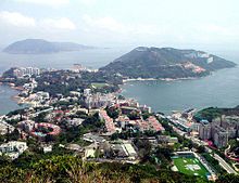
The Southern District is one of the 18 districts of Hong Kong. It is located in the southern part of Hong Kong Island. It had a population of 274,994 in 2016.

The Islands District is one of the 18 districts of Hong Kong. It is part of the New Territories. It had a population of 185,282 in 2021.
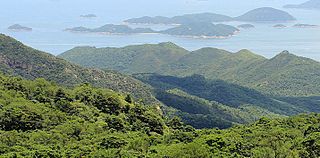
Hong Kong has a long coastline that is full of twists and turns with many bays and beaches. Many of them are well sheltered by mountains nearby, as Hong Kong is a mountainous place. As a result, large waves seldom appear at the bays, making them suitable for human swimming.

Tai Po District is one of the 18 districts of Hong Kong. The suburban district covers the areas of Tai Po New Town, Tai Po Tau, Tai Po Kau, Hong Lok Yuen, Ting Kok, Plover Cove, Lam Tsuen Valley, Tai Mei Tuk and other surrounding areas, and its exclaves Sai Kung North, in the northern part of the Sai Kung Peninsula and including islands such as Grass Island, and Ping Chau. Tai Po proper and Sai Kung North are divided by the Tolo Channel and the Tolo Harbour. The district is located in the Eastern New Territories. The de facto administrative centre of the district is Tai Po New Town.

North District is the northernmost district of the 18 districts of Hong Kong. It is located in the northeastern part of the New Territories. The new town of Fanling–Sheung Shui is within this district. It had a population of 298,657 in 2001. The district has the second lowest population density in Hong Kong.

Tung Ping Chau is an island in Hong Kong, part of Hong Kong UNESCO Global Geopark. It is also known as Ping Chau (平洲). Tung is prepended to the name at times so as to avoid possible confusion with Peng Chau, another island in Hong Kong with an identically pronounced name in Cantonese. Administratively, the island is part of the Tai Po District in the New Territories.

Waglan Island is a member of the Po Toi group of islands in Hong Kong. It hosts a ground of meteorological observation and recording.

Po Toi is the main island of the Po Toi Islands and the southernmost island of Hong Kong, with an area of 3.69 km².

The Soko Islands are a group of islands in Hong Kong. The group consists of Tai A Chau, Siu A Chau and several smaller nearby islands, in the southwesternmost waters of the territory, to the southwest of Lantau Island.

The Ninepin Group or Kwo Chau Islands (果洲群島) is a group of 29 islands in the easternmost waters of Hong Kong. The Ninepin Group falls under the jurisdiction of Sai Kung District of Hong Kong.

Green Island is an island off the northwest coast of Kennedy Town, Hong Kong Island, separated by the Sulphur Channel. A smaller island nearby to the east, uninhabited, is called Little Green Island (小青洲). Administratively, the two islands are part of Central and Western District.

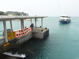
The kai-to, sometimes kaito or kaido is a type of small, motorised ferry that operates in Hong Kong. They are usually used to serve remote coastal settlements in the territory's outlying islands.

Cape D'Aguilar is a cape on Hong Kong Island, Hong Kong. The cape is on the southeastern end of D'Aguilar Peninsula. To its north are Shek O and D'Aguilar Peak.

Ap Chau, also known as Robinson Island, with a size of 0.04 km² is an island in the Crooked Harbour, in the north-eastern New Territories of Hong Kong. It is located in Ap Chau Bay. Islets located close by include Ap Chau Pak Tun Pai, Ap Chau Mei Pak Tun Pai, Ap Lo Chun, Ap Tan Pai and Kau Tau Shek.
Ap Chau Mei Pak Tun Pai is a small island in the New Territories of Hong Kong. It is located in Ap Chau Bay (鴨洲海) just off the southern tip of Ap Chau (鴨洲) and is not to be confused with Ap Chau Pak Tun Pai (鴨洲白墩排) which is located further west. It is under the administration of North District.

Ap Lo Chun is a small island in the New Territories of Hong Kong. It is under the administration of North District.

Rocky Harbour or Leung Shuen Wan Hoi is a harbour at the south-east of Sai Kung Peninsula, Hong Kong.

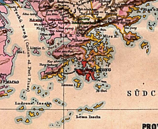
The Wanshan Archipelago, formerly known as the Ladrones Islands, is a 104-island archipelago that is a part of Xiangzhou District in Zhuhai, Guangdong Province, China.

Tang Lung Chau is a islet located off the southern coast of Ma Wan island to the northwest of Hong Kong Island, Hong Kong. It is located within Tsuen Wan District of the New Territories.


