
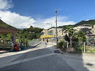
Sha Po (Chinese :沙埔) is a village located in the area of Yung Shue Wan on the North side of Lamma Island, the third largest island in the territory of Hong Kong.
Contents
It comprises Sha Po Old Village (沙埔舊村) and Sha Po New Village (沙埔新村).

Sha Po (Chinese :沙埔) is a village located in the area of Yung Shue Wan on the North side of Lamma Island, the third largest island in the territory of Hong Kong.
It comprises Sha Po Old Village (沙埔舊村) and Sha Po New Village (沙埔新村).
Sha Po is a recognized village under the New Territories Small House Policy. [1]
Sha Po Old Village is a place of archaeological interest. A complete hard geometric pot was unearthed in Sha Po Old Village by the Hong Kong Archaeological Society in 1970. [2] In 1988, Bronze Age hard geometric was found by the same party in basel layers near water table, underlying 2m of kiln debris and clean sand. [3]
All of Lamma Island is in Primary One Admission (POA) School Net 96. Within the school net is one aided school (operated independently but funded with government money): Northern Lamma School (南丫北段公立小學). No government schools are in the net. [4]

Kwai Chung is an urban area within Tsuen Wan New Town in the New Territories of Hong Kong. Together with Tsing Yi Island, it is part of the Kwai Tsing District of Hong Kong. It is also part of Tsuen Wan New Town.
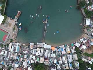
Yung Shue Wan is the main population centre on Lamma Island, Hong Kong. It has a population of approximately 6,000.
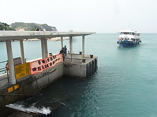
Po Toi is the main island of the Po Toi Islands and the southernmost island of Hong Kong, with an area of 3.69 km2.
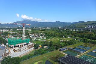
Kam Tin, or Kam Tin Heung, is an area in the New Territories, Hong Kong. It lies on a flat alluvial plain north of Tai Mo Shan mountain and east of Yuen Long town. It was formerly known as Sham Tin (岑田). Administratively, it is part of Yuen Long District.

Lai Chi Kok is a neighbourhood in Kowloon, Hong Kong, east of Kwai Chung and west of Cheung Sha Wan. Mei Foo Sun Chuen is the largest housing estate in the area and also the largest in Hong Kong with 99 blocks. Administratively, it belongs to Sham Shui Po District.

Tai Po is an area in the New Territories of Hong Kong. It refers to the vicinity of the traditional market towns in the area presently known as Tai Po Old Market or Tai Po Kau Hui (大埔舊墟) on the north of Lam Tsuen River and the Tai Po Hui on Fu Shin Street on the south of the Lam Tsuen River, near the old Tai Po Market railway station of the Kowloon-Canton Railway. Both market towns became part of the Tai Po New Town in the late 1970s and early 1980s. In present-day usage, "Tai Po" may refer to the area around the original market towns, the Tai Po New Town, or the entire Tai Po District.

Wu Kai Sha, formerly known as Wu Kwai Sha or U Kwai Sha, is a place at the shore of Tolo Harbour, northwest of Ma On Shan in the New Territories, Hong Kong. Wu Kai Sha is within the Sha Tin District, one of the 18 districts of Hong Kong. The name roughly translates as Black Sand Creek, based on the accumulation of black iron ore which traditionally flowed down from the Ma On Shan (peak).

High Island or Leung Shuen Wan Chau is a former island located in the southeast of Sai Kung Peninsula in Hong Kong, within Sai Kung District. Two sets of dams constructed between 1969 and 1979 and crossing the former Kwun Mun Channel (官門海峽), connect the island to the peninsula, thereby forming the High Island Reservoir. Before being connected to the mainland, the island had an area of 8.511 km² (3.29 square miles) and was the 4th largest island of Hong Kong in 1960.

Siu Lek Yuen is an area in Sha Tin District, New Territories East. Located to the east of Yuen Chau Kok, the area is surrounded on three sides by the Ma On Shan Country Park. Nowadays it is a residential area.

Sha Lan Tsuen or Shuen Wan Sha Lan (船灣沙欄) is a small village in Hong Kong, to the east of the Tai Po New Town. This village mainly comprises the Lee (李) family of the Hakka origin and they have been living there for more than a century.

Yuen Chau Kok is an area in Sha Tin District, New Territories, Hong Kong, near Sha Tin Road and Prince of Wales Hospital and is within walking distance of City One station of the MTR Tuen Ma line. Before reclamation work in the 1970s, the area was an island in Tide Cove.

Sha Po Tsuen is a walled village in Kam Tin, Yuen Long District, Hong Kong.

Pak Sha Tsuen is a walled village in Shap Pat Heung, Yuen Long District, Hong Kong.
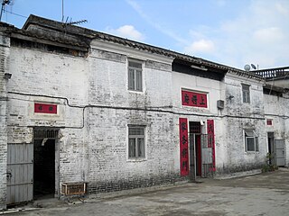
Fung Kat Heung is a village in the Kam Tin area of Yuen Long District, Hong Kong.

Sha Kok Mei is a village in Sai Kung Peninsula, Hong Kong.
Kau Lung Hang is a village in Tai Po District, Hong Kong.

Mai Po Tsuen is a village in Yuen Long District, Hong Kong.

Ko Po Tsuen or Ko Po Village is a village in Kwan Tei, Fanling, North District, Hong Kong.
Ma Mei Ha is a village situated in Fanling, within the North District of the New Territories in Hong Kong.

Lo So Shing is a village located on Lamma Island, the third largest island in the territory of Hong Kong.
22°13′28″N114°06′44″E / 22.224338°N 114.112171°E