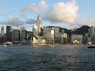
Wan Chai is a metropolitan area situated at the western part of the Wan Chai District on the northern shore of Hong Kong Island,in Hong Kong. Its other boundaries are Canal Road to the east,Arsenal Street to the west and Bowen Road to the south. The area north of Gloucester Road is often referred to as Wan Chai North.
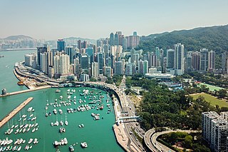
Causeway Bay is an area and a bay on Hong Kong Island,Hong Kong,straddling the border of the Eastern and the Wan Chai districts. It is a major shopping,leisure and cultural centre in Hong Kong,with a number of major shopping centres. The rents in the shopping areas of Causeway Bay were ranked as the world's most expensive for the second year in a row,after overtaking New York City's Fifth Avenue in 2012. When referring to the area,the Cantonese name is never written in English as "Tung Lo Wan".

Victoria Harbour is a natural landform harbour in Hong Kong separating Hong Kong Island in the south from the Kowloon Peninsula to the north. The harbour's deep,sheltered waters and strategic location on South China Sea were instrumental in Hong Kong's establishment as a British colony in 1841 and its subsequent development as a trading centre.
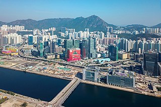
Kowloon Bay is a body of water within Victoria Harbour and an area within Kowloon,Hong Kong.
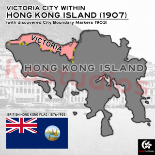
The City of Victoria,often called Victoria City or simply Victoria,was the de facto capital of Hong Kong during its time as a British dependent territory. It was initially named Queenstown but was soon known as Victoria. It was one of the first urban settlements in Hong Kong and its boundaries are recorded in the Laws of Hong Kong. All government bureaux and many key departments still have their head offices located within its limit.

Kellett Island is a former island of Victoria Harbour,off East Point in Hong Kong. It is now connected to Hong Kong Island at Causeway Bay following land reclamation in 1969.
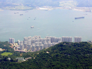
Heng Fa Chuen is a private housing estate in Chai Wan,Hong Kong Island,Hong Kong,jointly developed by MTR Corporation and Heng Fa Chuen Development. It is located on the waterfront and offers views of the Tathong Channel. Heng Fa Chuen lies within the Eastern District.

Siu Sai Wan is a residential area in the northeastern part of Hong Kong Island in Hong Kong. It is located in the eastern part of Chai Wan,and is administratively under the Eastern District. The population was 59,729 in June 2011.

Gloucester Road is a major highway in Hong Kong. It is one of the few major roads in Hong Kong with service roads. It was named on 14 June 1929 after Prince Henry,Duke of Gloucester,to commemorate his visit to Hong Kong that year. The road is 2.2 kilometres in length and has a speed limit of 70 km/h.

The Island Eastern Corridor (IEC) is an expressway built along the northeastern shore of Hong Kong Island in Hong Kong. It starts from Causeway Bay in the west and ends in Chai Wan in the east. It is mostly part of Route 4. The section between Causeway Bay and Quarry Bay consists mainly of viaducts built along Victoria Harbour.

Wan Chai Sports Ground is a stadium in Wan Chai North,Hong Kong Island,Hong Kong,with a seating capacity of 2,401. It is a government-run sports ground primarily used by local schools for sports days and other athletic activities. Situated by the Victoria Harbour,it is at a convenient location next to Hong Kong's Central business district,Wan Chai,and the shopping district of Causeway Bay.

Kau Yi Chau,also known as Tai Kau Yi Chau,is an uninhabited island located west of Victoria Harbour,between Peng Chau and Green Island in Hong Kong. It is located on the crossroad of sea routes,east to west and north to south. The ferry between Central and Mui Wo sails close to the south of the island. Administratively it is part of Islands District.

Central and Wan Chai Reclamation is a project launched by the government of Hong Kong since the 1990s to reclaim land for different purposes. This includes transportation improvements such as the Hong Kong MTR station,Airport Express Railway &Central-Wan Chai Bypass,as well as public recreation space such as the Central Harbourfront Event Space,Tamar Park and the Hong Kong Observation Wheel.
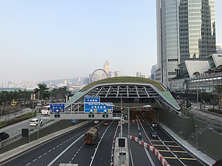
The Central–Wan Chai Bypass is a 4-kilometre (2.5 mi) trunk road running between Sheung Wan and Fortress Hill on Hong Kong Island. The original design consists of a 2.3 km dual three-lane tunnel running under new reclamation areas provided by the Central and Wan Chai Reclamation project,and also connections to Connaught Road West flyover and Island Eastern Corridor. It substitutes Connaught Road Central,Harcourt Road,Gloucester Road and Victoria Park Road to be part of Route 4.

Victoria Park Road is a road in Causeway Bay,Hong Kong. Its western section between Gloucester Road and Island Eastern Corridor before the completion of Central–Wan Chai Bypass,served as a portion of Route 4. It starts at the junction of Route 1 and ends in Hing Fat Street. The road is 750 metres long and was built in 1972 by reclamation following the shoreline,along with the Cross-Harbour Tunnel. Its northern side abuts Causeway Bay Typhoon Shelter,while to its south is Victoria Park,after which it is named.
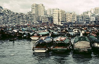
Yau Ma Tei Typhoon Shelter is a typhoon shelter located near Yau Ma Tei,Kowloon,Hong Kong.

The reclamation of land from the ocean has long been used in mountainous Hong Kong to expand the limited supply of usable land with a total of around 60 square kilometres of land created by 1996. The first reclamations can be traced back to the early Western Han Dynasty,when beaches were turned into fields for salt production. Major land reclamation projects have been conducted since the mid-19th century.

The Kai Tak Development,abbreviated as "KTD" and formerly called South East Kowloon Development (東南九龍發展計劃),refers to the redevelopment of the former Kai Tak Airport site in Kai Tak,Kowloon,Hong Kong.
Civic engagement in Central and Wan Chai harbourfront development is a process of civic engagement initiated by the Government of Hong Kong to explore the future development of the Victoria Harbour and its harbourfront areas since 2004. It was launched in response to the government's defeat in the judicial review case against the Central and Wan Chai Reclamation projects.


