Related Research Articles
West Quincy is a small commercial area in northeastern Marion County, Missouri, United States, on U.S. Route 24. It has no permanent residents.

Saint Catharine or St. Catharine is an unincorporated community and census-designated place in southeast Linn County, Missouri, United States. Saint Catharine is located approximately four miles east of Brookfield on Missouri Route 11. The Chicago, Burlington and Quincy Railroad passes the south side of the community.
Durham is an unincorporated community in southern Lewis County, Missouri, United States. It is located on Route 6, approximately ten miles southwest of La Grange. Durham is part of the Quincy, IL–MO Micropolitan Statistical Area.

Maywood is an unincorporated community in southern Lewis County, Missouri, United States. It is located on Missouri Route V just north of the Lewis-Marion county line, approximately eleven miles northwest of Palmyra and ten miles west of Quincy, Illinois. The community is part of the Quincy, IL–MO Micropolitan Statistical Area. The ZIP Code for Maywood is 63454.

Taylor is an unincorporated community in northeastern Marion County, Missouri, United States. Taylor is located at the northern junction of U.S. Routes 24 and 61, approximately five miles west of Quincy, Illinois and eight miles north of Palmyra. The community is part of the Hannibal Micropolitan Statistical Area.
Sperry is an unincorporated community in central Des Moines County, Iowa, United States. It lies along local roads north of the city of Burlington, the county seat of Des Moines County. Its elevation is 751 feet (229 m). Although Sperry is unincorporated, it has a post office with the ZIP code of 52650, which opened on 5 February 1870.
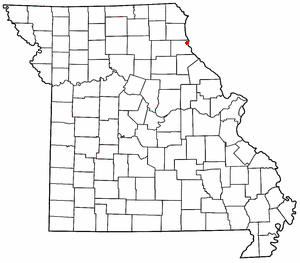
Ely is an unincorporated community in Marion County, in the U.S. state of Missouri.
Bridge Creek is an unincorporated community in northeast Carroll County, in the U.S. state of Missouri.
Medill is an unincorporated community and census-designated place in Clark County, in the U.S. state of Missouri. As of the 2020 census, its population was 82.
Apex is an unincorporated community in Lincoln County, in the U.S. state of Missouri.
Forker is an unincorporated community in southern Linn County, in the U.S. state of Missouri.
Mungers is an unincorporated community in Marion County, in the U.S. state of Missouri.
Lamb is an extinct town in Marion County, in the U.S. state of Missouri. The GNIS classifies it as a populated place.
Freedom is an unincorporated community in Osage County, in the U.S. state of Missouri. The village lies on Missouri Route N, approximately one mile north of U.S. Route 50 and two miles north of the Gasconade River.
Stillings is an unincorporated community in Platte County, in the U.S. state of Missouri. It lies within the Kansas City metropolitan area.
Flint Hill is an unincorporated community in Ralls County, in the U.S. state of Missouri. The community lies on Camp Creek approximately one-half mile north of the Salt River. US Route 61 passes 1.5 miles to the west along Missouri Route O.
Fort Henry is an unincorporated community in Randolph County, in the U.S. state of Missouri. The community is on Missouri Route O approximately 3.5 miles west-northwest of Huntsville.
Boynton is an unincorporated community in Sullivan County, in the U.S. state of Missouri.
Cora is an unincorporated community in southern Sullivan County, in the U.S. state of Missouri.
Nyssa is an unincorporated community in southeast Butler County, in the U.S. state of Missouri.
References
- ↑ U.S. Geological Survey Geographic Names Information System: Mark
- ↑ "Post Offices". Jim Forte Postal History. Retrieved 3 November 2016.
- ↑ "Marion County Place Names, 1928–1945". The State Historical Society of Missouri. Archived from the original on June 24, 2016. Retrieved November 3, 2016.
- ↑ U.S. Geological Survey Geographic Names Information System: Dunsford
- ↑ Chicago, Burlington & Quincy Railroad Company (1913). Corporate History of the Chicago, Burlington & Quincy Railroad Company and Affiliated Companies (as of Date June 30, 1917) Pursuant to Interstate Commerce Commission Valuation Order No. 20: Under Act of Congress Approved March 1, 1913. Chicago: Chicago, Burlington & Quincy Railroad Company. p. 280.
Municipalities and communities of Marion County, Missouri, United States | ||
|---|---|---|
| Cities |  | |
| Townships | ||
| CDP | ||
| Other communities | ||
| Ghost towns | ||
| Footnotes | ‡This populated place also has portions in an adjacent county or counties | |
39°53′17″N91°27′49″W / 39.88806°N 91.46361°W
| | This Marion County, Missouri state location article is a stub. You can help Wikipedia by expanding it. |