
Kokuraminami-ku (小倉南区) is a ward of Kitakyūshū, Fukuoka, Japan. It is the southern part of what used to be Kokura City, which was merged into Kitakyūshū city when the latter was created out of the merger of five cities in 1963. At this time Kokura was divided into North and South wards.
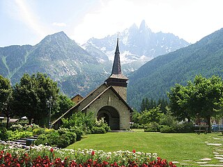
Les-Praz-de-Chamonix is a mountain village in the French Alps, part of the commune of Chamonix. Altitude: 1060m.

Jakubowice is a village in the administrative district of Gmina Oława, within Oława County, Lower Silesian Voivodeship, in south-western Poland. Prior to 1945 it was in Germany.
Popielarnia is a settlement in the administrative district of Gmina Potok Wielki, within Janów Lubelski County, Lublin Voivodeship, in eastern Poland.
Rogowo-Kolonia is a village in the administrative district of Gmina Choroszcz, within Białystok County, Podlaskie Voivodeship, in north-eastern Poland.
Ostrów is a village in the administrative district of Gmina Poświętne, within Białystok County, Podlaskie Voivodeship, in north-eastern Poland.

Zağaaltı is a village in the Lachin Rayon of Azerbaijan.
Muğanlı is a village in the Khojavend Rayon of Azerbaijan.
Binkowice is a village in the administrative district of Gmina Ożarów, within Opatów County, Świętokrzyskie Voivodeship, in south-central Poland. It lies approximately 8 kilometres (5 mi) south of Ożarów, 19 km (12 mi) east of Opatów, and 76 km (47 mi) east of the regional capital Kielce.
Nowa Wieś is a village in the administrative district of Gmina Wojciechowice, within Opatów County, Świętokrzyskie Voivodeship, in south-central Poland. It lies approximately 6 kilometres (4 mi) south-west of Wojciechowice, 8 km (5 mi) east of Opatów, and 64 km (40 mi) east of the regional capital Kielce.
Czyżów Plebański is a village in the administrative district of Gmina Zawichost, within Sandomierz County, Świętokrzyskie Voivodeship, in south-central Poland. It lies approximately 5 kilometres (3 mi) north-west of Zawichost, 17 km (11 mi) north of Sandomierz, and 84 km (52 mi) east of the regional capital Kielce.
Międzylesie is a village in the administrative district of Gmina Włoszczowa, within Włoszczowa County, Świętokrzyskie Voivodeship, in south-central Poland. It lies approximately 4 kilometres (2 mi) north-west of Włoszczowa and 48 km (30 mi) west of the regional capital Kielce.
Zajeziorze is a village in the administrative district of Gmina Zaleszany, within Stalowa Wola County, Subcarpathian Voivodeship, in south-eastern Poland. It lies approximately 2 kilometres (1 mi) south-west of Zaleszany, 14 km (9 mi) north-west of Stalowa Wola, and 69 km (43 mi) north of the regional capital Rzeszów.
Ostromęczyn-Kolonia is a village in the administrative district of Gmina Platerów, within Łosice County, Masovian Voivodeship, in east-central Poland.
Veliš is a municipality and village in Benešov District in the Central Bohemian Region of the Czech Republic.
Amiret El Fhoul is a village and commune located in the Monastir Governorate, Tunisia, located 205 kilometres from Tunis. Population 4525 (2004).
Sulu is a village in Märjamaa Parish, Rapla County in western Estonia.

National Highway 4 is the shortest national highway of Djibouti. The highway begins at 11°31′4″N42°53′5″E, at a junction with National Highway 1 and connects it with Arta at 11°31′30″N42°50′36″E.
German submarine U-2538 was a Type XXI U-boat of Nazi Germany's Kriegsmarine, built for service in World War II. She was ordered on 6 November 1943, and was laid down on 24 October 1944 at the Blohm & Voss yard at Hamburg, as yard number 2538. She was launched on 6 January 1945, and commissioned under the command of Oberleutnant zur See Heinrich Klapdor, on 16 February 1945.


