
Sulawesi, also known as Celebes, is one of the four Greater Sunda Islands. It is governed by Indonesia. The world's eleventh-largest island, it is situated east of Borneo, west of the Maluku Islands, and south of Mindanao and the Sulu Archipelago. Within Indonesia, only Sumatra, Borneo and Papua are larger in territory, and only Java and Sumatra have larger populations.

Cave paintings are a type of parietal art, found on the wall or ceilings of caves. The term usually implies prehistoric origin, but cave paintings can also be of recent production: In the Gabarnmung cave of northern Australia, the oldest paintings certainly predate 28,000 years ago, while the most recent ones were made less than a century ago.

Central Sulawesi is a province of Indonesia located at the centre of the island of Sulawesi. The administrative capital and largest city is located in Palu. The 2010 census recorded a population of 2,635,009 for the province, and the 2015 Census of 2,872,859, while the latest official estimate is 3,042,100. Central Sulawesi has an area of 61,841.29 km2 (23,877 sq mi), the largest area among all provinces on Sulawesi Island, and has the second-largest population on Sulawesi Island after the province of South Sulawesi. It is bordered by the provinces of Gorontalo to the north, West Sulawesi, South Sulawesi and South East Sulawesi to the south, by Maluku to the east, and by the Makassar Strait to the west. The province is inhabited by many ethnic groups, such as the Kaili, Tolitoli, etc. The official language of the province is Indonesian, which is used for official purposes and inter-ethnic communication, while there are several indigenous language spoken by the Indigenous peoples of Central Sulawesi. Islam is the dominant religion in the province, followed by Christianity which are mostly adhered by the people in the eastern part of the province.

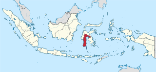
South Sulawesi is a province in the southern peninsula of Sulawesi. The Selayar Islands archipelago to the south of Sulawesi is also part of the province. The capital is Makassar. The province is bordered by Central Sulawesi and West Sulawesi to the north, the Gulf of Bone and Southeast Sulawesi to the east, Makassar Strait to the west, and Flores Sea to the south.

Makassar is the capital of the Indonesian province of South Sulawesi. It is the largest city in the region of Eastern Indonesia and the country's fifth-largest urban centre after Jakarta, Surabaya, Bandung, and Medan. From 1971 to 1999, the city was named after one of its subdistricts, Ujung Pandang. The city is located on the southwest coast of the island of Sulawesi, facing the Makassar Strait. Makassar is not only the gateway of Eastern Indonesia, but also the epicenter of West and East Indonesia, as well as between Australia and Asia.
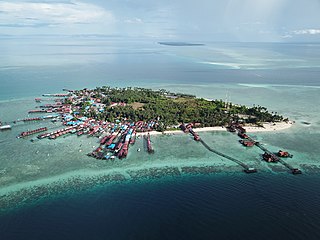
East Kalimantan is a province of Indonesia. Its territory comprises the eastern portion of Borneo. It had a population of about 3.03 million at the 2010 Census and 3.42 million at the 2015 Census; the latest official estimate is 3,619,700. Its capital is Samarinda.
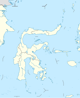
The South Peninsula is one of the four principal peninsulas on the island of Sulawesi, stretching south from the central part of the island. It is part of the province of South Sulawesi. The southern peninsula is the most densely populated peninsula in Sulawesi; over 45% of the population of Sulawesi are on the southern peninsula. Inhabited by an Austronesian people who came thousands of years ago. The largest ethnic group in Sulawesi is the Bugis, followed by Makassar and Toraja.
Hasanuddin University is one of the largest autonomous universities in Indonesia. It is located in Makassar, the capital of South Sulawesi province. The university was established in 1956, and named after Sultan Hasanuddin, a former King of the Gowa Kingdom.
Tadulako University is the only public university in Palu, Central Sulawesi, Indonesia. It was established on May 1, 1981 after being an affiliate of Hasanuddin University of Makassar for several years. Its rector is Muhammad Basir.
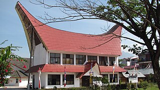
Rantepao is a town and capital of North Toraja Regency, which is known for the cultural center of Toraja ethnic group. National and regional tourism offices have developed the city as the starting point for visiting Tana Toraja, since the area was opened for tourism in the 1970s.

Gowa is a regency in the province of South Sulawesi, Indonesia. It has an area of 1,883 km² and a population of 652,329 at the 2010 Census. The majority of the Regency lies within the official metropolitan area of the city of Makassar, including the regency's administrative capital at Sungguminasa. The hill resort of Malino is within the eastern (non-metropolitan) part of the regency.

Polewali Mandar is one of the five regencies in West Sulawesi province of Indonesia. It borders on the regencies of Mamasa in the North, Majene in the West and Pinrang regency of South Sulawesi in the East. It has a population of 396,253 at the 2010 Census. The regency is inhabited by several ethnic groups such as Mandar, Buginese, Javanese and Toraja.
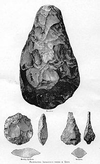
The oldest undisputed examples of figurative art are known from Europe and from Sulawesi, Indonesia, dated about 35,000 years old . Together with religion and other cultural universals of contemporary human societies, the emergence of figurative art is a necessary attribute of full behavioral modernity.

The art of the Upper Paleolithic represents the oldest form of prehistoric art. Figurative art is present in Europe and Southeast Asia, beginning between about 40,000 to 35,000 years ago.

Bantimurung-Bulusaraung National Park is a national park in South Sulawesi in Indonesia. The park contains the Rammang-Rammang karst area, the second largest karst area known in the world after the one in South-Eastern China.
Prehistoric Indonesia is a prehistoric period in the Indonesian archipelago that spanned from the Pleistocene period to about the 4th century CE when the Kutai people produced the earliest known stone inscriptions in Indonesia. Unlike the clear distinction between prehistoric and historical periods in Europe and the Middle East, the division is muddled in Indonesia. This is mostly because Indonesia's geographical conditions as a vast archipelago caused some parts — especially the interiors of distant islands — to be virtually isolated from the rest of the world. West Java and coastal Eastern Borneo, for example, began their historical periods in the early 4th century, but megalithic culture still flourished and script was unknown in the rest of Indonesia, including in Nias, Batak, and Toraja. The Papuans on the Indonesian part of New Guinea island lived virtually in the stone age until their first contacts with modern world in the early 20th century. Even today living megalithic traditions still can be found on the island of Sumba and Nias.
Maros Regency is a regency of South Sulawesi province of Indonesia. Almost all of the regency lies within the official metropolitan area of the city of Makassar. The capital town of the regency is Maros.
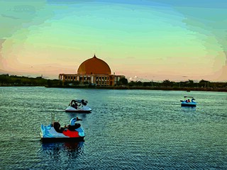
Raha is the main town and port on Muna Island, Southeast Sulawesi, Indonesia. Raha is the capital of Muna Regency.

Caves in the Maros-Pangkep karst are situated in South Sulawesi, Indonesia and contain paintings from the paleolithic considered to be the earliest figurative art in the world.
On 22 January 2019, floods caused by heavy rainfall struck the Indonesian province of South Sulawesi. At least 68 people were killed and thousands were displaced. Gowa Regency was particularly hard-hit, experiencing the majority of the fatalities.


