Ranga Reddy district is a district in the Indian state of Telangana. The district headquarters is located at Kongara Kalan Village, Ibrahimpatnam Mandal,. The district was named after the former deputy chief minister of the United Andhra Pradesh, K. V. Ranga Reddy. The district shares boundaries with Nalgonda, Yadadri Bhuvanagiri, Hyderabad, Medchal–Malkajgiri, Nagarkurnool, Mahabubnagar, Sangareddy and Vikarabad districts.

Vikarabad is a town and mandal in Vikarabad district of the Indian state of Telangana. It is located in Vikarabad mandal of Vikarabad revenue division.

Mylavaram is a town and Suburb of Vijayawada in NTR district of the Indian state of Andhra Pradesh. It is located in Mylavaram mandal of Vijayawada revenue division. Mylavaram town has higher literacy rate compared to Andhra Pradesh. In 2011, literacy rate of Mylavaram village was 69% compared to 67.02% of Andhra Pradesh.
Baireddipalle is a Mandal in Palamaner Revenue Division and Chittoor district of the Indian state of Andhra Pradesh. It is the mandal headquarters of Baireddipalle mandal.

Kannavam is a Village in Thalassery Taluk in Kannur District of Kerala State, India. It comes under Chittaripparamba Panchayat. It is located 37 km (23 mi) south east of District headquarters Kannur, 13 km (8.1 mi) east of Kuthuparamba and 466 km (290 mi) from State capital Thiruvananthapuram
Madlur is a village in the Belgaum district of Karnataka State, India. The village is famous for its history and its also called Siddhabhoomi. The place was once ruled by the Chalukyas. The ancient village is rich with the architecture of the Chalukyas. The Historical name of the place is Shreerangapur. Shree Shiddeshwar temple and Koranar Bhavi are the major attractions. Other major attractions are Marakumb Kola and lake Maagani.
Puritipenta is located in Gajapathinagaram Mandal/Tehsil of Vizianagaram District in Andhra Pradesh State, India.
Chennuru is a village in Kalluru Mandal in Khammam District of Telangana State. Chennuru is a large village located in Kallur Mandal of Khammam district, Telangana with total 1004 families residing. The Chennuru village has population of, 3416 of which 1693 are males while 1723 are females as per Population Census 2011. In Chennuru village, population of children with age 0-6 is 337 which makes up 9.87 % of total population of village. Average Sex Ratio of Chennuru village is 1018 which is higher than Andhra Pradesh state average of 993. Child Sex Ratio for the Chennuru as per census is 994, higher than Andhra Pradesh average of 939.
Pamena is a village and panchayat in Ranga Reddy district, Telangana, India. It falls under Chevella mandal. Pamena a village is on the Chevella-Shadnagar road route. It also a part of Hyderabad Metropolitan Development Authority.
Dhak Pandori is a village in Kapurthala district in North India, in the central part of the Punjab. Dhak Pandori is a small village located in Phagwara Tehsil of Kapurthala district, Punjab with total 441 families residing. The Dhak Pandori village has population of 2439 of which 1297 are males while 1142 are females as per Population Census 2011.
Kheri Shilla is a village in Makrana tehsil in Nagaur district, Rajasthan state of India. It is 7 km from Gachhipura. Other names for Kheri Shella are Mundelo Ki kheri and Guda Kheri, and the latest name of is Devnagari Kheri Sheela.
Manakawad is a village in Dharwad district of Karnataka, India.
Dighalgram is a village located in Mohammad Bazar Block of Birbhum district, West Bengal with total 1360 families residing. The Dighalgram village has population of 6284 of which 3194 are males while 3090 are females as per Population Census 2011.
Deengli is a village in Rajgarh, Churu, Rajasthan, India. As per 2011 Census of India, the village has population of 2197 of which 1144 are males while 1053 are females. It comes under ‘’’Sulkhnia chhotta’’’ Panchayath. It belongs to Bikaner Division. As per constitution of India and Panchyati Raaj Act, Deengli village is administrated by Sarpanch who is elected representative of village. It is located 65 km towards East from District headquarters Churu. 230 km from State capital Jaipur. The most famous place in Deengli is Net Dada JI temple.
Nanagwas is a small village located in Behror Tehsil of Alwar District, Rajasthan, India.
Chamundery Ranawatan is a large village located in Bali of Pali district, Rajasthan with total 1616 families residing. The Chamunderi Rana Watan village has population of 7854 of which 4007 are males while 3847 are females as per Population Census 2011.

Sangareddy district, is a district in the Indian state of Telangana. This district contains a part of the Hyderabad Metropolitan Region.Sangareddy is the district headquarters of the district. It was named after the ruler Sanga, the son of queen Shankaramba, who was the ruler of Medak during the period of Nizams. The district shares boundaries with Medak, Medchal, Vikarabad, Kamareddy and Rangareddy districts and with the state boundary of Karnataka.

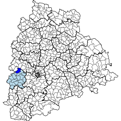
Vikarabad district is a district in the Indian state of Telangana. Vikarabad is the headquarters of the district..The district shares boundaries with Sangareddy, Mahabubnagar, Narayanpet, Rangareddy districts and the state boundary of Karnataka.
Mendora is a mandal in Nizamabad district in the state of Telangana in India. Mendora is situated beside NH 7. There are 1306 houses in Mendora. It is located 54 km towards East from District headquarters Nizamabad.