
Little Crosby is a small village in the Sefton district of Merseyside, England. Despite being within 8 miles of Liverpool it has retained its rural character by, for example, opting not to have street lights. Until 1974 it was in Lancashire.

Nalgonda is a city and municipality in the Indian state of Telangana. It is the headquarters of the Nalgonda district, as well as the headquarters of the Nalgonda mandal in the Nalgonda revenue division. It is located about 90 kilometres (56 mi) from the state capital Hyderabad.
Ganeswarpur is an Indian village. The village falls under the Gop block of Puri District. It was founded before 1500 AD by Puri Gajapati Prataprudra Deva.
Gram Panchayat is a basic governing institution in Indian villages. It is a political institution, acting as the cabinet of a village or group of villages. The Gram Sabha works as the general body of the Gram Panchayat. The members of the gram panchayat are elected directly by the people. The gram panchayat is headed by an elected President and Vice President, assisted by a Secretary who serves as the administrative head of the panchayat. The president of a gram panchayat is known as a "Pradhan" or "Sarpanch" in Northern India. There are about 250,000 gram panchayats present in India.

Nalgonda district is a district in the Telangana state of India. Nalgonda district has the highest number of mandals in the state with 31 mandals. The district shares boundaries with Suryapet, Rangareddy, Yadadri and Nagarkurnool districts and with the state boundary of Andhra Pradesh. In terms of area, Nalgonda is the largest district with an area of 7222.78 km2 in the state.

Devarakonda is a town in the Nalgonda district of the Indian state of Telangana. It is a municipality in Devarakonda mandal of Devarakonda division. It is located about 60 kilometres (37 mi) from the district headquarters Nalgonda, 104 kilometres (65 mi) from the state capital Hyderabad

Kamiesberg Municipality is a local municipality within the Namakwa District Municipality, in the Northern Cape province of South Africa.

Panchayati raj is the system of local self-government of villages in rural India as opposed to urban and suburban municipalities.
Jangaon (Janagama) is a city and the district headquarters of Jangaon district in the Indian state of Telangana. It is also the mandal and divisional headquarters of Jangaon Mandal and Jangaon revenue division respectively. It is about 85 kilometres (53 mi) from the state capital Hyderabad. It lies on the National Highway 163.

Pandhurna is the administrative headquarter of the Pandhurna District in Madhya Pradesh, India. Pandhurna city is an important city from the business point of view. The famous Gotmar Fair is organized every year on the banks of Jam River. Pandhurna is also famous for its orange fields. Pandhurna also has a multinational company called drytech situated at Nagpur road.

The Telangana Rebellion, natively known as Telangana Sayudha Poratam, was a communist-led insurrection of peasants against the princely state of Hyderabad in the region of Telangana, Dominion of India, that escalated out of agitations in 1944–46.
Chandur is a census town and Municipality and it is a Mandal Headquarters of Chandur Mandal in Nalgonda district & in the state of Telangana, India. It is located in Chandur mandal of Nalgonda division Postal code or Pin code: 508255. A beautiful and peaceful town. There are various legends about the etymology of the name one of the folklore says Chandi uuru as there is a famous Chandi maata temple of which the deity resembles to the goddess Durga of Vijayawada and is said to be commenced at the same time of the famous temple.
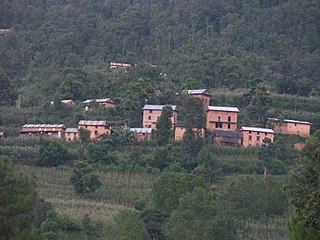
Saping is a sparsely populated village in Kabhrepalanchok district, about 60 kilometres east of Kathmandu, Nepal. As of 2011 census, Saping village has 786 households with 3,246 individuals, 1,472 males and 1,774 females, and under the "new" federal structure, formed by a new constitution, adopted on 20 September 2015, Saping is now a part of Bhumlu Gaupalika and is organized as Ward Number 1.

Gutha Sukender Reddy is an Indian BRS politician who is the 2nd and current Chairman of the Telangana Legislative Council since 14 March 2022. He was elected as MLC in 2019 & 2021 respectively.
Bhoodan Pochampally is a census town in the Yadadri Bhuvanagiri district of the Indian state of Telangana. It is located in Pochampalle mandal of Bhongir division. This village is Known for woven products, especially hand-woven Ikkat sarees. There are thousands of looms in the village that produce large quantities of sarees. In 2004, Pochampalli saree also received a geographical indication (GI) tag. This village was one of the three nominated under the category of best tourism villages by the United Nations World Tourism Organization.
Samsthan Narayanapur is a Mandal in Bhuvanagiri district of Telangana State, India. Narayanapur Mandal Headquarters is Narayanapur town. It belongs to Telangana region. It is located 39 km towards west from District headquarters Bhongir.
Gundrampally or Gundrampalli is a village in Nalgonda district in Telangana, India. It falls under Chityala mandal.

Komatireddy Venkat Reddy is an Indian politician and currently serves as the cabinet minister of Roads & Buildings and Cinematography in Telangana. He served as a MLA for the Nalgonda Constituency for 20 years consecutively, following which he served as a Member of Parliament of Bhuvanagiri Parliament Constituency from 2019 to 2023.
He joined the Congress Party in 1986 as NSUI District in charge and has worked his way up. He has been the star campaigner of Telangana Pradesh Congress Committee, known for his unwavering participation in the formation of the State of Telangana and some revolutionary development in Nalgonda. He was the Deputy Floor Leader, Telangana Congress Legislative Party.
Bothalapalem is a village in Palakeedu mandal, Suryapet district in Telangana state, India. It is located 50 km from District headquarters, Suryapet and 15 km from Deccan cement Factory and Penna Cement Factory . The total population of the village is about 2,074 among which 55% are males. The number of voters in the village is 1,724.this village exists since 150 years ..major families was in village Bogala around 80years ago Bogala saidireddy ,china kotaiah family ..and Ande Mallaiah family ..bogala nagireddy alias bogala Nagaraj..all these families were served food for many families..

Birpur is a village in Vaishali district, Bihar which is situated at the river island called Raghopur Diyara Island. It is one of the largest village in Raghopur community block. People of this village are mostly dependent on agriculture. People in this area has long tradition of joining armed forces. Its population is approximately 20,000 and peoples of this village are living their life in peaceful manner. Most of the Villagers work outside and bring revenue to this place which helps flourish the local community and enhance purchasing power. Birpur comes under Raghopur community block and a police station is Jurawanpur. It is the second largest village in the Raghopur block in terms of area and population. its pin code is 844508. Education rate of this village is quite low around 33% overall. Higher education facility is not available in the village and also there are no major hospitals, only private clinics and some small hospitals. Thethi is the only language which people speaks. It is spread over in the area of 20 km.


