
Bear Creek is a census-designated place (CDP) in Kenai Peninsula Borough, Alaska, United States. At the 2020 census the population was 2,129 up from 1,956 in 2010. Bear Creek is a few miles north of Seward near the stream of the same name and its source, Bear Lake.

Kalifornsky is a census-designated place (CDP) in Kenai Peninsula Borough, Alaska, United States. The population was 8,487 at the 2020 census, up from 7,850 in 2010. It is the most populated locality in the borough.

Nikiski is a census-designated place (CDP) in Kenai Peninsula Borough, Alaska, United States. The population was 4,456 at the 2020 census, down from 4,493 in 2010.
Sterling is a census-designated place (CDP) in Kenai Peninsula Borough, Alaska, United States. At the 2020 census the population was 5,918, up from 5,617 in 2010. Sterling is the tenth-most populated CDP in Alaska.

The Kenai Peninsula is a large peninsula jutting from the coast of Southcentral Alaska. The name Kenai is derived from the word "Kenaitze" or "Kenaitze Indian Tribe", the name of the Native Athabascan Alaskan tribe, the Kahtnuht’ana Dena’ina, who historically inhabited the area. They called the Kenai Peninsula Yaghanen.

The Copper River or Ahtna River, Ahtna Athabascan ‘Atna’tuu, "river of the Ahtnas", Tlingit Eeḵhéeni, "river of copper", is a 290-mile (470 km) river in south-central Alaska in the United States. It drains a large region of the Wrangell Mountains and Chugach Mountains into the Gulf of Alaska. It is known for its extensive delta ecosystem, as well as for its prolific runs of wild salmon, which are among the most highly prized stocks in the world. The river is the tenth largest in the United States, as ranked by average discharge volume at its mouth.
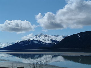
Turnagain Arm is a waterway into the northwestern part of the Gulf of Alaska. It is one of two narrow branches at the north end of Cook Inlet, the other being Knik Arm. Turnagain is subject to climate extremes and large tide ranges.
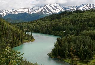
The Kenai River called Kahtnu in the Dena'ina language, is the longest river in the Kenai Peninsula of southcentral Alaska. It runs 82 miles (132 km) westward from Kenai Lake in the Kenai Mountains, through the Kenai National Wildlife Refuge and Skilak Lake to its outlet into the Cook Inlet of the Pacific Ocean near Kenai and Soldotna.
The Swanson River (Dena'ina: Yaghetnu) is a stream, 40 miles (64 km) long, on the Kenai Peninsula of south-central Alaska in the United States. Beginning at Gene Lake in the Swanson Lakes district, it flows southwest then north to Number Three Bay on the Gompertz Channel of Cook Inlet.

The Ninilchik River is a 21-mile-long (34 km) stream on the Kenai Peninsula of the U.S. state of Alaska. From headwaters near the west coast of the peninsula, the river flows south, parallel to the coast, then turns sharply west near Ninilchik. Ninilchik Road runs parallel to the lower river along its left bank to near the road's intersection with the Sterling Highway. At Ninilchik, the river passes under the highway, flows through Ninilchik State Recreation Area, and empties into Cook Inlet.
The Chakachatna River is a stream, 36 miles (58 km) long, in northwestern Kenai Peninsula Borough in the U.S. state of Alaska. It flows from Chakachamna Lake southeastward into the McArthur River, which flows into the Gompertz Channel of Cook Inlet. The river mouth is about 3 miles (5 km) north of Trading Bay and 32 miles (51 km) northwest of Kenai.
The King Salmon River is a 35-mile (56 km) tributary of the Ugashik River in the U.S. state of Alaska. Beginning at Mother Goose Lake in the Aleutian Range, it flows northwest to meet the larger river near the upper reaches of Ugashik Bay. The lake and the upper course of the King Salmon lie within the Alaska Peninsula National Wildlife Refuge. The river's gravel bottom and braided channels are ideal for the many king salmon that spawn in its waters, but they limit navigation to small skiff.
The King Salmon River is a 45-mile (72 km) tributary of the Nushagak River in southwest Alaska, United States. It flows eastward from headwaters 60°17′06″N158°28′33″W at a small unnamed lake in the Taylor Mountains to its confluence with the larger river about 220 miles (354 km) north of Nushagak Bay.

Fox River is a stream, 27 miles (43 km) long, on the Kenai Peninsula in the U.S. state of Alaska. The river heads at the terminus of the Chernof Glacier in the Kenai Mountains, then flows southwest to the northeast end of Kachemak Bay. The river mouth is 24 miles (39 km) northeast of Homer.

The Snow River is a 28-mile (45 km) tributary of Kenai Lake in the U.S. state of Alaska. Beginning in the Kenai Mountains of the Kenai Peninsula, it flows southwest through Chugach National Forest where its main and south forks join to near Primrose at the southern inlet of the lake. The river mouth is about 12 miles (19 km) northeast of Seward. Along its final reaches, the river intersects the Iditarod Trail and passes under the Seward Highway. The glacier from which it flows has an associated glacial dammed lake that releases every few years, often causing flooding in Primrose and Kenai Lake.

The Anchor River is a stream on the Kenai Peninsula in the U.S. state of Alaska. Beginning near Bald Mountain on the eastern side of the lower peninsula, if flows generally west for 30 miles (48 km) into Cook Inlet near Anchor Point on the western side of the peninsula. The river mouth is 15 miles (24 km) northwest of Homer.
Portlock is a ghost town in the U.S. state of Alaska, located on the southern edge of the Kenai Peninsula, around 16 miles (26 km) south of Seldovia. It is located in Port Chatham bay, from which an adjacent community takes its name. Named after Nathaniel Portlock, the town was an active cannery community in the early 20th century.

Mount Madson, also known as Madson Mountain, is a prominent 5,266-foot (1,605 m) summit in the U.S. state of Alaska.

Sheep Mountain is a 6,305-foot-elevation (1,922-meter) summit in Alaska, United States.

