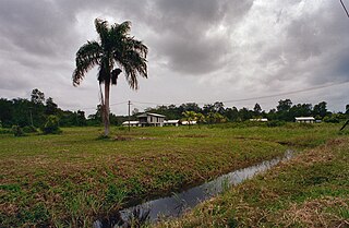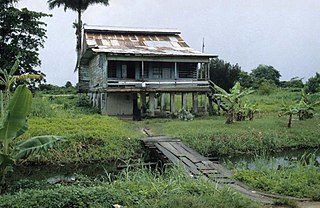
Commewijne is a district of Suriname, located on the right bank of the Suriname River. Commewijne's capital city is Nieuw Amsterdam. Tamanredjo is another major town, while Meerzorg is the most populated.

Coronie is a district of Suriname, situated on the coast. Coronie's capital city is Totness. The district border the Atlantic Ocean to the north, the Surinamese district of Saramacca to the east, the Surinamese district of Sipaliwini to the south and the Surinamese district of Nickerie to the west. The district is served by the Totness Airstrip.

Nickerie is a district of Suriname, on the north-west coast. Nickerie's capital city is Nieuw-Nickerie. Another town is Wageningen. The district borders the Atlantic Ocean to the north, the Surinamese district of Coronie to the east, the Surinamese district of Sipaliwini to the south and the region of East Berbice-Corentyne in Guyana to the west.

Wageningen is a community resort and an agricultural place in the Republic of Suriname and located in the coastal area of West Suriname in the Nickerie District, at the harbour of the Nickerie River across the right estuary of the Maratakka River. The town was known as the rice centre of Suriname, Wageningen has been founded in 1949 and named after the Dutch city of Wageningen.

Totness is a town in Suriname, located in the Coronie district, of which it is the capital. Totness is the oldest settlement in the district.

Friendship is a town in the Totness resort in the Coronie district in Suriname. Friendship is a former cotton plantation founded in 1824. The village of Friendship is to the north of the East-West Link, and Totness is to the south of the road. A clinic is located in the town, and serves both Totness and Friendship. The school in Totness is shared with Friendship.

Meerzorg is a town and resort (municipality) in Suriname, located on the eastern bank of the Suriname River, directly opposite the capital Paramaribo. Its population at the 2012 census was 12,405. Since 2000 it has been connected to Paramaribo by the Jules Wijdenbosch Bridge, named after the former President Jules Wijdenbosch.

Alkmaar is a resort in Suriname, located in the Commewijne District. Its population at the 2012 census was 5,561.

Johan & Margaretha or sometimes just Margaretha is a resort in Suriname, located in the Commewijne District. Its population at the 2012 census was 756. It is located along a peninsula northeast of Paramaribo. It is named after the coffee plantation Johan & Margaretha which was founded in 1745 by Johan Knöffel. It is safe to assume that his wife was called Margaretha.

Johanna Maria is a town and resort in Suriname, located in the Coronie District. Its population at the 2012 census was 648. The town is named the cotton plantation Johanna Maria founded in 1801 which was owned by Johanna Maria Christina van Onna from 1863 onwards. The coast line subject to flooding and erosion caused by the degradation of the mangrove forests. Plans have been drawn up to construct a 12 kilometre long dike near the coast.

Welgelegen is a resort in Suriname, located in the Coronie District. Its population at the 2012 census was 593. Welgelegen started as a cotton plantation in 1824. The church of Welgelegen was consecrated on 1 November 1883, but wasn't built at the spot. It was first erected on Cardross Park, and later moved to its current location. The church is no longer in service.

Oostelijke Polders is a resort in Suriname located in the Nickerie District. Its population at the 2012 census was 7,153. Villages in the resort include Glasgow, Hamptoncourtpolder, and Paradise. Oostelijke Polders is an agricultural area with a focus on rice production. Oostelijke Polder has a clinic and a school.

Beekhuizen is a former sugarcane plantation and currently a resort in Suriname, located in the Paramaribo District. Its population at the 2012 census was 17,185.

Mariënburg is a former sugarcane plantation, factory and village, situated in the district of Commewijne, in northern Suriname.

Berg en Dal is a village in the resort of Klaaskreek in the Brokopondo District of Suriname. The village is located on the Suriname River.
Jean Samuel Guisan was a Swiss engineer and civil servant known for his poldering work in the marshes near Kaw in French Guiana.
The Brooskampers were a Maroon people, descendants of runaway African slaves, living in the forested interior of Suriname. The tribe is related to the Saramaka, and originated from Loango-Angola. The Brooskampers gained autonomy in 1863, but sold their land in 1917.

Maripaston was a village situated in the Bigi Poika resort of the Para District, Suriname. The village was located along the Saramacca River and used to be the main village of the Matawai maroons, a group of descendants of African slaves who escaped and formed their own communities in the interior of Suriname.

Berlijn is a village and former wood plantation in the resort of Zuid in the Para District in Suriname. It is located on the Para Creek, and about 4 kilometres (2.5 mi) from the Johan Adolf Pengel International Airport.


