
Huntsville is the largest town in Muskoka Region, Ontario, Canada. It is located 215 kilometres (134 mi) north of Toronto and 130 kilometres (81 mi) south of North Bay.

Georgian Bay is a large bay of Lake Huron, in the Laurentia bioregion. It is located entirely within the borders of Ontario, Canada. The main body of the bay lies east of the Bruce Peninsula and Manitoulin Island. To its northwest is the North Channel.

Scugog is a township in the Regional Municipality of Durham, south-central Ontario, Canada. It is northeast of Toronto and just north of Oshawa. Due to its location in the Greater Toronto Area, many residents commute to Toronto for work on a daily basis. The anchor and largest population base of the township is Port Perry. The township has a population of roughly 22,500. A smaller Scugog Township was also a historic municipality and geographic township prior to the amalgamation that formed the current municipality.

The District Municipality of Muskoka, more generally referred to as the District of Muskoka or Muskoka, is a regional municipality in Central Ontario, Canada. Muskoka extends from Georgian Bay in the west, to the northern tip of Lake Couchiching in the south, to the western border of Algonquin Provincial Park in the east. A two-hour drive north of Toronto, Muskoka spans 6,475 km2 (2,500 sq mi). Muskoka has some 1,600 lakes, making it a popular cottaging destination.

The Township of Georgian Bay is an area municipality of the District Municipality of Muskoka, in south-central Ontario, Canada. It is located on the Severn River, where it empties into the eponymous Georgian Bay. The municipal offices are at Port Severn.
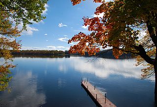
The Township of Muskoka Lakes is a municipality of the District Municipality of Muskoka, Ontario, Canada. It has a year-round population of 6,588.

Ramara is a lower-tier township municipality in Simcoe County, Ontario, Canada.
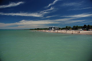
Grand Bend is a community located on the shores of Lake Huron in Southwestern Ontario, Canada. It is part of the Municipality of Lambton Shores in Lambton County.
The Kawartha Lakes (/kə'wɔrθɐ/) are a chain of lakes in south-central Ontario, Canada that form the upper watershed of the Trent River. The lakes are located on the boundary between the Paleozoic limestone regions of the Golden Horseshoe, and the Precambrian granite Canadian Shield of northern and central Ontario.

The Municipality of Trent Lakes is a lower-tier township in the rural, mostly wooded northern section of Peterborough County, Ontario, Canada. The municipality has a primarily cottage and tourist industry based economy but has grown year round residency due to its commute distance to the Greater Toronto Area.

Bala is a compact rural community in the township municipality of Muskoka Lakes, District Municipality of Muskoka in Central Ontario, Canada. It is well-known for the Bala Falls, the source of the Moon River, which flows from Lake Muskoka to the Georgian Bay.

Port Carling is an unincorporated community in the Township of Muskoka Lakes in the Canadian province of Ontario. It has been the municipal seat of the township since 1971. It has several hundred year-round residents and is a service centre for thousands of other seasonal residents in the area.

Kawartha Pine Ridge District School Board is a public, secular, English language school board headquartered in Peterborough, Ontario. It is the amalgamation of the former Peterborough County Board of Education and the Northumberland-Clarington Board of Education and serves the communities located in the Kawarthas to the north, and south to Lake Ontario. Hastings County is its eastern border and its western border extends to the City of Kawartha Lakes and to the edge of the City of Oshawa.

Lake Muskoka is located between Port Carling and Gravenhurst, Ontario, Canada. The lake is surrounded by many cottages. The lake is primarily within the boundary of the Township of Muskoka Lakes, the southeast corner is within the boundary of the Town of Gravenhurst and another small portion around the mouth of the Muskoka River is within the boundary of the Town of Bracebridge. The town of Bala is located on the southwest shores of the lake, where the Moon River starts. Lake Muskoka is connected to Lake Rosseau through the Indian River and lock system at Port Carling. The lake is mainly fed by the Muskoka River, Lake Joseph and Lake Rosseau.

Lake Bernard is a freshwater lake 276 km (171 mi) north of Toronto and 6 km (3.7 mi) west of Algonquin Park in Parry Sound District, Ontario, Canada, between Huntsville and North Bay. It measures roughly 2.5 km (1.5 mi) across and 7 km (4.3 mi) long. The village of Sundridge lies on the northern shore of this clean, clear lake, which is otherwise surrounded by the municipal township of Strong.
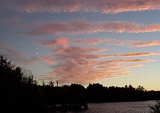
Paudash Lake is a lake in south central Ontario southwest of Bancroft along Highway 28. The lake is located just north of Silent Lake Provincial Park in Haliburton County, 27 km (17 mi) south of the panhandle of Algonquin Provincial Park. The nearest communities to Paudash Lake are the village of Cardiff, close to the lake's Inlet Bay, and the hamlet of Paudash to the northeast of Lower Paudash Lake. Actually two lakes, 'Paudash' and 'Lower Paudash', the lakes are located on the Crowe River, near its head waters, which flows into the Trent River at Crowe Bay north of Campbellford.
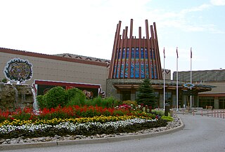
Chippewas of Rama First Nation, also known as Chippewas of Mnjikaning and Chippewas of Rama Mnjikaning First Nation, is an Anishinaabe (Ojibway) First Nation located in the province of Ontario in Canada. The name Mnjikaning, or fully vocalized as Minjikaning, refers to the fishing weirs at Atherley Narrows between Lake Simcoe and Lake Couchiching and it means "in/on/at or near the fence".
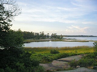
Beausoleil Island; Île Beausoleil; is an 8-kilometre (5.0 mi) long island in the municipality of Georgian Bay, District Municipality of Muskoka in Central Ontario, Canada. The island is named after Louis Beausoleil, a Métis settler whose 1819 homestead stood at the island's southern tip.The name of the island in the Huron-Wendat language is Skiondechiara which means "The land to appear floating afar". Located in the Thirty Thousand Islands in Georgian Bay on Lake Huron, it is the largest island in Georgian Bay Islands National Park and is the only place in the park where camping is allowed. Beausoleil Island is also part of the Georgian Bay Littoral UNESCO Biosphere reserve.

Lake of Bays is a large lake in the District Municipality of Muskoka in Central Ontario, Canada. It is located almost entirely in the Township municipality of Lake of Bays, which is named after the lake, with the exception of the southwest arm of the lake which is in the Town of Huntsville. Ontario Highway 35 runs north and east of the lake.


