Related Research Articles
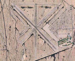
Bisbee Douglas International Airport is a county-owned airport 9 miles northwest of Douglas and 17 miles east of Bisbee, both in Cochise County, Arizona, United States, that was formerly known as Douglas Army Airfield. The FAA's National Plan of Integrated Airport Systems for 2009–2013 categorizes it as a general aviation facility.
Lone Pine Airport is a public airport located one mile (1.6 km) southeast of Lone Pine serving Inyo County, California, United States. The airport has two runways and is mostly used for general aviation. Charts: San Francisco; L5.

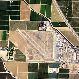
Sacramento McClellan Airport is a privately owned public-use airport located six miles (10 km) northeast of the central business district of Sacramento.
Shafter Airport, also known as Minter Field and formerly known as Air Corps Basic Flying School, is a public use airport located four nautical miles east of the central business district of Shafter and 14 miles northwest of Bakersfield, a city in Kern County, California, United States. Originally a World War II primary training facility for pilots, it is currently a public airport owned by the Minter Field Airport District. This airport is included in the National Plan of Integrated Airport Systems for 2011–2015, which categorized it as a general aviation facility.
Kathrinstadt Airport is a private-use airport located eight miles (11 km) southeast of the central business district of Hastings, a town in St. Johns County, Florida, United States. It is approximately 25 miles southwest of St. Augustine.
Needles Airport is a county-owned public airport in San Bernardino County, California, United States, five miles (9 km) south of Needles.
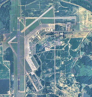
Fort Walton Beach Airport is a public-use airport located two miles east of the central business district of Navarre, Florida in the United States. It is privately owned by John S. Williams.
Flagler Executive Airport (ICAO: KFIN, FAA LID: FIN) is a county-owned public-use airport located three miles (5 km) east of the central business district of Bunnell, a city in Flagler County, Florida, United States. The airport's former FAA location identifiers were X47 and XFL. The airfield was originally constructed by the United States Navy during World War II as Naval Outlying Field Bunnell (NOLF Bunnell), an auxiliary airfield for flight training operations originating from nearby Naval Air Station Jacksonville, NAS Daytona Beach and NAS DeLand. Following the end of the war, the airfield was transferred from the Navy to Flagler County for use as a general aviation airport.
Maryland Airport is a privately owned, public use airport located four miles (6 km) east of the central business district of Indian Head, in Charles County, Maryland, United States.

Avon Park Executive Airport is a city-owned, public-use airport located two nautical miles (3.7 km) west of the central business district of Avon Park, a city in Highlands County, Florida, United States.
Eric Marcus Municipal Airport is a county-owned, public-use airport in Pima County, Arizona, United States. It is located 5.75 miles north of the central business district of Ajo and is about 82 miles southwest of Phoenix. The airport was renamed on February 11, 2006; it was formerly known as Ajo Municipal Airport.

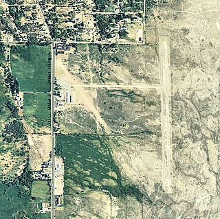
La Junta Municipal Airport is three miles north of La Junta, in Otero County, Colorado, United States. The National Plan of Integrated Airport Systems for 2011–2015 categorized it as a general aviation facility.
Boswell Bay Airport is owned by the U.S. Forest Service and is located near Boswell Bay, in the Valdez–Cordova Census Area, Alaska of the U.S. state of Alaska. The airfield was constructed in 1968 to serve the nearby White Alice radar site, now abandoned.
Greenwood–Leflore Airport is a public airport located seven miles east of Greenwood, the county seat of Leflore County, Mississippi, United States. It is owned by the City of Greenwood and Leflore County, but is geographically located in Carroll County.

Liberty County Airport was a county-owned public-use airport in Liberty County, Georgia, United States. The airport was closed in 2008, when local civilian entities and the U.S. Army teamed up to open the joint use MidCoast Regional Airport at Wright Army Airfield.
Delta Junction Airport is a public use airport located in and owned by Delta Junction, a city in the Southeast Fairbanks Census Area of the U.S. state of Alaska.

Fort Sumner Municipal Airport is a village owned, public use airport located two nautical miles (4 km) northeast of the central business district of Fort Sumner, a village in De Baca County, New Mexico, United States. It is included in the National Plan of Integrated Airport Systems for 2011–2015, which categorized it as a general aviation airport.
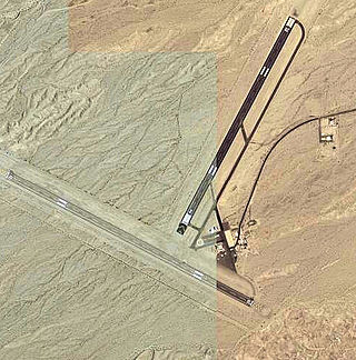
Ugashik Bay Airport is a public use airport located 11 nautical miles south-southwest of the central business district of Pilot Point, near Ugashik Bay in the Lake and Peninsula Borough of the U.S. state of Alaska. It is owned by the Bureau of Land Management.

Rolla National Airport is a public use airport in Maries County, Missouri, United States. It is owned by the City of Rolla and located 11 nautical miles north of its central business district. The airport is one nautical mile (2 km) northwest of Vichy, Missouri. It is included in the National Plan of Integrated Airport Systems for 2011–2015, which categorized it as a general aviation facility.
References
- 1 2 FAA Airport Form 5010 for APH PDF , effective 25 January 2024